Enable Location

We need your location to show you interesting places around you

Discover nearby places

Find interesting locations and hidden gems around you

Precise directions

Get accurate directions and distances to places

Your location is never shared with other users. It's only used when you tap the location button.

Lai Vung

Log in to your account

Start exploring — it's free

Trusted by 65,394 travelers worldwide

Continue with Google
Continue with Apple
or

We will send you a code to connect

By continuing, you accept our Terms and Conditions and our Privacy Policy

Check your inbox

We've sent a pincode in your inbox. Please enter the code below.

Lai Vung
Discussion Reviews 1 Photos
10.8k Popularity

Lai Vung, Rural district in Đồng Tháp Province, Vietnam.

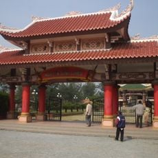
Lai Vung is a rural district in Đồng Tháp Province, located in the Mekong Delta of southern Vietnam. The land is flat and low-lying, crossed by river branches, and covered largely by rice paddies and fruit orchards.

The area has long been part of the farming heartland of the Mekong Delta and took its current administrative shape after the country's reunification in 1976. In 1989, the administrative center moved to Lai Vung township, marking the start of a more organized local development.

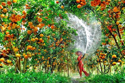
The area is closely tied to its mandarin orange groves, which reach their peak around the Tet festival when fruit is harvested and sold along roadsides. Visiting at that time of year gives a clear sense of how farming shapes the rhythm of daily life here.

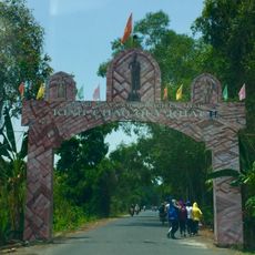
National Highway 54 connects the district to nearby towns, making it easy to reach by car or motorbike. The flat terrain makes cycling a practical way to move between villages and orchards across the area.

Alongside mandarin oranges, the area is known for its fermented pork product, a handmade specialty that has been produced in the region for generations. The Phong Hoa pomelo, a locally grown variety, is another fruit that can be found in the orchards here alongside the mandarins.

The community of curious travelers

AroundUs brings together thousands of curated places, local tips, and hidden gems, enriched daily by 60,000 contributors worldwide.

Start exploring
Location
Location
Inception
1976
Elevation above the sea
1 m
Shares border with
Sa Đéc City, Châu Thành, Thốt Nốt, Lấp Vò
GPS coordinates
10.28808,105.65964
Latest update
March 3, 2026 10:12
Reviews
Share your experience

No review yet

Discussions
Start a discussion...

No discussion yet

« Lai Vung - Rural district in Đồng Tháp Province, Vietnam » is provided by Around Us (aroundus.com). Images and texts are derived from Wikimedia project under a Creative Commons license. You are allowed to copy, distribute, and modify copies of this page, under the conditions set by the license, as long as this note is clearly visible.

Discover hidden gems everywhere you go!

From secret cafés to breathtaking viewpoints, skip the crowded tourist spots and find places that match your style. Our app makes it easy with voice search, smart filtering, route optimization, and insider tips from travelers worldwide. Download now for the complete mobile experience.

Around Us App Screenshot

A unique approach to discovering new places

Le Figaro

All the places worth exploring

France Info

A tailor-made excursion in just a few clicks

20 Minutes

Around Us
Travel Guide & Maps
Download

Send to your phone

QR Code
1

Open the camera app on your mobile.

2

Point at the QR code with your camera. A notification will appear.

3

Tap the notification to open the link.