See the monuments around you in AROpen chests in the app
Around Us is built for your phone — point your camera at the streets and discover the monuments and places around you in augmented reality.Around Us is built for your phone — chests unlock when you walk, explore and capture nearby places.
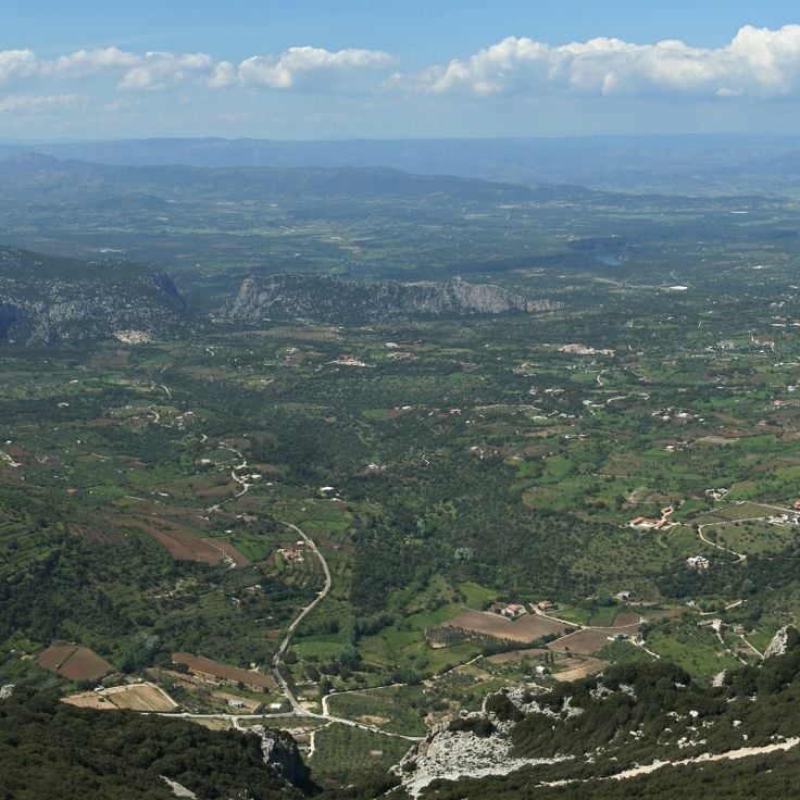
Sardinia preserves evidence of over 3,000 years of human settlement. Nuragic towers from the Bronze Age rise across plains and hills, while rock-cut tombs recall prehistoric communities. Roman temples stand beside Byzantine churches, and medieval basilicas mark coastal towns. The landscape forms through limestone caves with stalactite formations, deep gorges that cut through mountain ranges, and springs that emerge from the ground.
The coast alternates between long sandy bays and steep cliffs, where lighthouses rise above the sea. Inland, mountain passes lead through wilderness to hidden settlements and archaeological sites. Visitors can walk through burial grounds, descend into cave systems, swim at remote beaches or explore Roman ruins. The island connects history with nature in a way that invites exploration.
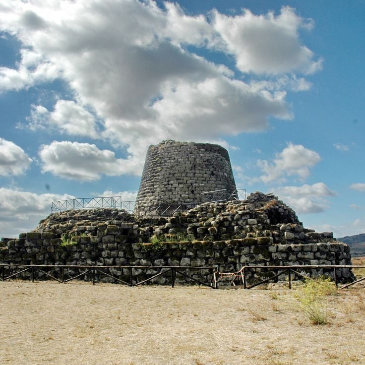
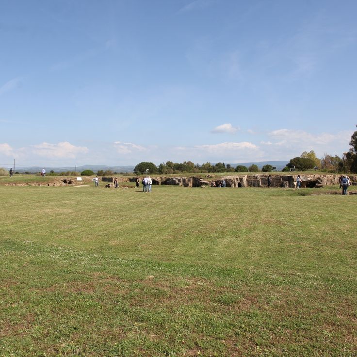
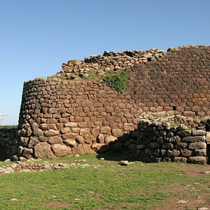
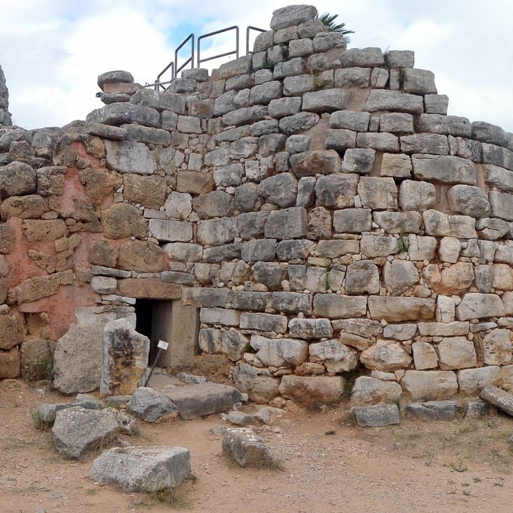
This Bronze Age fortress in central Sardinia features a central tower surrounded by four corner towers, with stone walls running in concentric rings. Su Nuraxi di Barumini dates from the Nuragic civilization and includes living quarters, defensive structures, and a village of round huts. The complex documents the organization of this society through its architecture, built from basalt blocks without mortar, and through the preserved spaces for daily life and defense.
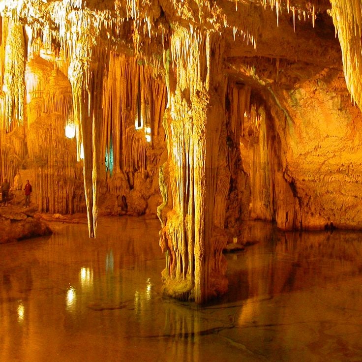
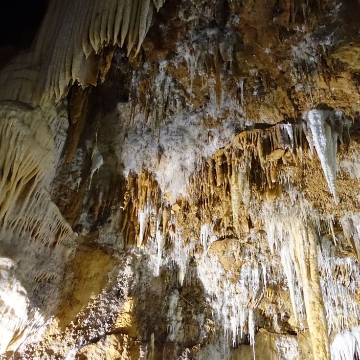
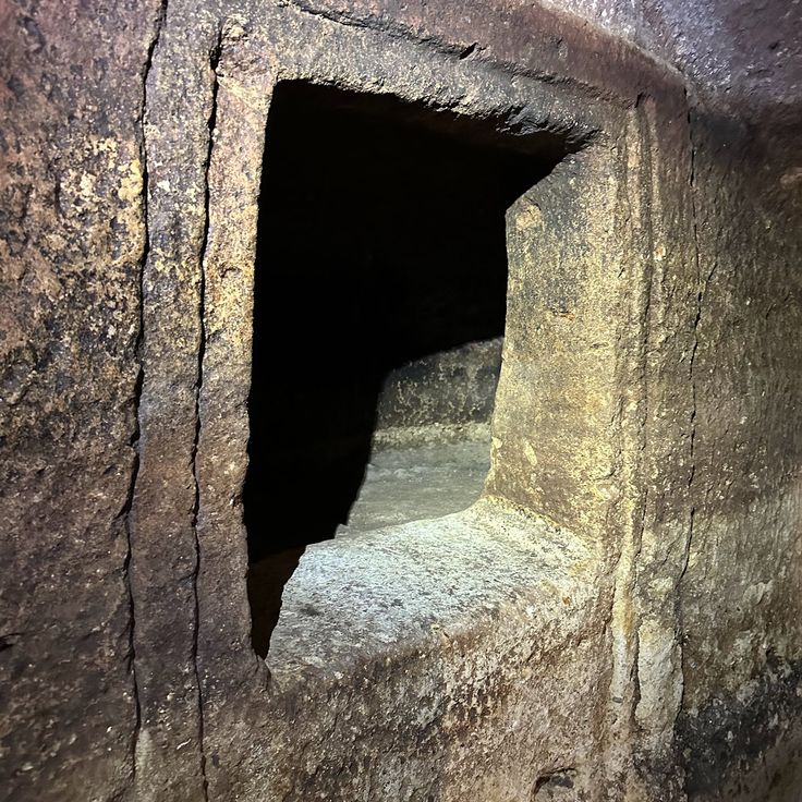
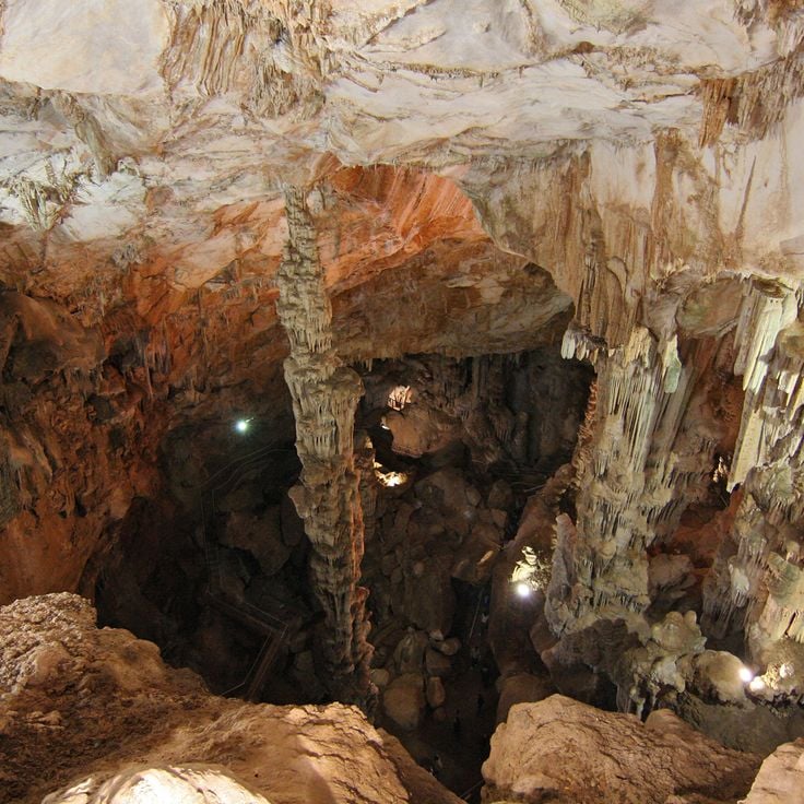
This marine cave sits along the Capo Caccia coastline and shows underground halls with formations of mineral deposits that have grown over thousands of years. The Grotta di Nettuno contains several chambers where stalagmites rise from the floor and stalactites hang from the ceiling. An underground saltwater lake reflects the rock formations. Access is through a staircase of 656 steps carved into the cliff, or by boat from Alghero. The cave was discovered in the 18th century and takes its name from the Roman god of the sea. Inside, the temperature remains constant throughout the year. Lighting highlights the mineral structures, while saltwater pools in the deeper sections.
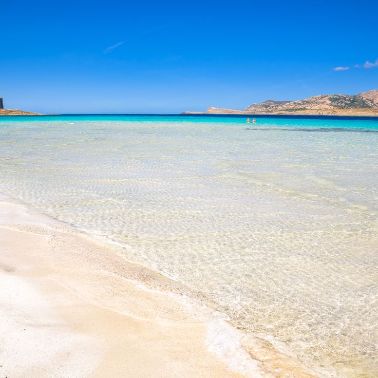
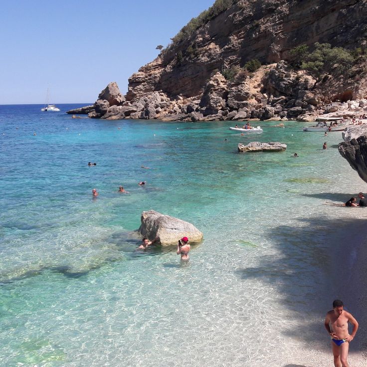
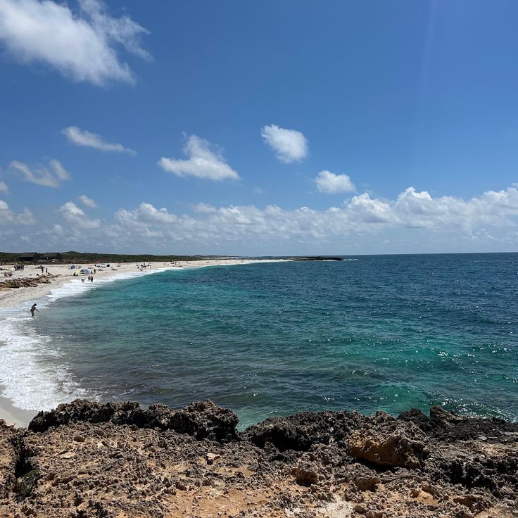
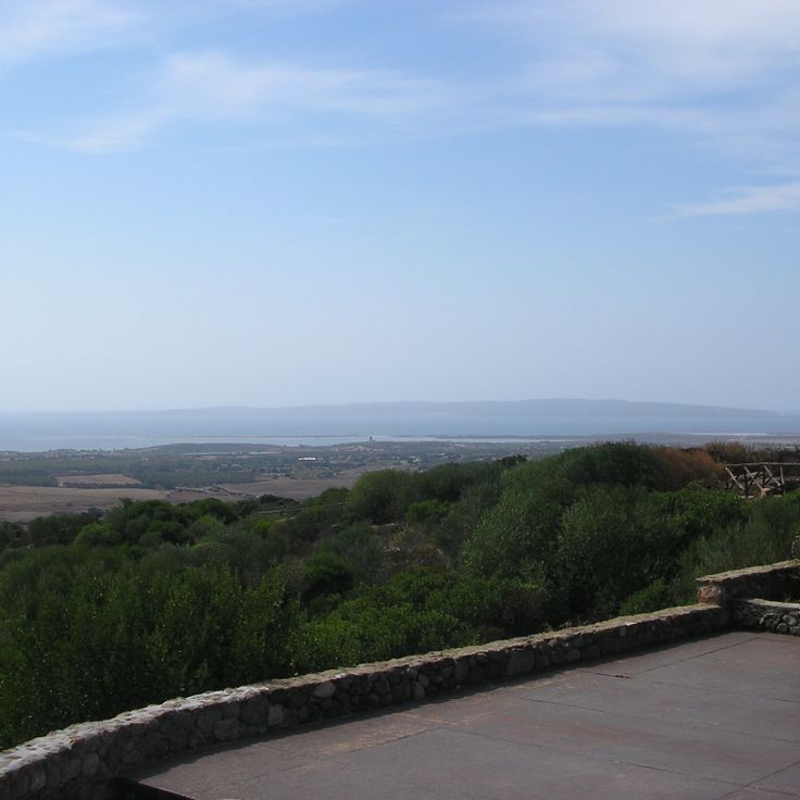
This beach sits near the village of Stintino and is watched over by a 16th-century tower. The water has a turquoise color and the sand is white and fine. The bay opens toward the island of Asinara and the sea stays shallow for many yards. Visitors arrive early in the morning to find a spot, as the beach is small and often crowded in summer. The tower stands on a rocky point and once served the coast guard. Today families spend the day here, swimming in the clear water or seeking shade under umbrellas. The water is calm and warm, especially during the summer months.
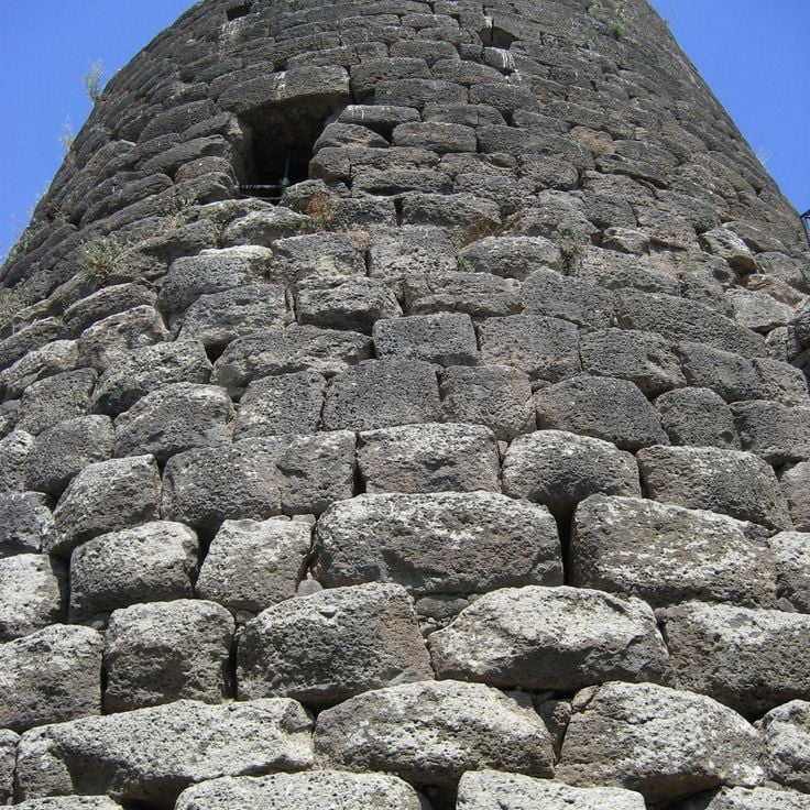
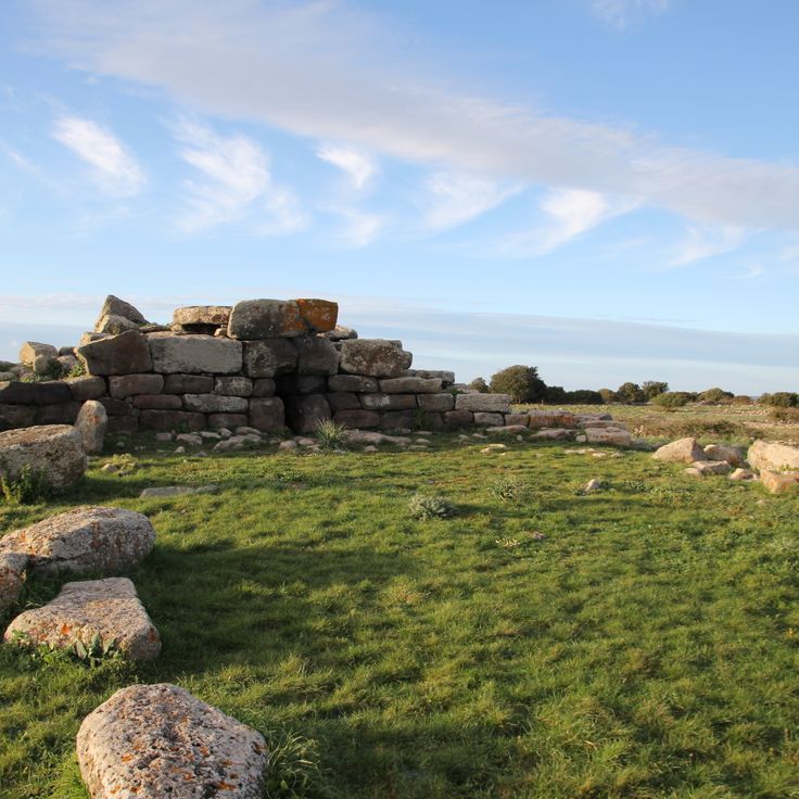
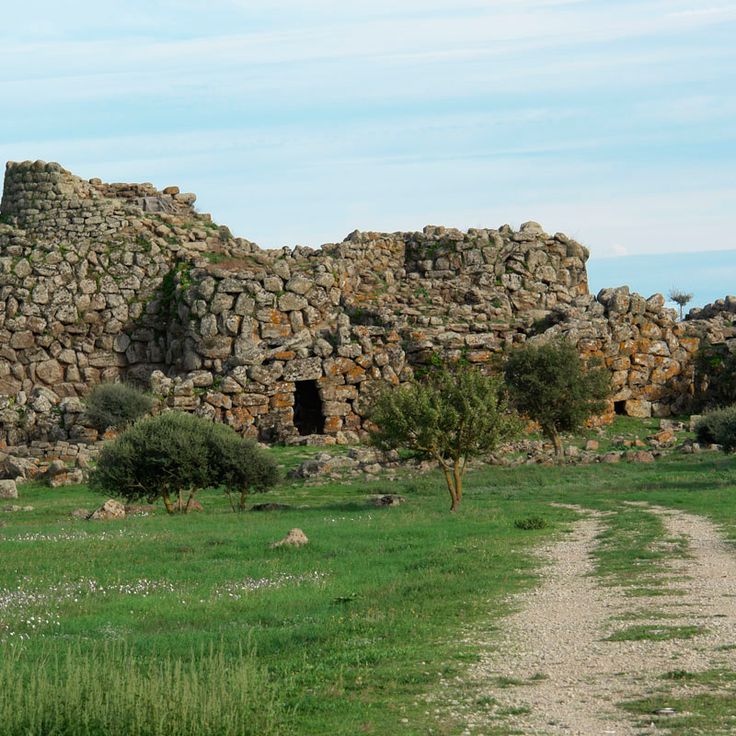
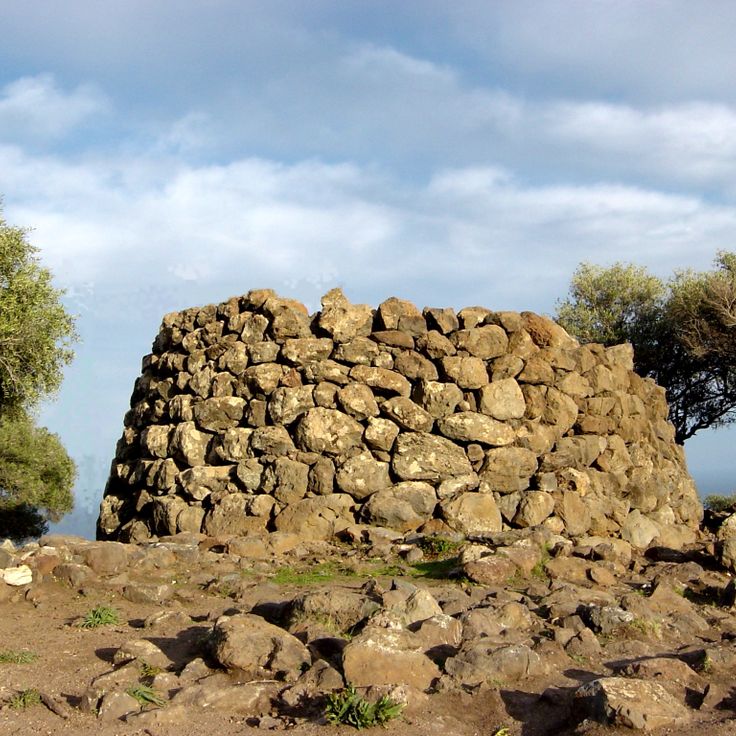
This Bronze Age tower stands in the Sardinian countryside and shows the building skills of the island's early inhabitants. Nuraghe Santu Antine was built around 1600 BCE and rises three stories high. Inside, rooms and underground passages run through the structure, constructed with large stone blocks. The site is among the largest of its kind on Sardinia and offers a sense of life and organization in the Nuragic culture.
This Bronze Age burial site lies in Siddi and served as a communal resting place for the people of the region. The stone structure covers a considerable length and shows the burial practices of a time when Sardinia was already home to organized communities. The chambers inside tell of a population that gave its dead a shared space, where generations rested side by side. Visitors to Sa Domu 'e S'Orcu see how prehistoric inhabitants created lasting structures with simple means, structures that remain today.
These caves hold aragonite crystals that shimmer in the darkness when light strikes their surfaces. The ceilings and walls display dripstone formations that developed over millennia through the action of water. The underground network winds through limestone chambers where stalactites hang and stalagmites rise from the floor. The air remains cool and damp as visitors walk along the paths through the passages. The caves form part of the natural sites of Sardinia, where ancient geological processes have left visible traces. The formations reflect the slow dripping of water through the stone, depositing minerals and building the structures over time. The rock shows different shades that come from the minerals it contains. The Is Zuddas Caves offer a glimpse into the hidden spaces beneath the Sardinian landscape.
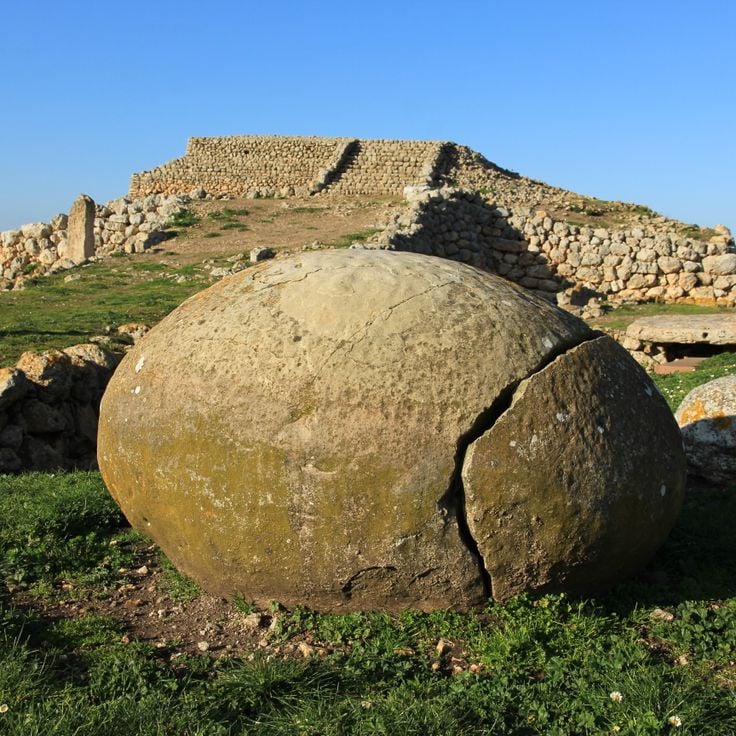
This stone platform from the 4th millennium BCE served religious purposes and shows Mesopotamian architectural traditions. Monte d'Accoddi sits on a low hill in the plain of Sassari and consists of a rectangular ramp leading to a raised terrace. The site was expanded and modified over several centuries. Visitors can see the remains of altars, offering places and dwelling areas that document the ritual life of prehistoric communities.
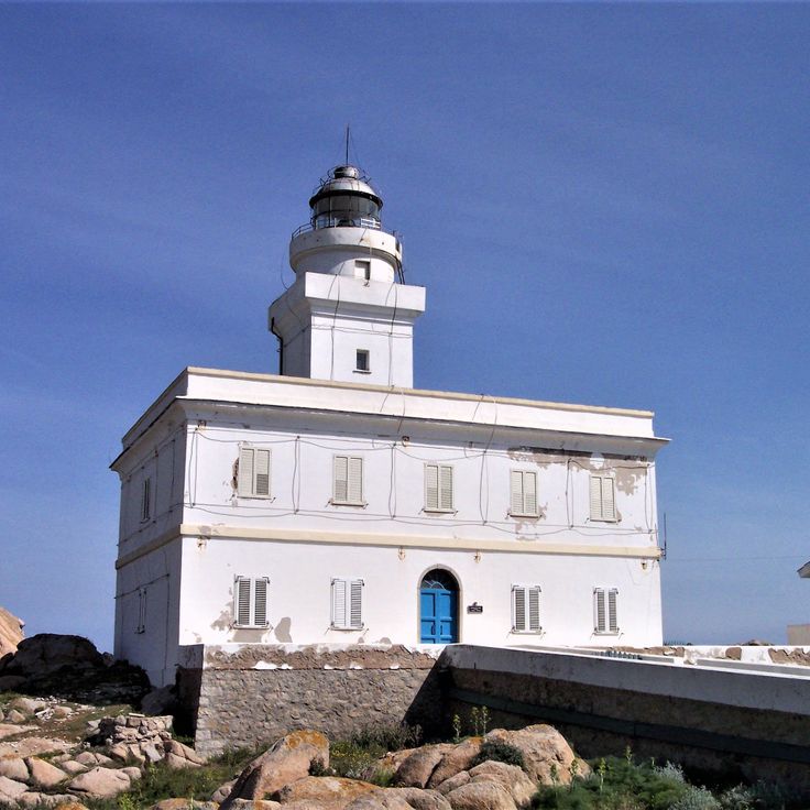
This lighthouse stands on a promontory of granite rocks jutting into the sea. It was built in 1845 and overlooks the strait between Sardinia and Corsica. Around Capo Testa Lighthouse you find old Roman quarries where granite was cut for temples and columns. The coast is covered with macchia, a dense scrubland of broom, rockrose and wild herbs. Between the rocks lie small coves with sand and clear water. The area shows how Roman mining history and Sardinian nature come together.
This Bronze Age settlement sits inside a cave in the limestone rock of the Supramonte mountains. Nuragic Settlement Tiscali consists of stone ruins built thousands of years ago within a natural hollow. The site can be reached only on foot and provides insight into the construction methods and daily life of the Nuragic culture. The cave location protected inhabitants from wind and enemies while creating a secluded living space between rock and sky.
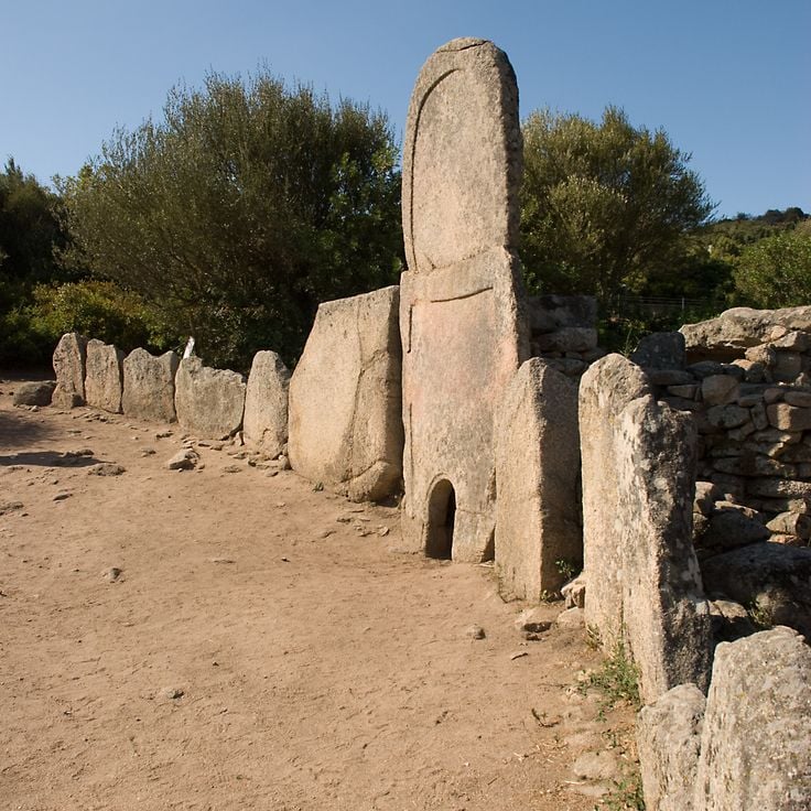
This Bronze Age burial site consists of a central stone chamber and a long corridor. The structure lies in northern Sardinia and shows the construction methods of a necropolis from the second millennium BC. Coddu Vecchiu Tomb is among the examples of prehistoric architecture on the island, where large stone blocks were fitted together without mortar. Access is through a covered passage leading to the burial chamber. The site stands in a hilly landscape with granite outcrops and low shrubs.
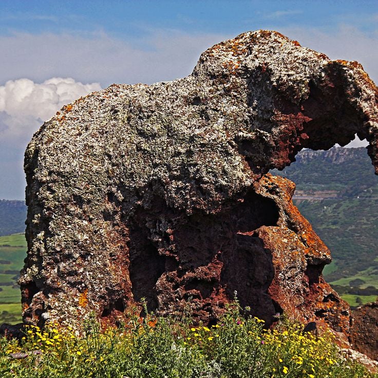
This rock formation stands in Castelsardo, shaped over centuries by wind and water into a form that resembles an elephant. The trachyte stone has two inner passages that visitors can walk through. The rock shows the typical colors of volcanic material, with reddish and gray tones that change with the light. Mediterranean plants grow around the formation. From the rock, you can see the sea and the coastline. The formation is an example of how natural erosion works in this part of Sardinia.
This cemetery from the Copper Age contains 38 underground burial chambers built between 3300 and 2900 BCE. The chambers lie near Alghero and show how people in prehistoric Sardinia buried their dead. Some rooms still carry traces of color on the walls, while others contain stone sculptures. The site is one of the largest prehistoric necropolises in the Mediterranean and offers insight into the life and burial practices of early communities on the island.
This beach on the Sardinian coast is made up of white pebbles and small rocks that cover the entire shoreline. Tall limestone cliffs enclose the cove from both sides, creating a sheltered setting. The sea shows different shades of turquoise depending on the light and depth. Visitors usually reach Cala Mariolu by boat, as the approach by land is difficult. The cliffs in the background carry sparse vegetation.
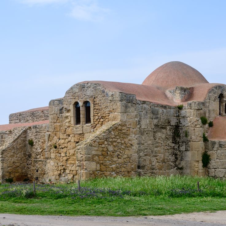
This coastal church dates from the sixth century and shows a cross-shaped floor plan. The sandstone walls carry Byzantine architectural elements. San Giovanni di Sinis connects early Christian architecture with the sparse coastal landscape and reflects the religious roots of the island in that period.
This watchtower from 1600 BCE rises above the Sardinian landscape with a central structure and five additional towers. The complex shows how the Nuragic culture organized protection and community through thick stone walls and interlocking rooms. Walking through the corridors, you sense how people lived and worked here thousands of years ago. Nuraghe Arrubiu belongs to the largest preserved fortresses of its kind and gives a direct impression of Bronze Age construction.
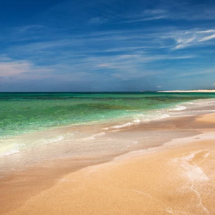
This beach lies on the western coast of Sardinia and consists of small white quartz grains instead of regular sand. The Mediterranean drops to around 100 feet (30 meters) near the shore. Access follows a road through low vegetation and open terrain. When the sea is calm, the water is clear enough to see the bottom. The bay extends for several hundred yards and is bordered by flat rocks that appear at low tide. This site is among the natural coastal formations of Sardinia, shaped by mineral erosion.
This necropolis was carved into limestone during the Neolithic period and contains several burial chambers decorated with geometric patterns and symbols. The rooms of S'Incantu show vaulted ceilings and entrances cut into the living rock, typical of Sardinia's prehistoric burial sites. Engravings of spirals, circles and other motifs appear on the walls and ceilings, offering insight into the ritual practices of early communities. The monument sits on a hillside surrounded by Mediterranean vegetation and preserves traces of a burial culture thousands of years old.
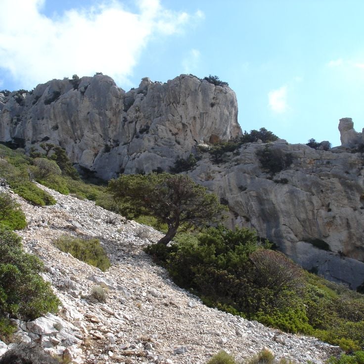
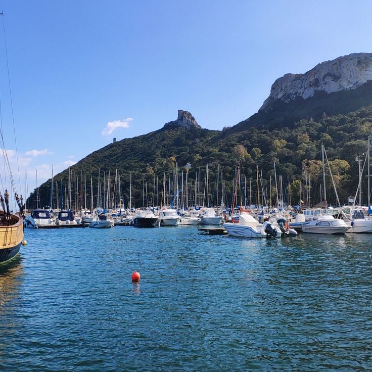
This limestone promontory rises 135 meters (443 feet) above sea level and forms a natural landmark at the edge of Cagliari. The formation takes its name from the saddle-like silhouette visible from the sea. The site contains remains of Punic settlements and later military fortifications, showing the strategic importance of the place over the centuries. The path leading up passes through Mediterranean scrubland with juniper, mastic shrubs and wild herbs that bloom in spring. From the top, views open over the coastline, the gulf and the city. On clear days, the sea extends to the horizon while seabirds circle along the cliffs.
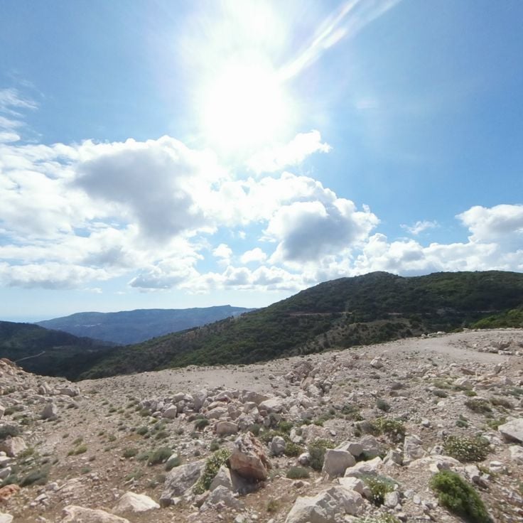
The Genna Silana Pass sits at 1017 meters (3337 feet) elevation and connects the Ogliastra and Supramonte regions through limestone cliffs and Mediterranean forests. Marked trails cross the area and lead through changing landscapes of rock formations and tree cover. This pass serves as a passage between the two regions and provides access to the surrounding mountains and valleys of Sardinia.
Sa Sedda 'e Sos Carros is a Bronze Age ritual site in the mountains near Oliena. This complex includes stone buildings, a temple with water channels and round basins decorated with bull-head protomes carved in stone. Water flowed through the channels and played a central role in ceremonies. The protomes show detailed bull faces and reveal the importance of cattle in Nuragic religious beliefs. The site sits away from main routes in a rocky mountain landscape, surrounded by low vegetation and exposed stone formations.
This nuraghe presents a central tower from the Bronze Age surrounded by three smaller towers connected through triangular walls. The stone structure stands on a plain and documents the building methods of early Sardinian culture. The ramparts form a protected courtyard, and the arrangement of towers follows a geometric plan. Visitors can walk through the passages between towers and observe the construction of large stone blocks placed without mortar.
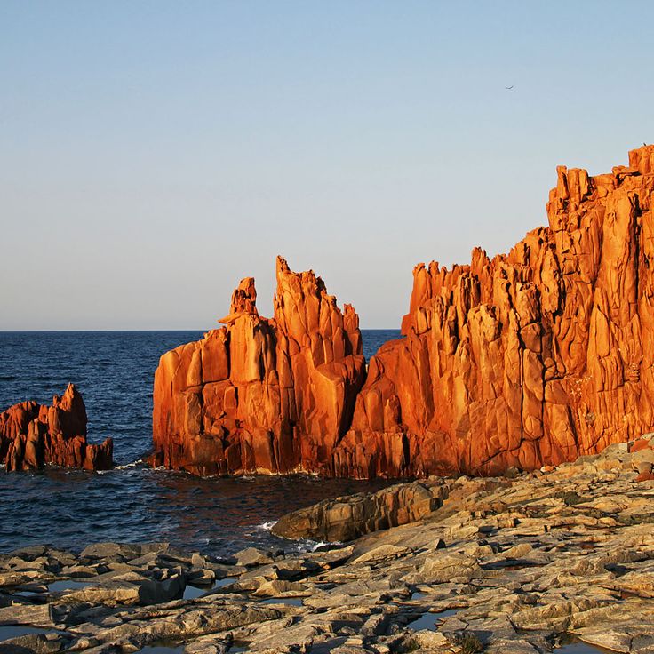
These rock formations of red porphyry rise from the sea along the coast of Arbatax. The stone has a reddish color that stands out against the blue water of the Mediterranean. The rocks formed through volcanic processes and mark this stretch of coastline. Under sunlight the porphyry shows different shades of red. The sea washes against the base of the formations, and visitors can walk along the shore to view the rocks from different angles.
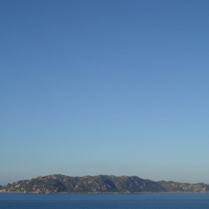
This island off Sardinia's coast shows granite cliffs shaped by wind and marine chambers along the shoreline. The waters around Molara host various fish species, sea urchins and octopuses, while the surface carries native Mediterranean plants adapted to salty breezes and sparse soil. The rock terrain alternates between smooth outcrops and jagged formations, with some areas accessible for exploration. The clarity of the water allows visitors to observe marine life while swimming or snorkeling in the shallower coves. The island is uninhabited, giving it a quiet, secluded feel. Goats move freely across the terrain, grazing on the low vegetation. During summer months, boats bring day visitors who explore the caves or swim in the clear water. The coastline offers small sandy stretches surrounded by rocks where people rest in the sun.
This basilica stands on Sant'Antioco and combines Romanesque architecture with early Christian catacombs from the fifth century. Stone walls and rounded arches shape the upper church space, while underground burial chambers recall the island's first Christians. Visitors can walk through the old burial passages and see how faith and memory have been preserved across centuries. The church continues to serve religious celebrations and shows the long Christian tradition of Sardinia.
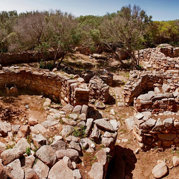
Lu Brandali Ancient Site is a settlement from the Nuragic period located on a hillside above the coast of Santa Teresa Gallura. Stone huts, burial chambers and observation points date from 1800 to 1600 BC. The layout shows how communities lived and monitored their surroundings during that era. From here, people could watch the sea and the nearby hills. Dry stone walls enclose rectangular rooms, some of which remain visible. Large stone slabs form the tombs, set into the ground. The site lies near the Strait of Bonifacio and offered shelter and a clear view to those who lived there.
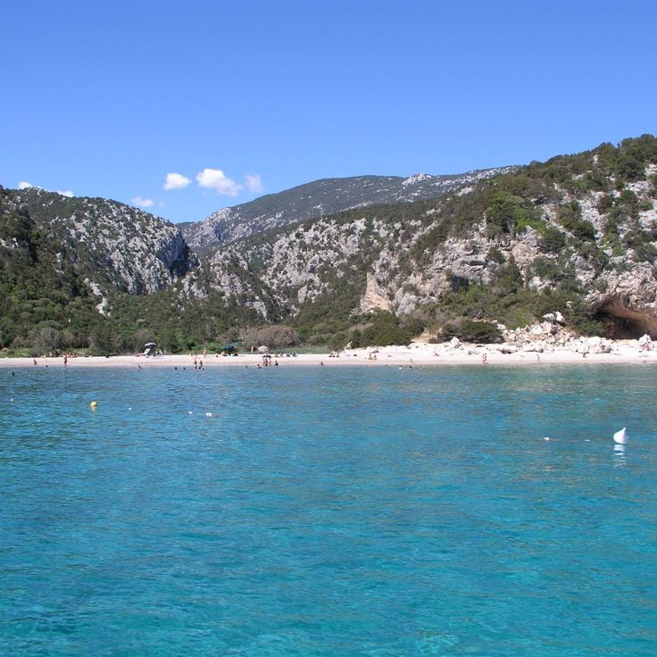
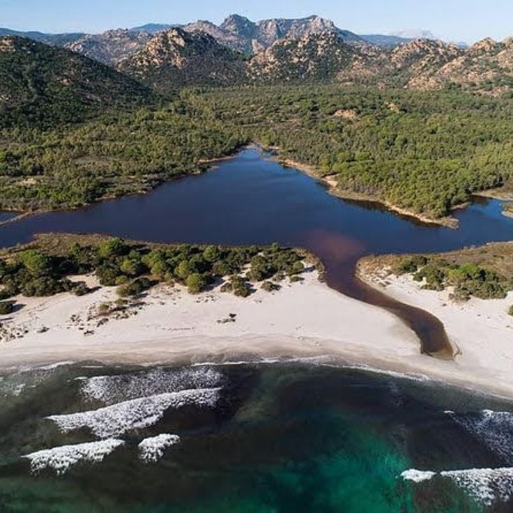
This beach sits between limestone cliffs and offers pale sand with natural caves carved into the rock. The water is clear and invites swimming and snorkeling. The cove connects Sardinia's coastal line with the mountains inland and can be reached both from land and by sea.
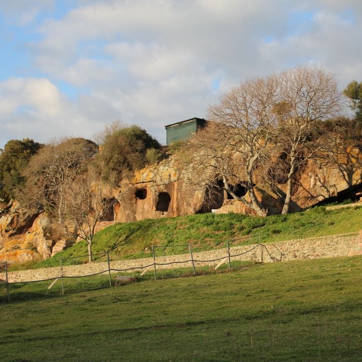
This necropolis contains rock-cut tombs dating to 3000 BC with carved pillars and painted chambers. During the Byzantine period, the complex was converted into a church, and frescoes remain visible today. The rooms show multiple construction phases, from prehistoric burials to Christian use. The rock walls bear traces of tools and pigments. The site combines Nuragic burial traditions with later religious adaptations, documenting the continuity of human occupation in this part of Sardinia.
These sand formations stretch along the coast of Capo Comino and create an area of dunes and Mediterranean vegetation. The coastal section shows a 19th-century lighthouse standing on a rocky elevation. The terrain combines sandy surfaces with low shrub vegetation adapted to the salty climate. Walking paths lead through the formations and offer views of the sea.
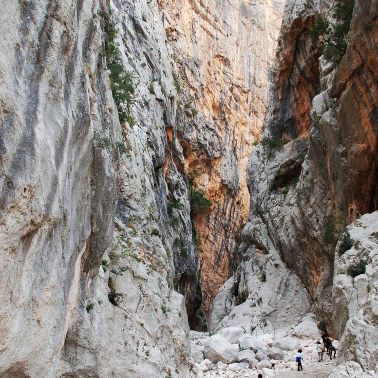
This canyon in inland Sardinia cuts deep into the limestone mountains. The rock walls rise over 400 meters and form one of the deepest gorges in Europe. A stream runs along the bottom between smooth stones. Plants that are rare elsewhere on the island grow on the walls. Hikers reach the entrance through a trail crossing a wooded valley. Inside, the passage becomes very narrow in places. Climbers use the vertical faces for demanding routes. The gorge lies far from larger settlements, surrounded by mountains and scrubland. On hot days it stays cool inside. The rock shows traces of thousands of years of erosion by water.
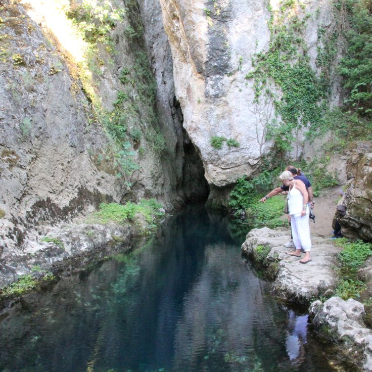
This spring emerges from limestone rocks and releases groundwater that collects in a pool. The flow reaches high volumes and the water remains cool throughout the year. Mediterranean plants grow along the banks, while rock formations rise above the surface. The site sits at the base of the Supramonte massif and forms the origin of a river. Visitors come here to see the surroundings and observe the clear water that exits from the rock layers and continues through the landscape.
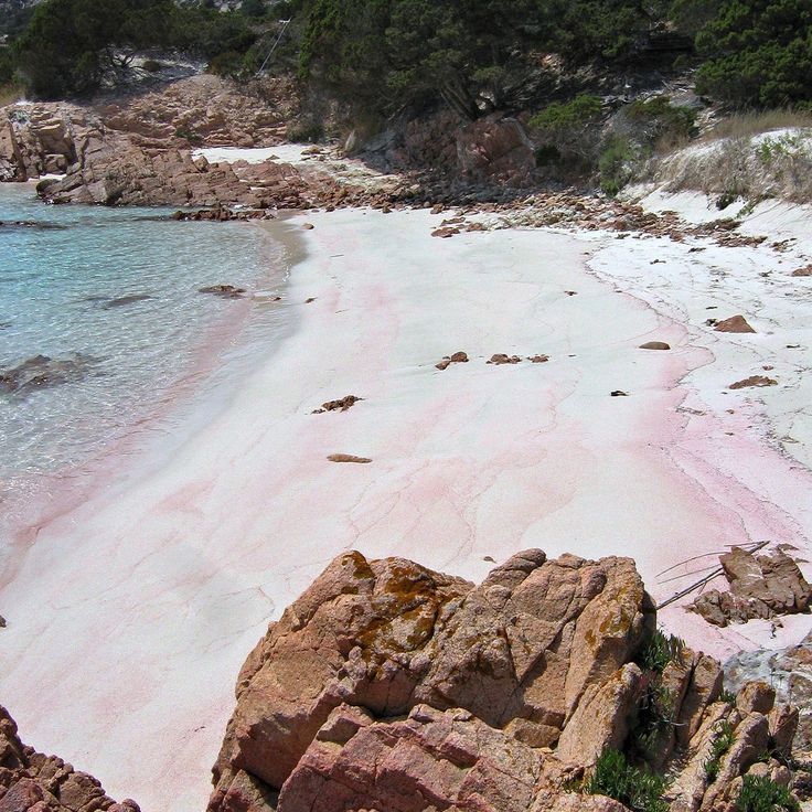
This stretch of coast runs for two kilometers and shows pink quartz sand. Green juniper trees grow close to the water. The color of the sand comes from crushed seashells and quartz crystals. In sunlight the surface glows in pale rose tones. The beach sits between low dunes and shallow water. Juniper forms scattered groups along the shoreline. In the morning the sand feels cool underfoot. In the afternoon the surface warms quickly.
The Bidderosa Reserve covers 860 hectares of Mediterranean forest and five white sand beaches. Granite formations line the shore. Walking paths lead through dense woodland with juniper and mastic shrubs. The water is shallow and clear in the small coves. Access is limited to protect the landscape. Visitors find quiet spots between the trees and the coast.
The Ispinigoli Cave is a limestone formation that contains a 38-meter column formed when a stalactite and stalagmite joined over thousands of years. This cave sits near Dorgali and forms part of the karst landscape of eastern Sardinia. The interior descends through several chambers, and the walls are covered with calcium carbonate deposits. Light illuminates the main column, revealing the slow process of its formation. The cave also served as a burial site during the Bronze Age. Visitors follow a path through the main chamber and experience the scale of this underground space.
This Bronze Age stone structure rises from a limestone plateau at about two thousand feet above sea level, offering views across the Gulf of Orosei. The Nuraghe Mannu belongs to the remains of Nuragic culture that shaped the interior of Sardinia over many centuries. From this point, the eastern coast of the island and the Supramonte mountains extend into view. The position on the plateau shows the strategic importance such structures held in prehistoric times.
This island off the southwest coast of Sardinia still shows traces of its Ligurian past. Carloforte, the only town, was founded in 1738 by Genoese coral fishers. The streets follow a planned grid, houses carry pastel colors and shutters like those on the Ligurian coast. People speak a dialect closer to Genoese than to Sardinian. Restaurants serve farinata and pesto. The coastline shows cliffs, small coves and caves. Fishermen still go out in small boats. In summer, visitors come to swim and walk along the shore.
This beach on an uninhabited island shows a pink tint from broken coral, shells and granite particles. The mixture of organic and mineral fragments gives the sand its characteristic color. Access is restricted to protect the natural formation. The shore lies within a marine reserve that monitors the preservation of delicate coastal ecology. This beach is part of a larger archipelago known for its varied coastal landscapes.
These thermal springs lie in a quiet area where hot water flows from the ground through volcanic rock. The temperature reaches 76 degrees Celsius, and the mineral-rich water has a long history as a healing source. People come here to use the warm pools and rest in a natural setting. The site links old traditions of water therapy with the wild landscape of Sardinia, where vegetation and stone form a sheltered backdrop. The place feels removed from crowds and offers space for recovery in direct contact with the thermal source.
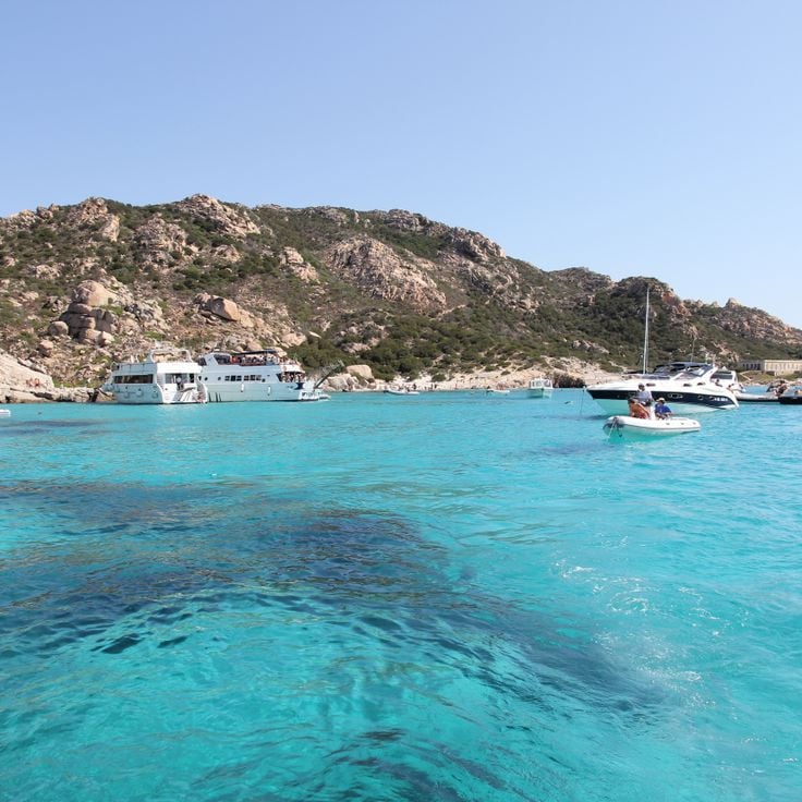
This marine reserve spreads across seven main islands and many small islets, marked by clear waters, granite rocks and white sand. The sea here shelters dolphins, while rare birds nest along the coasts. Mediterranean scrubland covers the slopes with juniper, mastic bushes and wild rosemary. Narrow straits run between the islands, with currents that flow through and form shallow bays. Seabirds circle above the cliffs, and in the early morning you can see boats moving between the islands. The light changes with the time of day, making the rocks shift from gray to pink and gold.
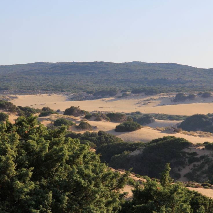
These coastal sand dunes stretch along a 5-kilometer section where wind and Mediterranean currents have shaped the sand into hills rising up to 328 feet (100 meters). The landscape resembles a desert meeting the sea. The pale sand alternates with low shrubs adapted to the dry ground. Visitors can walk among the dunes and observe how their shapes shift with the wind direction. The area belongs to the less-visited parts of the Sardinian coast.
This archaeological site preserves a Bronze Age settlement established around 1100 BCE. Nuraghe Palmavera shows a central tower built from layered stone, a meeting hall and the foundations of roughly 50 dwellings from the Nuragic civilization. Around the main tower lie the remains of smaller towers and stone walls. Walking among the ruins gives a sense of how people lived and organized their community here thousands of years ago.
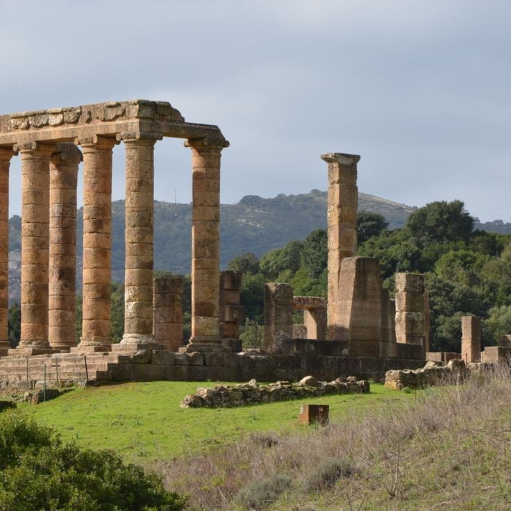
This Roman temple from the 3rd century stands on the remains of an older Punic sanctuary dedicated to Phoenician deities. The architecture shows six re-erected columns made of local limestone, rising against the forested slopes of the Iglesiente mountains. The complex occupies a narrow valley at 1,180 feet (360 meters) elevation, surrounded by Mediterranean scrub and ancient holm oaks. Visitors reach the site along a winding road through the mountainous landscape of southwestern Sardinia. Archaeological investigations have uncovered coins, pottery fragments and votive offerings that indicate centuries of religious activity. The podium still bears traces of the original construction methods. A spring emerges nearby, likely used since ancient times. The location combines Roman building techniques with the religious traditions of earlier peoples who worshipped their gods here.
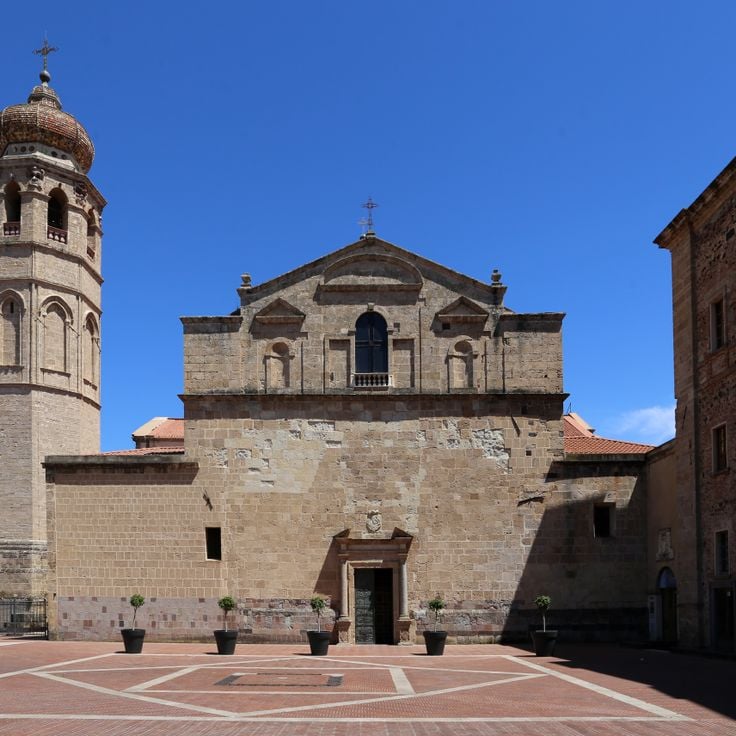
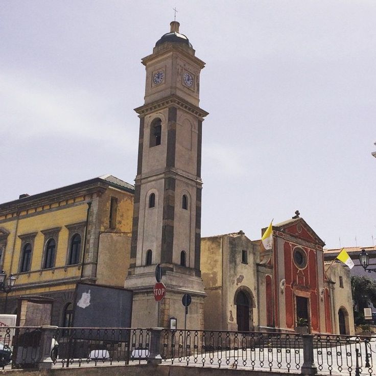
This cathedral was built in 1130 and renovated during the 19th century. The facade shows Baroque elements with a portal of light-colored stone and curved lines. The interior preserves Romanesque arches and columns that remain from the original structure. The bell tower rises 42 meters (138 feet) above the streets of Oristano and can be seen from many points in the old town. Frescoes, altars and side chapels inside the nave give insight into Sardinia's religious history.
This Bronze Age fortress in central Sardinia features a central tower surrounded by four corner towers, with stone walls running in concentric rings. Su Nuraxi di Barumini dates from the Nuragic civilization and includes living quarters, defensive structures, and a village of round huts. The complex documents the organization of this society through its architecture, built from basalt blocks without mortar, and through the preserved spaces for daily life and defense.
This marine cave sits along the Capo Caccia coastline and shows underground halls with formations of mineral deposits that have grown over thousands of years. The Grotta di Nettuno contains several chambers where stalagmites rise from the floor and stalactites hang from the ceiling. An underground saltwater lake reflects the rock formations. Access is through a staircase of 656 steps carved into the cliff, or by boat from Alghero. The cave was discovered in the 18th century and takes its name from the Roman god of the sea. Inside, the temperature remains constant throughout the year. Lighting highlights the mineral structures, while saltwater pools in the deeper sections.
This beach sits near the village of Stintino and is watched over by a 16th-century tower. The water has a turquoise color and the sand is white and fine. The bay opens toward the island of Asinara and the sea stays shallow for many yards. Visitors arrive early in the morning to find a spot, as the beach is small and often crowded in summer. The tower stands on a rocky point and once served the coast guard. Today families spend the day here, swimming in the clear water or seeking shade under umbrellas. The water is calm and warm, especially during the summer months.
This Bronze Age tower stands in the Sardinian countryside and shows the building skills of the island's early inhabitants. Nuraghe Santu Antine was built around 1600 BCE and rises three stories high. Inside, rooms and underground passages run through the structure, constructed with large stone blocks. The site is among the largest of its kind on Sardinia and offers a sense of life and organization in the Nuragic culture.
This Bronze Age burial site lies in Siddi and served as a communal resting place for the people of the region. The stone structure covers a considerable length and shows the burial practices of a time when Sardinia was already home to organized communities. The chambers inside tell of a population that gave its dead a shared space, where generations rested side by side. Visitors to Sa Domu 'e S'Orcu see how prehistoric inhabitants created lasting structures with simple means, structures that remain today.
These caves hold aragonite crystals that shimmer in the darkness when light strikes their surfaces. The ceilings and walls display dripstone formations that developed over millennia through the action of water. The underground network winds through limestone chambers where stalactites hang and stalagmites rise from the floor. The air remains cool and damp as visitors walk along the paths through the passages. The caves form part of the natural sites of Sardinia, where ancient geological processes have left visible traces. The formations reflect the slow dripping of water through the stone, depositing minerals and building the structures over time. The rock shows different shades that come from the minerals it contains. The Is Zuddas Caves offer a glimpse into the hidden spaces beneath the Sardinian landscape.
This stone platform from the 4th millennium BCE served religious purposes and shows Mesopotamian architectural traditions. Monte d'Accoddi sits on a low hill in the plain of Sassari and consists of a rectangular ramp leading to a raised terrace. The site was expanded and modified over several centuries. Visitors can see the remains of altars, offering places and dwelling areas that document the ritual life of prehistoric communities.
This lighthouse stands on a promontory of granite rocks jutting into the sea. It was built in 1845 and overlooks the strait between Sardinia and Corsica. Around Capo Testa Lighthouse you find old Roman quarries where granite was cut for temples and columns. The coast is covered with macchia, a dense scrubland of broom, rockrose and wild herbs. Between the rocks lie small coves with sand and clear water. The area shows how Roman mining history and Sardinian nature come together.
This Bronze Age settlement sits inside a cave in the limestone rock of the Supramonte mountains. Nuragic Settlement Tiscali consists of stone ruins built thousands of years ago within a natural hollow. The site can be reached only on foot and provides insight into the construction methods and daily life of the Nuragic culture. The cave location protected inhabitants from wind and enemies while creating a secluded living space between rock and sky.
This Bronze Age burial site consists of a central stone chamber and a long corridor. The structure lies in northern Sardinia and shows the construction methods of a necropolis from the second millennium BC. Coddu Vecchiu Tomb is among the examples of prehistoric architecture on the island, where large stone blocks were fitted together without mortar. Access is through a covered passage leading to the burial chamber. The site stands in a hilly landscape with granite outcrops and low shrubs.
This rock formation stands in Castelsardo, shaped over centuries by wind and water into a form that resembles an elephant. The trachyte stone has two inner passages that visitors can walk through. The rock shows the typical colors of volcanic material, with reddish and gray tones that change with the light. Mediterranean plants grow around the formation. From the rock, you can see the sea and the coastline. The formation is an example of how natural erosion works in this part of Sardinia.
This cemetery from the Copper Age contains 38 underground burial chambers built between 3300 and 2900 BCE. The chambers lie near Alghero and show how people in prehistoric Sardinia buried their dead. Some rooms still carry traces of color on the walls, while others contain stone sculptures. The site is one of the largest prehistoric necropolises in the Mediterranean and offers insight into the life and burial practices of early communities on the island.
This beach on the Sardinian coast is made up of white pebbles and small rocks that cover the entire shoreline. Tall limestone cliffs enclose the cove from both sides, creating a sheltered setting. The sea shows different shades of turquoise depending on the light and depth. Visitors usually reach Cala Mariolu by boat, as the approach by land is difficult. The cliffs in the background carry sparse vegetation.
This coastal church dates from the sixth century and shows a cross-shaped floor plan. The sandstone walls carry Byzantine architectural elements. San Giovanni di Sinis connects early Christian architecture with the sparse coastal landscape and reflects the religious roots of the island in that period.
This watchtower from 1600 BCE rises above the Sardinian landscape with a central structure and five additional towers. The complex shows how the Nuragic culture organized protection and community through thick stone walls and interlocking rooms. Walking through the corridors, you sense how people lived and worked here thousands of years ago. Nuraghe Arrubiu belongs to the largest preserved fortresses of its kind and gives a direct impression of Bronze Age construction.
This beach lies on the western coast of Sardinia and consists of small white quartz grains instead of regular sand. The Mediterranean drops to around 100 feet (30 meters) near the shore. Access follows a road through low vegetation and open terrain. When the sea is calm, the water is clear enough to see the bottom. The bay extends for several hundred yards and is bordered by flat rocks that appear at low tide. This site is among the natural coastal formations of Sardinia, shaped by mineral erosion.
This necropolis was carved into limestone during the Neolithic period and contains several burial chambers decorated with geometric patterns and symbols. The rooms of S'Incantu show vaulted ceilings and entrances cut into the living rock, typical of Sardinia's prehistoric burial sites. Engravings of spirals, circles and other motifs appear on the walls and ceilings, offering insight into the ritual practices of early communities. The monument sits on a hillside surrounded by Mediterranean vegetation and preserves traces of a burial culture thousands of years old.
This limestone promontory rises 135 meters (443 feet) above sea level and forms a natural landmark at the edge of Cagliari. The formation takes its name from the saddle-like silhouette visible from the sea. The site contains remains of Punic settlements and later military fortifications, showing the strategic importance of the place over the centuries. The path leading up passes through Mediterranean scrubland with juniper, mastic shrubs and wild herbs that bloom in spring. From the top, views open over the coastline, the gulf and the city. On clear days, the sea extends to the horizon while seabirds circle along the cliffs.
The Genna Silana Pass sits at 1017 meters (3337 feet) elevation and connects the Ogliastra and Supramonte regions through limestone cliffs and Mediterranean forests. Marked trails cross the area and lead through changing landscapes of rock formations and tree cover. This pass serves as a passage between the two regions and provides access to the surrounding mountains and valleys of Sardinia.
Sa Sedda 'e Sos Carros is a Bronze Age ritual site in the mountains near Oliena. This complex includes stone buildings, a temple with water channels and round basins decorated with bull-head protomes carved in stone. Water flowed through the channels and played a central role in ceremonies. The protomes show detailed bull faces and reveal the importance of cattle in Nuragic religious beliefs. The site sits away from main routes in a rocky mountain landscape, surrounded by low vegetation and exposed stone formations.
This nuraghe presents a central tower from the Bronze Age surrounded by three smaller towers connected through triangular walls. The stone structure stands on a plain and documents the building methods of early Sardinian culture. The ramparts form a protected courtyard, and the arrangement of towers follows a geometric plan. Visitors can walk through the passages between towers and observe the construction of large stone blocks placed without mortar.
These rock formations of red porphyry rise from the sea along the coast of Arbatax. The stone has a reddish color that stands out against the blue water of the Mediterranean. The rocks formed through volcanic processes and mark this stretch of coastline. Under sunlight the porphyry shows different shades of red. The sea washes against the base of the formations, and visitors can walk along the shore to view the rocks from different angles.
This island off Sardinia's coast shows granite cliffs shaped by wind and marine chambers along the shoreline. The waters around Molara host various fish species, sea urchins and octopuses, while the surface carries native Mediterranean plants adapted to salty breezes and sparse soil. The rock terrain alternates between smooth outcrops and jagged formations, with some areas accessible for exploration. The clarity of the water allows visitors to observe marine life while swimming or snorkeling in the shallower coves. The island is uninhabited, giving it a quiet, secluded feel. Goats move freely across the terrain, grazing on the low vegetation. During summer months, boats bring day visitors who explore the caves or swim in the clear water. The coastline offers small sandy stretches surrounded by rocks where people rest in the sun.
This basilica stands on Sant'Antioco and combines Romanesque architecture with early Christian catacombs from the fifth century. Stone walls and rounded arches shape the upper church space, while underground burial chambers recall the island's first Christians. Visitors can walk through the old burial passages and see how faith and memory have been preserved across centuries. The church continues to serve religious celebrations and shows the long Christian tradition of Sardinia.
Lu Brandali Ancient Site is a settlement from the Nuragic period located on a hillside above the coast of Santa Teresa Gallura. Stone huts, burial chambers and observation points date from 1800 to 1600 BC. The layout shows how communities lived and monitored their surroundings during that era. From here, people could watch the sea and the nearby hills. Dry stone walls enclose rectangular rooms, some of which remain visible. Large stone slabs form the tombs, set into the ground. The site lies near the Strait of Bonifacio and offered shelter and a clear view to those who lived there.
This beach sits between limestone cliffs and offers pale sand with natural caves carved into the rock. The water is clear and invites swimming and snorkeling. The cove connects Sardinia's coastal line with the mountains inland and can be reached both from land and by sea.
This necropolis contains rock-cut tombs dating to 3000 BC with carved pillars and painted chambers. During the Byzantine period, the complex was converted into a church, and frescoes remain visible today. The rooms show multiple construction phases, from prehistoric burials to Christian use. The rock walls bear traces of tools and pigments. The site combines Nuragic burial traditions with later religious adaptations, documenting the continuity of human occupation in this part of Sardinia.
These sand formations stretch along the coast of Capo Comino and create an area of dunes and Mediterranean vegetation. The coastal section shows a 19th-century lighthouse standing on a rocky elevation. The terrain combines sandy surfaces with low shrub vegetation adapted to the salty climate. Walking paths lead through the formations and offer views of the sea.
This canyon in inland Sardinia cuts deep into the limestone mountains. The rock walls rise over 400 meters and form one of the deepest gorges in Europe. A stream runs along the bottom between smooth stones. Plants that are rare elsewhere on the island grow on the walls. Hikers reach the entrance through a trail crossing a wooded valley. Inside, the passage becomes very narrow in places. Climbers use the vertical faces for demanding routes. The gorge lies far from larger settlements, surrounded by mountains and scrubland. On hot days it stays cool inside. The rock shows traces of thousands of years of erosion by water.
This spring emerges from limestone rocks and releases groundwater that collects in a pool. The flow reaches high volumes and the water remains cool throughout the year. Mediterranean plants grow along the banks, while rock formations rise above the surface. The site sits at the base of the Supramonte massif and forms the origin of a river. Visitors come here to see the surroundings and observe the clear water that exits from the rock layers and continues through the landscape.
This stretch of coast runs for two kilometers and shows pink quartz sand. Green juniper trees grow close to the water. The color of the sand comes from crushed seashells and quartz crystals. In sunlight the surface glows in pale rose tones. The beach sits between low dunes and shallow water. Juniper forms scattered groups along the shoreline. In the morning the sand feels cool underfoot. In the afternoon the surface warms quickly.
The Bidderosa Reserve covers 860 hectares of Mediterranean forest and five white sand beaches. Granite formations line the shore. Walking paths lead through dense woodland with juniper and mastic shrubs. The water is shallow and clear in the small coves. Access is limited to protect the landscape. Visitors find quiet spots between the trees and the coast.
The Ispinigoli Cave is a limestone formation that contains a 38-meter column formed when a stalactite and stalagmite joined over thousands of years. This cave sits near Dorgali and forms part of the karst landscape of eastern Sardinia. The interior descends through several chambers, and the walls are covered with calcium carbonate deposits. Light illuminates the main column, revealing the slow process of its formation. The cave also served as a burial site during the Bronze Age. Visitors follow a path through the main chamber and experience the scale of this underground space.
This Bronze Age stone structure rises from a limestone plateau at about two thousand feet above sea level, offering views across the Gulf of Orosei. The Nuraghe Mannu belongs to the remains of Nuragic culture that shaped the interior of Sardinia over many centuries. From this point, the eastern coast of the island and the Supramonte mountains extend into view. The position on the plateau shows the strategic importance such structures held in prehistoric times.
This island off the southwest coast of Sardinia still shows traces of its Ligurian past. Carloforte, the only town, was founded in 1738 by Genoese coral fishers. The streets follow a planned grid, houses carry pastel colors and shutters like those on the Ligurian coast. People speak a dialect closer to Genoese than to Sardinian. Restaurants serve farinata and pesto. The coastline shows cliffs, small coves and caves. Fishermen still go out in small boats. In summer, visitors come to swim and walk along the shore.
This beach on an uninhabited island shows a pink tint from broken coral, shells and granite particles. The mixture of organic and mineral fragments gives the sand its characteristic color. Access is restricted to protect the natural formation. The shore lies within a marine reserve that monitors the preservation of delicate coastal ecology. This beach is part of a larger archipelago known for its varied coastal landscapes.
These thermal springs lie in a quiet area where hot water flows from the ground through volcanic rock. The temperature reaches 76 degrees Celsius, and the mineral-rich water has a long history as a healing source. People come here to use the warm pools and rest in a natural setting. The site links old traditions of water therapy with the wild landscape of Sardinia, where vegetation and stone form a sheltered backdrop. The place feels removed from crowds and offers space for recovery in direct contact with the thermal source.
This marine reserve spreads across seven main islands and many small islets, marked by clear waters, granite rocks and white sand. The sea here shelters dolphins, while rare birds nest along the coasts. Mediterranean scrubland covers the slopes with juniper, mastic bushes and wild rosemary. Narrow straits run between the islands, with currents that flow through and form shallow bays. Seabirds circle above the cliffs, and in the early morning you can see boats moving between the islands. The light changes with the time of day, making the rocks shift from gray to pink and gold.
These coastal sand dunes stretch along a 5-kilometer section where wind and Mediterranean currents have shaped the sand into hills rising up to 328 feet (100 meters). The landscape resembles a desert meeting the sea. The pale sand alternates with low shrubs adapted to the dry ground. Visitors can walk among the dunes and observe how their shapes shift with the wind direction. The area belongs to the less-visited parts of the Sardinian coast.
This archaeological site preserves a Bronze Age settlement established around 1100 BCE. Nuraghe Palmavera shows a central tower built from layered stone, a meeting hall and the foundations of roughly 50 dwellings from the Nuragic civilization. Around the main tower lie the remains of smaller towers and stone walls. Walking among the ruins gives a sense of how people lived and organized their community here thousands of years ago.
This Roman temple from the 3rd century stands on the remains of an older Punic sanctuary dedicated to Phoenician deities. The architecture shows six re-erected columns made of local limestone, rising against the forested slopes of the Iglesiente mountains. The complex occupies a narrow valley at 1,180 feet (360 meters) elevation, surrounded by Mediterranean scrub and ancient holm oaks. Visitors reach the site along a winding road through the mountainous landscape of southwestern Sardinia. Archaeological investigations have uncovered coins, pottery fragments and votive offerings that indicate centuries of religious activity. The podium still bears traces of the original construction methods. A spring emerges nearby, likely used since ancient times. The location combines Roman building techniques with the religious traditions of earlier peoples who worshipped their gods here.
This cathedral was built in 1130 and renovated during the 19th century. The facade shows Baroque elements with a portal of light-colored stone and curved lines. The interior preserves Romanesque arches and columns that remain from the original structure. The bell tower rises 42 meters (138 feet) above the streets of Oristano and can be seen from many points in the old town. Frescoes, altars and side chapels inside the nave give insight into Sardinia's religious history.