Interstate 96

Log in to your account

AroundUs is a community-driven map of interesting places, built by curious explorers like you. It grows with every review, story, and photo you share.
Connect to save your favorite spots, contribute locations, and create personalized routes.
By continuing, you accept our Terms and Conditions and our Privacy Policy
Add to collection
Map
Suggest a change
Share

Interstate 96, Interstate highway in Michigan, United States.

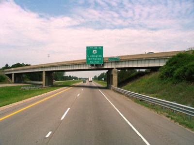
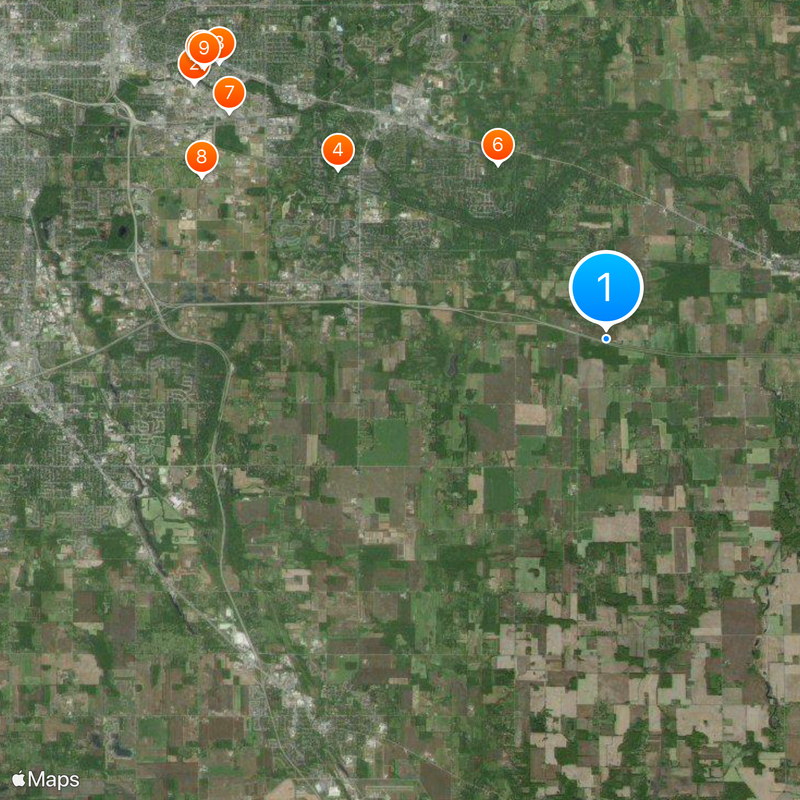
Interstate 96 is a federal freeway that runs approximately 192 miles from Norton Shores to Detroit in the southern half of Michigan's Lower Peninsula. The multi-lane highway connects western coastal areas with the industrial and commercial center of Detroit, passing through several counties and communities along the way.

The highway replaced U.S. Route 16 in 1963, marking a modernization of the state's transportation infrastructure. The construction was part of a broader national program to develop the Interstate Highway System that shaped America in the mid-20th century.

The Detroit section has been named Rosa Parks Memorial Highway since 2005, honoring a key figure in the civil rights movement. The route connects thousands of daily commuters traveling between western Michigan's coastal communities and the Detroit metropolitan area.

The freeway is open year-round and carries about 200,000 vehicles daily, so expect peak traffic during early morning and late afternoon hours. Travelers should be aware of winter weather conditions, as snow and ice can significantly affect driving conditions and visibility along the route.

This is Michigan's only two-digit Interstate highway that runs entirely within the state's borders. What makes this notable is that most Interstate highways connect multiple states, making a route confined to just one state quite rare within the national system.

Location: Muskegon County

Location: Ottawa County

Location: Kent County

Location: Ionia County

Location: Clinton County

Location: Eaton County

Location: Ingham County

Location: Livingston County

Location: Oakland County

Location: Wayne County

Inception: 1959

GPS coordinates: 42.66880,-84.35490

Latest update: December 14, 2025 19:54

Photos
Around this place
Spartan Stadium
United States of America

Spartan Stadium

12.5 km
Eli and Edythe Broad Art Museum
United States of America

Eli and Edythe Broad Art Museum

12.2 km
Goetsch-Winckler House
United States of America

Goetsch-Winckler House

8.2 km
Beaumont Tower
United States of America

Beaumont Tower

12.6 km
Donald Schaberg House
United States of America

Donald Schaberg House

5.3 km
Michigan State University Horticulture Gardens
United States of America

Michigan State University Horticulture Gardens

11.3 km
Michigan State University Observatory
United States of America

Michigan State University Observatory

11.2 km
Great Lakes Quilt Center
United States of America

Great Lakes Quilt Center

12.5 km
Abrams Planetarium
United States of America

Abrams Planetarium

11.8 km
Toumey Woods
United States of America

Toumey Woods

9.8 km
Ingham County Courthouse
United States of America

Ingham County Courthouse

12.3 km
Eustace Hall
United States of America

Eustace Hall

8.3 km
St. Katherine's Chapel
United States of America

St. Katherine's Chapel

5.6 km
Philip Nice House
United States of America

Philip Nice House

12.2 km
John Raynor House
United States of America

John Raynor House

11.9 km
Williamston Downtown Historic District
United States of America

Williamston Downtown Historic District

8 km
Courthouse Square Historic District
United States of America

Courthouse Square Historic District

12.3 km
Ash Street-Sycamore Creek Bridge
United States of America

Ash Street-Sycamore Creek Bridge

12.5 km
Westside Neighborhood Historic District
United States of America

Westside Neighborhood Historic District

12.6 km
Somerville Barn
United States of America

Somerville Barn

12.2 km
Wharton Center for Performing Arts
United States of America

Wharton Center for Performing Arts

11.3 km
Michigan State University Pavilion
United States of America

Michigan State University Pavilion

11.1 km
Michigan State University-Founded 1855 Historical Marker
United States of America

Michigan State University-Founded 1855 Historical Marker

12.6 km
Harry J Eustace Hall Historical Marker
United States of America

Harry J Eustace Hall Historical Marker

12.4 km
Eustace-Cole Hall
United States of America

Eustace-Cole Hall

12.4 km
Linton Hall
United States of America

Linton Hall

12.5 km
Michigan State University Agriculture Hall
United States of America

Michigan State University Agriculture Hall

12.3 km
Erickson Hall
United States of America

Erickson Hall

12.1 km
Show the full map
Reviews

Visited this place? Tap the stars to rate it and share your experience / photos with the community! Try now! You can cancel it anytime.

« Interstate 96 - Interstate highway in Michigan, United States » is provided by Around Us (aroundus.com). Images and texts are derived from Wikimedia project under a Creative Commons license. You are allowed to copy, distribute, and modify copies of this page, under the conditions set by the license, as long as this note is clearly visible.

Discover hidden gems everywhere you go!

From secret cafés to breathtaking viewpoints, skip the crowded tourist spots and find places that match your style. Our app makes it easy with voice search, smart filtering, route optimization, and insider tips from travelers worldwide. Download now for the complete mobile experience.

Around Us App Screenshot

A unique approach to discovering new places

Le Figaro

All the places worth exploring

France Info

A tailor-made excursion in just a few clicks

20 Minutes