Juniata County, Administrative county in Pennsylvania, United States
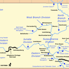
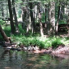
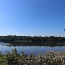
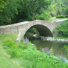
Juniata County is an administrative region in Pennsylvania that spans hilly terrain with rivers, fields, and forests throughout. The landscape is shaped by the Juniata River, which flows through the entire area and defines the natural structure of the region.
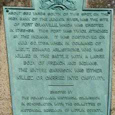
The region was established as a separate administrative unit in 1831 after splitting from Mifflin County. This founding marked an important step in local governance as communities in the area grew and needed their own administration.
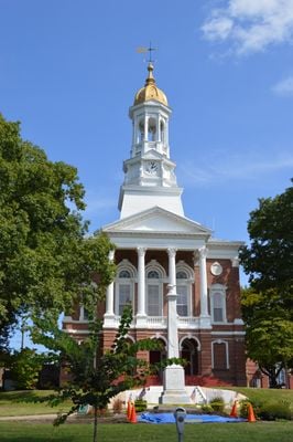
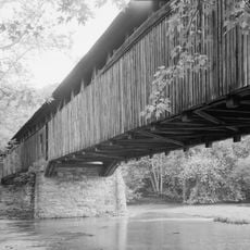
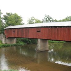
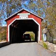
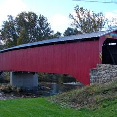
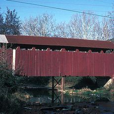
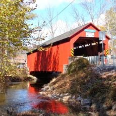
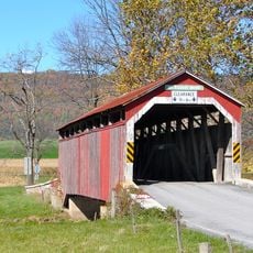
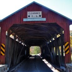
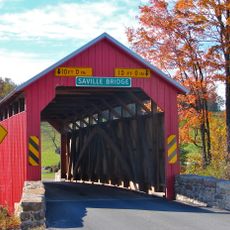
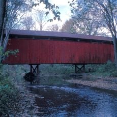
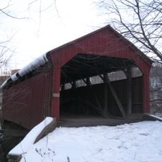
The region takes its name from the Juniata River, which winds through the landscape and has shaped how people settled here. Visitors can see old covered bridges and historic structures that reflect the way communities developed in this area.
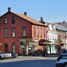
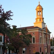
Visitors explore the region best by car, since communities are spread across a larger area. Mifflintown in the center serves as the main place to find information and administrative services.
The territory rests on different rock layers from various geological periods, creating a complex soil landscape. This geological diversity shapes the terrain and influences conditions for farming and natural habitats.
Location: Pennsylvania
Inception: March 2, 1831
Capital city: Mifflintown
Shares border with: Snyder County, Northumberland County, Dauphin County, Perry County, Franklin County, Huntingdon County, Mifflin County
Website: http://co.juniata.pa.us
GPS coordinates: 40.53000,-77.40000
Latest update: December 23, 2025 02:29
Main Line of Public Works
16.4 km
Port Royal Speedway
1.1 km
Little Buffalo State Park
21.1 km
Colonel Denning State Park
28.6 kmTuscarora State Forest
23 km
Fort Granville
18.2 kmClarks Ferry Bridge
36.1 km
Fowlers Hollow State Park
32.5 kmHoverter and Sholl Box Huckleberry Natural Area
23.6 kmDarlington Trail
37.4 km
Academia Pomeroy Covered Bridge
7.4 km
Clemson Island Prehistoric District
39.1 km
Dellville Covered Bridge
30.3 km
Old Stone Arch Bridge
14.5 km
New Germantown Covered Bridge
28.7 km
Montgomery Ward Building
16.5 km
State Game Lands Number 256
26.8 km
Adairs Covered Bridge
20.1 km
Newport Historic District
23.4 km
Perry County Courthouse
21.8 km
North Oriental Covered Bridge
36 km
Book's Covered Bridge
25.2 km
Mount Pleasant Covered Bridge
26.9 km
Rice Covered Bridge
22.9 km
Embassy Theatre
16.5 km
Saville Covered Bridge
10.2 km
Bistline Covered Bridge
22.6 km
Aline Covered Bridge
39.1 kmVisited this place? Tap the stars to rate it and share your experience / photos with the community! Try now! You can cancel it anytime.
Discover hidden gems everywhere you go!
From secret cafés to breathtaking viewpoints, skip the crowded tourist spots and find places that match your style. Our app makes it easy with voice search, smart filtering, route optimization, and insider tips from travelers worldwide. Download now for the complete mobile experience.
A unique approach to discovering new places❞
— Le Figaro
All the places worth exploring❞
— France Info
A tailor-made excursion in just a few clicks❞
— 20 Minutes