Enable Location

We need your location to show you interesting places around you

Discover nearby places

Find interesting locations and hidden gems around you

Precise directions

Get accurate directions and distances to places

Your location is never shared with other users. It's only used when you tap the location button.

Log in to your account

Start exploring — it's free

Trusted by 69,069 travelers worldwide

Continue with Google
Continue with Apple
or

We will send you a code to connect

By continuing, you accept our Terms and Conditions and our Privacy Policy

Check your inbox

We've sent a pincode in your inbox. Please enter the code below.

Discussion Reviews Photo
11.6k Popularity

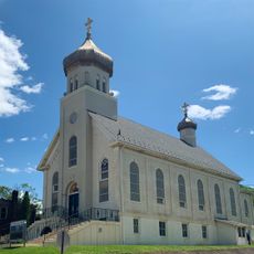
Albrightsville, Census-designated place in Carbon County, Pennsylvania, United States.

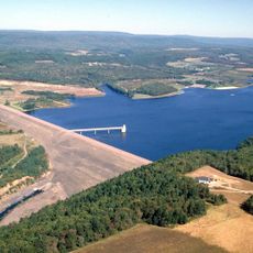
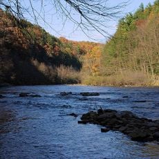
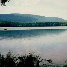
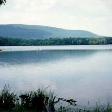
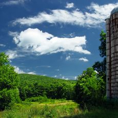
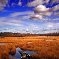
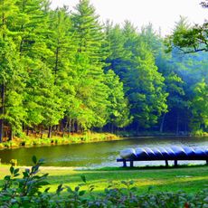
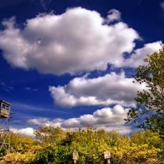
Albrightsville is a small residential area near the Pocono Mountains, spread across parts of Kidder and Penn Forest townships. The landscape here is shaped by forests and small streams, including Mud Run, which eventually flows into the Lehigh River.

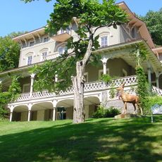
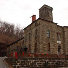
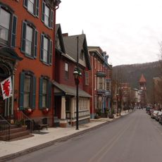
The area grew from early roots in mining and industry and gradually transformed into a residential community. This shift happened as the region moved away from extracting resources toward tourism and residential development.

The name comes from a local family with deep roots in the region, and the settlement grew around the needs of its residents. Today, modest homes and tree-covered land define the character of this quiet place.

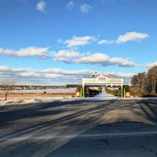
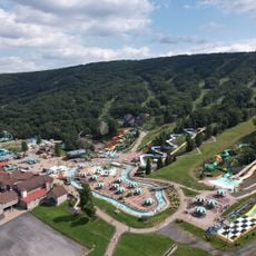
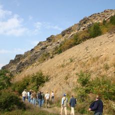
Pennsylvania Routes 534 and 903 meet at the eastern edge and provide easy access to Hickory Run State Park and outdoor activities in the area. Keep in mind this is a very rural location, so a car is necessary if you want to explore the neighborhood and nearby spots.

The area sits at an interesting junction between different natural zones, where Mud Run feeds into the larger Lehigh River system. This location makes it a quiet retreat with direct access to a major river valley in the region.

The community of curious travelers

AroundUs brings together thousands of curated places, local tips, and hidden gems, enriched daily by 60,000 contributors worldwide.

Start exploring
Location
Shares border with
Holiday Pocono
GPS coordinates
41.01440,-75.60110
Latest update
December 7, 2025 20:49
Around this place
Pocono Raceway
United States of America

Pocono Raceway

8.8 km
Hickory Run State Park
United States of America

Hickory Run State Park

7.4 km
Beltzville State Park
United States of America

Beltzville State Park

16.3 km
Lehigh Gorge State Park
United States of America

Lehigh Gorge State Park

14.3 km
Asa Packer Mansion
United States of America

Asa Packer Mansion

20.3 km
Camelback Mountain
United States of America

Camelback Mountain

21.1 km
Big Pocono State Park
United States of America

Big Pocono State Park

21.7 km
Harry Packer Mansion
United States of America

Harry Packer Mansion

20.3 km
Camelbeach Waterpark
United States of America

Camelbeach Waterpark

21 km
Nescopeck State Park
United States of America

Nescopeck State Park

26.3 km
Lehigh Gap
United States of America

Lehigh Gap

26.5 km
Gouldsboro State Park
United States of America

Gouldsboro State Park

25 km
Carbon County Jail
United States of America

Carbon County Jail

20.8 km
Turn Hole Tunnel
United States of America

Turn Hole Tunnel

19.9 km
Pinemere Camp
United States of America

Pinemere Camp

23.2 km
Kalahari Indoor Waterpark
United States of America

Kalahari Indoor Waterpark

19.8 km
Old Mauch Chunk Historic District
United States of America

Old Mauch Chunk Historic District

20.7 km
St. Mark's Episcopal Church
United States of America

St. Mark's Episcopal Church

20.5 km
Little Gap Covered Bridge
United States of America

Little Gap Covered Bridge

21.4 km
Stoddartsville Historic District
United States of America

Stoddartsville Historic District

13 km
Dimmick Memorial Library
United States of America

Dimmick Memorial Library

20.4 km
Bear Creek Village Historic District
United States of America

Bear Creek Village Historic District

22.8 km
Fenner–Snyder Mill
United States of America

Fenner–Snyder Mill

25.7 km
Summit Lanes
United States of America

Summit Lanes

20.5 km
Palmerton Historic District
United States of America

Palmerton Historic District

23.4 km
H2Oooohh! Indoor Waterpark
United States of America

H2Oooohh! Indoor Waterpark

5.7 km
Big Pocono Fire Tower
United States of America

Big Pocono Fire Tower

21.1 km
Hickory Run Boulder Field
United States of America

Hickory Run Boulder Field

5.3 km
Show the full map
Reviews
Share your experience

No review yet

Discussions
Start a discussion...

No discussion yet

« Albrightsville - Census-designated place in Carbon County, Pennsylvania, United States » is provided by Around Us (aroundus.com). Images and texts are derived from Wikimedia project under a Creative Commons license. You are allowed to copy, distribute, and modify copies of this page, under the conditions set by the license, as long as this note is clearly visible.

Discover hidden gems everywhere you go!

From secret cafés to breathtaking viewpoints, skip the crowded tourist spots and find places that match your style. Our app makes it easy with voice search, smart filtering, route optimization, and insider tips from travelers worldwide. Download now for the complete mobile experience.

Around Us App Screenshot

A unique approach to discovering new places

Le Figaro

All the places worth exploring

France Info

A tailor-made excursion in just a few clicks

20 Minutes

Around Us
Travel Guide & Maps
Download

Send to your phone

QR Code
1

Open the camera app on your mobile.

2

Point at the QR code with your camera. A notification will appear.

3

Tap the notification to open the link.