Cime de la Bercia, Mountain summit in Provence-Alpes-Côte d'Azur, France.
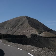
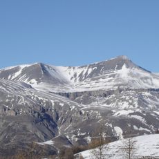
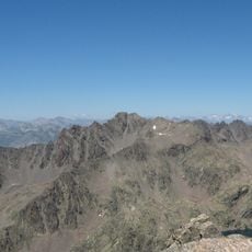
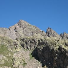
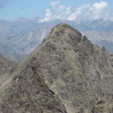
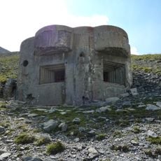
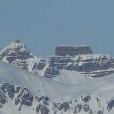
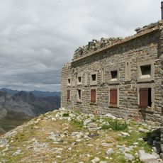
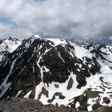
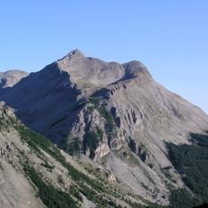
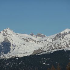
Cime de la Bercia is a mountain summit in the Southern Alps that rises to 2090 meters and displays rocky slopes with trails cutting through alpine plants. The terrain features exposed rock faces and ridgelines that shape the mountain's distinctive profile.
French cartographers documented the peak in the 18th century during topographical surveys of the Southern Alps, contributing to the first precise maps of the region. These mapping efforts established the geographic understanding of the area.
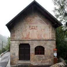
Local shepherds use the slopes for seasonal movement of sheep herds in summer, a practice that remains part of the region's pastoral heritage and daily rural life.
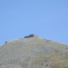
Several marked trails lead to the summit and require good physical fitness plus equipment suited for alpine conditions. Weather can change rapidly at this altitude, so visitors should be prepared for variable conditions and bring appropriate clothing.
On clear days, visitors enjoy 360-degree views over surrounding valleys toward distant Alpine ranges extending toward the Mediterranean coast. This panorama allows sight of multiple mountain chains in a single view.
Location: Provence-Alpes-Côte d'Azur
Elevation above the sea: 2,090 m
GPS coordinates: 44.23601,6.90291
Latest update: December 15, 2025 13:23
Cime de la Bonette
12.2 km
Mont Mounier
10.6 km
Ouvrage Restefond
12.9 km
Ouvrage La Moutière
12.2 km
Monte Tenibres
7.6 km
Corborant
8.2 km
Becco Alto d'Ischiator
8.9 km
Ouvrage Granges Communes
12.8 km
Ouvrage Col de Crous
8.4 km
Saint-Étienne-de-Tinée - Chapelle Saint-Erige
2.7 km
Fort Carra
7.7 km
Point d'appui de Pelousette
12.5 km
Fortificazioni ai Becchi Rossi
12.2 km
Saint-Étienne-de-Tinée - Ancien couvent des Trinitaires de Saint-Salaire
2.8 km
Côte de l'Âne
8.2 km
Église Saint-Dalmas de Saint-Dalmas-le-Selvage
6 km
Saint-Étienne-de-Tinée - Église des Dignitaires
2.9 km
Saint-Étienne-de-Tinée - Chapelle Saint-Sébastien
2.7 km
Mont Bal
11.4 km
Batterie de la Tête de Vinaigre
8.1 km
Chapelle Sainte-Marguerite de Saint-Dalmas-le-Selvage
6.2 km
Roche Grande
10.2 km
Cime de Pal
6.8 km
Saint-Étienne-de-Tinée - Chapelle Saint-Maur
2.8 km
Saint-Étienne-de-Tinée - Maison de Sébastien Fabri
2.9 km
Chapelle des Barrels
10.9 km
Église Saint-Pierre de Bousiéyas
10.1 km
Chapelle Saint-Michel
2.9 kmVisited this place? Tap the stars to rate it and share your experience / photos with the community! Try now! You can cancel it anytime.
Discover hidden gems everywhere you go!
From secret cafés to breathtaking viewpoints, skip the crowded tourist spots and find places that match your style. Our app makes it easy with voice search, smart filtering, route optimization, and insider tips from travelers worldwide. Download now for the complete mobile experience.
A unique approach to discovering new places❞
— Le Figaro
All the places worth exploring❞
— France Info
A tailor-made excursion in just a few clicks❞
— 20 Minutes