Enable Location

We need your location to show you interesting places around you

Discover nearby places

Find interesting locations and hidden gems around you

Precise directions

Get accurate directions and distances to places

Your location is never shared with other users. It's only used when you tap the location button.

Mandohol Dam

Log in to your account

Start exploring — it's free

Trusted by 63,841 travelers worldwide

Continue with Google
Continue with Apple
or

We will send you a code to connect

By continuing, you accept our Terms and Conditions and our Privacy Policy

Check your inbox

We've sent a pincode in your inbox. Please enter the code below.

Mandohol Dam
Discussion Reviews 1 Photos
2.1k Popularity

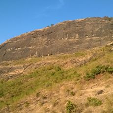
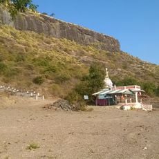
Mandohol Dam, Embankment dam in Karjule Hareshwar, India.

Mandohol Dam is an earth-fill dam that spans the Mandohol River in Maharashtra and reaches about 26 meters in height. The structure holds water behind it and releases it through a canal system to irrigate the surrounding areas.

The dam was built between 1977 and 1983, a time of major infrastructure development in the Ahmednagar region. This construction period was part of broader efforts in Maharashtra to improve water management.

The dam supports farming in the region by providing water that allows farmers to irrigate their fields throughout the year. It has become part of daily life for local communities who depend on the water it supplies.

The best way to visit the structure is by approaching it from the nearby roads that lead to it. Those who go should keep in mind that the weather can strongly influence conditions on site and that the area is relatively open with little shade.

Behind the dam forms a lake that grows and shrinks depending on the season. This lake is not only important for water storage but also attracts birds and provides a gathering place for the local community.

The community of curious travelers

AroundUs brings together thousands of curated places, local tips, and hidden gems, enriched daily by 60,000 contributors worldwide.

Start exploring
Location
Height
26.07 m
GPS coordinates
19.19889,74.30778
Latest update
December 14, 2025 09:47
Reviews
Share your experience

No review yet

Discussions
Start a discussion...

No discussion yet

« Mandohol Dam - Embankment dam in Karjule Hareshwar, India » is provided by Around Us (aroundus.com). Images and texts are derived from Wikimedia project under a Creative Commons license. You are allowed to copy, distribute, and modify copies of this page, under the conditions set by the license, as long as this note is clearly visible.

Discover hidden gems everywhere you go!

From secret cafés to breathtaking viewpoints, skip the crowded tourist spots and find places that match your style. Our app makes it easy with voice search, smart filtering, route optimization, and insider tips from travelers worldwide. Download now for the complete mobile experience.

Around Us App Screenshot

A unique approach to discovering new places

Le Figaro

All the places worth exploring

France Info

A tailor-made excursion in just a few clicks

20 Minutes

Around Us
Travel Guide & Maps
Download

Send to your phone

QR Code
1

Open the camera app on your mobile.

2

Point at the QR code with your camera. A notification will appear.

3

Tap the notification to open the link.