Chest opened
+${chestReward.xp} XP
Explorer
NOUVEAU ×${chestReward.collectible.quantity}
tapez pour fermer
Chest locked

Open chests in the app

Around Us is built for your phone — chests unlock when you walk, explore and capture nearby places.

Enable Location

We need your location to show you interesting places around you

Discover nearby places

Find interesting locations and hidden gems around you

Precise directions

Get accurate directions and distances to places

Your location is never shared with other users. It's only used when you tap the location button.

Cerro del Chiquihuite

Log in to your account

Start exploring — it's free

Trusted by 72,990 travelers worldwide

Continue with Google
Continue with Apple
or

We will send you a code to connect

By continuing, you accept our Terms and Conditions and our Privacy Policy

Check your inbox

We've sent a pincode in your inbox. Please enter the code below.

Cerro del Chiquihuite
Discussion Reviews 1 Photos
25.8k Popularity

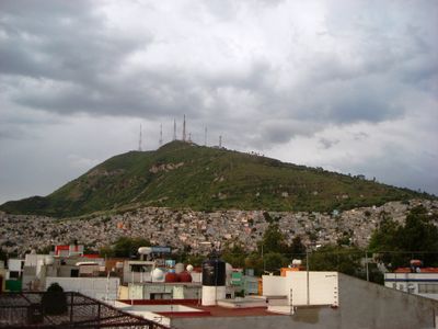
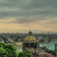
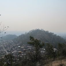
Cerro del Chiquihuite, Mountain in Sierra de Guadalupe range, Mexico.

Cerro del Chiquihuite is a mountain in State of Mexico that reaches a height of 2,730 meters (8,960 feet) and displays pinkish and violet andesite rock formations across its slopes. The summit holds numerous transmission towers for radio and television stations, connected by a road network from both sides.

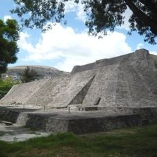
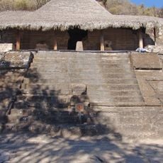
During the 15th century, this formation stood near Lake Texcoco and served as a quarry for construction materials used in the Templo Mayor. The Aztecs extracted volcanic rock from these slopes for various building projects in their capital Tenochtitlan.

The mountain shelters several water springs, including El Pocito, which still provide drinking water to nearby communities in both the capital and the state. Local residents have relied on these natural sources for generations, making them central to daily life in the surrounding areas.

Access to the summit follows paved roads from both sides, though entry may be restricted around the transmission towers. Hikers can explore the lower slopes on open trails, while the peak zone often remains closed to visitors.

In 2002, the summit became the site of an incident called Chiquihuitazo when armed guards took control of the television transmission facilities. The event attracted national attention and sparked widespread debate about media security and infrastructure protection in the country.

The community of curious travelers

AroundUs brings together thousands of curated places, local tips, and hidden gems, enriched daily by 60,000 contributors worldwide.

Start exploring
Location
Location
Elevation above the sea
2,730 m
GPS coordinates
19.53280,-99.13060
Latest update
December 20, 2025 15:58
Reviews
Share your experience

No review yet

Discussions
Start a discussion...

No discussion yet

« Cerro del Chiquihuite - Mountain in Sierra de Guadalupe range, Mexico » is provided by Around Us (aroundus.com). Images and texts are derived from Wikimedia project under a Creative Commons license. You are allowed to copy, distribute, and modify copies of this page, under the conditions set by the license, as long as this note is clearly visible.

Discover hidden gems everywhere you go!

From secret cafés to breathtaking viewpoints, skip the crowded tourist spots and find places that match your style. Our app makes it easy with voice search, smart filtering, route optimization, and insider tips from travelers worldwide. Download now for the complete mobile experience.

Around Us App Screenshot

A unique approach to discovering new places

Le Figaro

All the places worth exploring

France Info

A tailor-made excursion in just a few clicks

20 Minutes

Around Us
Travel Guide & Maps
Download

Send to your phone

QR Code
1

Open the camera app on your mobile.

2

Point at the QR code with your camera. A notification will appear.

3

Tap the notification to open the link.