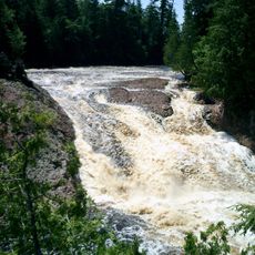
Manabezho Falls, Waterfall in Gogebic County, US.
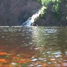
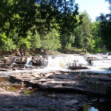
Manabezho Falls is a waterfall on the Presque Isle River in the Ottawa National Forest where water drops roughly 25 feet over rocky ledges. The cascade spreads widely across the valley and is reached by hiking trails that include a suspension bridge.
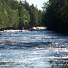
The waterfall has been an important site for Ojibwe and other indigenous nations for many centuries as they inhabited and used this region. The name itself preserves the memory of this long human history at this location.
The name comes from Ojibwe tradition, honoring the indigenous peoples who lived in harmony with these lands for generations. Visitors walking here today step through a place that held deep meaning for the communities who came before.
The waterfall is accessible via well-maintained trails that wind through the forest and offer several viewpoints. A suspension bridge across the river allows visitors to see the falls from different angles and perspectives.
During periods of low water, the falls split into separate channels that flow around small rock islands in the riverbed. This shifting pattern means the waterfall looks noticeably different depending on the season and recent rainfall.
Location: Gogebic County
Part of: Presque Isle River
GPS coordinates: 46.70750,-89.97180
Latest update: December 14, 2025 13:03
Porcupine Mountains
18.2 km
Copper mining in Michigan
34.9 km
Copper Peak
14.9 km
Big Bay State Park
54.4 km
SS Ira H. Owen
23.1 km
Michigan Island Light
44 km
Ontonagon School
53.5 km
Superior Falls
37.5 km
Outer Island Light
53.2 km
Ironwood Theatre
32 km
Ontonagon Light
53.1 km
Great Conglomerate Falls
10.5 km
Manido Falls
396 m
Nawadaha Falls
888 m
Ironwood Memorial/Municipal Building
31.7 km
Ironwood Carnegie Library
32.3 km
Ontonagon Harbor Piers Historic District
53.8 km
Gogebic County Courthouse
25.8 km
Ontonagon County Courthouse
53.7 km
Solomon S. Curry House
31.5 km
Annala Round Barn
35.3 km
Old Iron County Courthouse
33.1 km
Bergland Administrative Site
32.8 km
Plummer Mine Headframe
41.5 km
Planter Road – Jackson Creek Bridge
21.6 km
Lake Gogebic State Park Beach
41.7 km
Lake Gogebic State Park
41.1 km
Porcupine Mountains Wilderness State Park
18.6 kmVisited this place? Tap the stars to rate it and share your experience / photos with the community! Try now! You can cancel it anytime.
Discover hidden gems everywhere you go!
From secret cafés to breathtaking viewpoints, skip the crowded tourist spots and find places that match your style. Our app makes it easy with voice search, smart filtering, route optimization, and insider tips from travelers worldwide. Download now for the complete mobile experience.
A unique approach to discovering new places❞
— Le Figaro
All the places worth exploring❞
— France Info
A tailor-made excursion in just a few clicks❞
— 20 Minutes