Chest opened
+${chestReward.xp} XP
Explorer
NOUVEAU ×${chestReward.collectible.quantity}
tapez pour fermer
Chest locked

Open chests in the app

Around Us is built for your phone — chests unlock when you walk, explore and capture nearby places.

Enable Location

We need your location to show you interesting places around you

Discover nearby places

Find interesting locations and hidden gems around you

Precise directions

Get accurate directions and distances to places

Your location is never shared with other users. It's only used when you tap the location button.

Spruce Mountain

Log in to your account

Start exploring — it's free

Trusted by 72,889 travelers worldwide

Continue with Google
Continue with Apple
or

We will send you a code to connect

By continuing, you accept our Terms and Conditions and our Privacy Policy

Check your inbox

We've sent a pincode in your inbox. Please enter the code below.

Spruce Mountain
Discussion Reviews 1 Photos
12.2k Popularity

Spruce Mountain, Mountain peak in Monongahela National Forest, West Virginia.

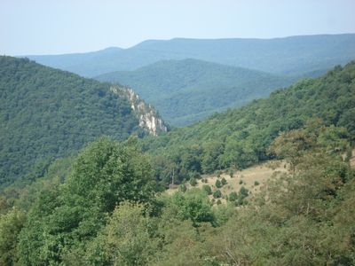
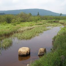
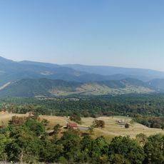
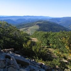
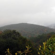
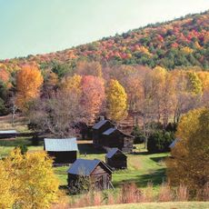
Spruce Mountain is a ridge in Monongahela National Forest that rises across multiple peaks with elevations over 4,500 feet. The mountain forms the highest ridge line of the Allegheny Mountains in this region, covered with dense spruce forests.

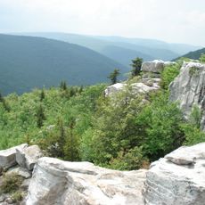
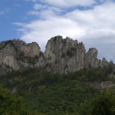
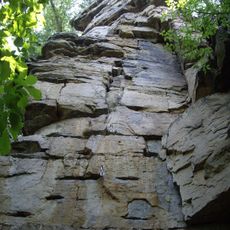
The mountain formed through tectonic activity and erosion over millions of years, leaving exposed sedimentary layers and distinctive boulder fields visible today. Its geological history shaped the landscape that exists here now.

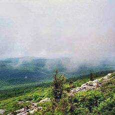
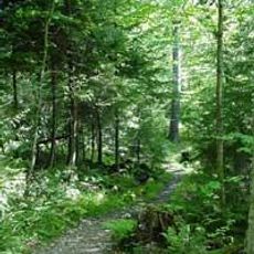
The dense spruce forest in higher elevations creates an environment like those found in northern New England, shaping how locals use the mountain for outdoor activities.

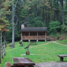
The mountain is accessible from Route 33 via paved roads, though winter weather often limits access during colder months. Visitors should expect changing conditions and be prepared for limited trail options in the off-season.

Strong year-round winds at the summit shape trees into twisted, low-growing forms that resemble Krummholz patterns. These unusual tree shapes develop because of the harsh, persistent winds at this elevation.

The community of curious travelers

AroundUs brings together thousands of curated places, local tips, and hidden gems, enriched daily by 60,000 contributors worldwide.

Start exploring
Location
GPS coordinates
38.75000,-79.48000
Latest update
December 7, 2025 20:46
Around this place
Dolly Sods Wilderness
United States of America

Dolly Sods Wilderness

29 km
Spruce Knob
United States of America

Spruce Knob

7.2 km
Smoke Hole Canyon
United States of America

Smoke Hole Canyon

20.9 km
Canaan Valley Resort State Park
United States of America

Canaan Valley Resort State Park

30.5 km
Smoke Hole Caverns
United States of America

Smoke Hole Caverns

32.1 km
Germany Valley
United States of America

Germany Valley

8 km
Seneca Caverns
United States of America

Seneca Caverns

8.1 km
Roaring Plains West Wilderness
United States of America

Roaring Plains West Wilderness

21.3 km
Otter Creek Wilderness
United States of America

Otter Creek Wilderness

34.9 km
Bickle Knob
United States of America

Bickle Knob

29.9 km
Gaudineer Scenic Area
United States of America

Gaudineer Scenic Area

34.3 km
Spruce Knob-Seneca Rocks National Recreation Area
United States of America

Spruce Knob-Seneca Rocks National Recreation Area

13.5 km
Shavers Mountain
United States of America

Shavers Mountain

29.4 km
Laurel Fork North Wilderness
United States of America

Laurel Fork North Wilderness

16.8 km
Sites Homestead
United States of America

Sites Homestead

13.3 km
Middle Mountain Cabins
United States of America

Middle Mountain Cabins

23.1 km
Laurel Fork South Wilderness
United States of America

Laurel Fork South Wilderness

21.1 km
Old Probst Church
United States of America

Old Probst Church

25.7 km
Pendleton County Poor Farm
United States of America

Pendleton County Poor Farm

16.7 km
Camp Bartow Historic District
United States of America

Camp Bartow Historic District

34.7 km
Bowers House
United States of America

Bowers House

30.3 km
Ananias Pitsenbarger Farm
United States of America

Ananias Pitsenbarger Farm

23.8 km
Franklin Gorge
United States of America

Franklin Gorge

16.9 km
Old Judy Church
United States of America

Old Judy Church

26.1 km
United States of America

Castle Mountain

12.8 km
Circleville School
United States of America

Circleville School

8.6 km
Day-Vandevander Mill
United States of America

Day-Vandevander Mill

20.6 km
McCoy House
United States of America

McCoy House

17.7 km
Show the full map
Reviews
Share your experience

No review yet

Discussions
Start a discussion...

No discussion yet

« Spruce Mountain - Mountain peak in Monongahela National Forest, West Virginia » is provided by Around Us (aroundus.com). Images and texts are derived from Wikimedia project under a Creative Commons license. You are allowed to copy, distribute, and modify copies of this page, under the conditions set by the license, as long as this note is clearly visible.

Discover hidden gems everywhere you go!

From secret cafés to breathtaking viewpoints, skip the crowded tourist spots and find places that match your style. Our app makes it easy with voice search, smart filtering, route optimization, and insider tips from travelers worldwide. Download now for the complete mobile experience.

Around Us App Screenshot

A unique approach to discovering new places

Le Figaro

All the places worth exploring

France Info

A tailor-made excursion in just a few clicks

20 Minutes

Around Us
Travel Guide & Maps
Download

Send to your phone

QR Code
1

Open the camera app on your mobile.

2

Point at the QR code with your camera. A notification will appear.

3

Tap the notification to open the link.