Chest opened
+${chestReward.xp} XP
Explorer
NOUVEAU ×${chestReward.collectible.quantity}
tapez pour fermer
Chest locked

Open chests in the app

Around Us is built for your phone — chests unlock when you walk, explore and capture nearby places.

Enable Location

We need your location to show you interesting places around you

Discover nearby places

Find interesting locations and hidden gems around you

Precise directions

Get accurate directions and distances to places

Your location is never shared with other users. It's only used when you tap the location button.

Log in to your account

Start exploring — it's free

Trusted by 72,987 travelers worldwide

Continue with Google
Continue with Apple
or

We will send you a code to connect

By continuing, you accept our Terms and Conditions and our Privacy Policy

Check your inbox

We've sent a pincode in your inbox. Please enter the code below.

State Game Lands Number 38
Discussion Reviews Photo
1.3k Popularity

State Game Lands Number 38, Wildlife conservation area in Monroe County, Pennsylvania

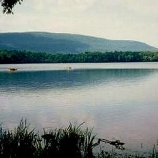
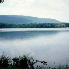
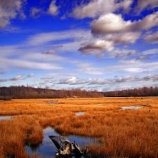
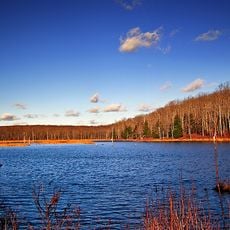
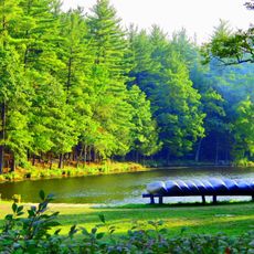
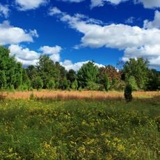
State Game Lands Number 38 is a wildlife conservation area in Monroe County covering roughly 5,500 acres of mixed forest, grassland, and rolling terrain. The land is managed by the Pennsylvania Game Commission to maintain habitats for native wildlife species.

The Pennsylvania Game Commission acquired these lands in the early 1900s as part of a statewide effort to restore wildlife populations depleted by uncontrolled hunting. Since then, the area has served as a refuge for deer, bears, and other forest-dwelling species.

Local hunters come here during fall and winter to pursue their traditional hunting practices in a regulated setting. The activities are woven into the fabric of regional outdoor life and support conservation goals at the same time.

Access to the land requires valid hunting permits and licenses from the Pennsylvania Game Commission. Regulations change seasonally based on wildlife management needs, so visitors should check current rules before planning their visit.

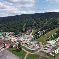
This conservation area shares a boundary with Big Pocono State Park and connects to a network of four neighboring state game lands. These linked protected areas together form one of the largest continuous natural corridors in the region.

The community of curious travelers

AroundUs brings together thousands of curated places, local tips, and hidden gems, enriched daily by 60,000 contributors worldwide.

Start exploring
Location
Location
GPS coordinates
41.04639,-75.38694
Latest update
December 14, 2025 18:14
Around this place
Pocono Raceway
United States of America

Pocono Raceway

10.5 km
Camelback Mountain
United States of America

Camelback Mountain

3 km
Big Pocono State Park
United States of America

Big Pocono State Park

3.5 km
Delaware Water Gap Toll Bridge
United States of America

Delaware Water Gap Toll Bridge

22.5 km
Camelbeach Waterpark
United States of America

Camelbeach Waterpark

2.7 km
Tobyhanna State Park
United States of America

Tobyhanna State Park

21.5 km
Sherman Theater
United States of America

Sherman Theater

17.7 km
Gouldsboro State Park
United States of America

Gouldsboro State Park

19.2 km
United States of America

Tannersville Cranberry Bog

10.8 km
Delaware State Forest
United States of America

Delaware State Forest

20.4 km
Pinemere Camp
United States of America

Pinemere Camp

7.2 km
Kalahari Indoor Waterpark
United States of America

Kalahari Indoor Waterpark

5.9 km
Cherry Valley National Wildlife Refuge
United States of America

Cherry Valley National Wildlife Refuge

19.6 km
Weona Park Carousel
United States of America

Weona Park Carousel

22.7 km
Pocono Manor Historic District
United States of America

Pocono Manor Historic District

12.4 km
Columcille Megalith Park
United States of America

Columcille Megalith Park

20.4 km
Stroud Mansion
United States of America

Stroud Mansion

17.3 km
Quiet Valley Farm
United States of America

Quiet Valley Farm

15.2 km
Christ Hamilton United Lutheran Church and Cemetery
United States of America

Christ Hamilton United Lutheran Church and Cemetery

15.7 km
Stoddartsville Historic District
United States of America

Stoddartsville Historic District

22.3 km
Shawnee-Minisink Site
United States of America

Shawnee-Minisink Site

22.1 km
Monroe County Courthouse
United States of America

Monroe County Courthouse

17.4 km
Academy Hill Historic District
United States of America

Academy Hill Historic District

17.4 km
Ross Common Manor
United States of America

Ross Common Manor

21.3 km
Fenner–Snyder Mill
United States of America

Fenner–Snyder Mill

13.8 km
Summit Lanes
United States of America

Summit Lanes

7.1 km
H2Oooohh! Indoor Waterpark
United States of America

H2Oooohh! Indoor Waterpark

19.6 km
Big Pocono Fire Tower
United States of America

Big Pocono Fire Tower

2.9 km
Show the full map
Reviews
Share your experience

No review yet

Discussions
Start a discussion...

No discussion yet

« State Game Lands Number 38 - Wildlife conservation area in Monroe County, Pennsylvania » is provided by Around Us (aroundus.com). Images and texts are derived from Wikimedia project under a Creative Commons license. You are allowed to copy, distribute, and modify copies of this page, under the conditions set by the license, as long as this note is clearly visible.

Discover hidden gems everywhere you go!

From secret cafés to breathtaking viewpoints, skip the crowded tourist spots and find places that match your style. Our app makes it easy with voice search, smart filtering, route optimization, and insider tips from travelers worldwide. Download now for the complete mobile experience.

Around Us App Screenshot

A unique approach to discovering new places

Le Figaro

All the places worth exploring

France Info

A tailor-made excursion in just a few clicks

20 Minutes

Around Us
Travel Guide & Maps
Download

Send to your phone

QR Code
1

Open the camera app on your mobile.

2

Point at the QR code with your camera. A notification will appear.

3

Tap the notification to open the link.