Enable Location

We need your location to show you interesting places around you

Discover nearby places

Find interesting locations and hidden gems around you

Precise directions

Get accurate directions and distances to places

Your location is never shared with other users. It's only used when you tap the location button.

Sendero Los Quetzales

Log in to your account

Start exploring — it's free

Trusted by 62,064 travelers worldwide

Continue with Google
Continue with Apple
or

We will send you a code to connect

By continuing, you accept our Terms and Conditions and our Privacy Policy

Check your inbox

We've sent a pincode in your inbox. Please enter the code below.

Sendero Los Quetzales

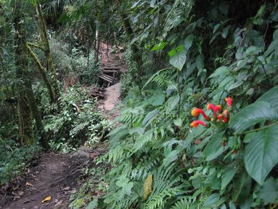
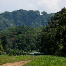
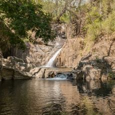
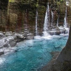
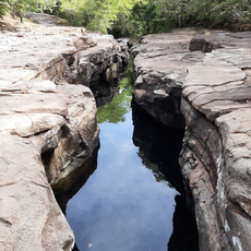
Sendero Los Quetzales, Nature trail in Los Naranjos, Panama.

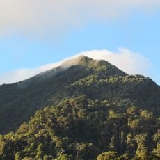
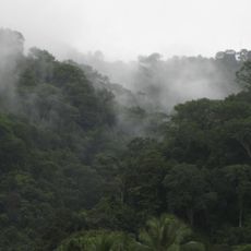
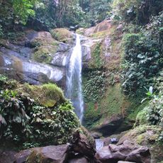
Sendero Los Quetzales is a hiking path that runs through cloud forests and high terrain, connecting Cerro Punta and Boquete over roughly 9.6 kilometers. The trail climbs to about 2,500 meters (8,200 feet) and passes through several different landscape types as it gains elevation.

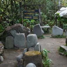
The trail was created to establish a protected corridor within Volcan Baru National Park for wildlife watching and conservation work. This development significantly changed how eco-tourism developed in Panama.

Local farmers work their coffee plants along sections of the path, and their presence shows how agriculture shapes daily life in this mountain region.

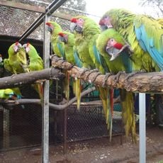
Start early in the morning to get the best chance of seeing quetzals and other birds along the way. Wear good hiking boots and bring rain gear, since the terrain is steep and weather changes quickly at this elevation.

The path crosses through several different climate zones over a short distance, allowing rare orchids and endemic bird species to live in these specific spots. This natural variety happens because of how elevation and weather change as you walk.

The community of curious travelers

AroundUs brings together thousands of curated places, local tips, and hidden gems, enriched daily by 60,000 contributors worldwide.

Start exploring
Location
GPS coordinates
8.84473,-82.53347
Latest update
December 6, 2025 19:08
Panama off the main routes

Panama offers much more than its famous canal. The places in this collection show the country's range and variety. In the west, mountain landscapes and volcanoes rise above the land. Volcan Baru offers views of both oceans on clear days. Along the coasts, islands sit with tropical beaches and coral...

« Sendero Los Quetzales - Nature trail in Los Naranjos, Panama » is provided by Around Us (aroundus.com). Images and texts are derived from Wikimedia project under a Creative Commons license. You are allowed to copy, distribute, and modify copies of this page, under the conditions set by the license, as long as this note is clearly visible.

Discover hidden gems everywhere you go!

From secret cafés to breathtaking viewpoints, skip the crowded tourist spots and find places that match your style. Our app makes it easy with voice search, smart filtering, route optimization, and insider tips from travelers worldwide. Download now for the complete mobile experience.

Around Us App Screenshot

A unique approach to discovering new places

Le Figaro

All the places worth exploring

France Info

A tailor-made excursion in just a few clicks

20 Minutes

Around Us
Travel Guide & Maps
Download

Send to your phone

QR Code
1

Open the camera app on your mobile.

2

Point at the QR code with your camera. A notification will appear.

3

Tap the notification to open the link.