Chirripó National Park, National park in Limón Province, Costa Rica.
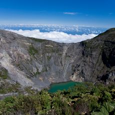
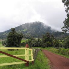
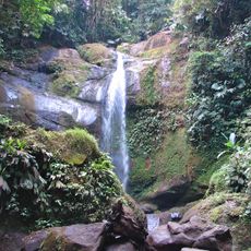
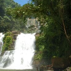
This protected area spans 508 square kilometers across three provinces, featuring cloud forests, rainforests, and high-altitude wet desert environments.
The Costa Rican government established Chirripó National Park in 1975 to safeguard the diverse ecosystems of the Talamanca mountain range.
Local communities near the park provide essential services including baggage transport, accommodations, and food services through the Aguas Eternas consortium.
Visitors must make reservations Monday through Friday and can access the park daily from 8:00 AM to 12:00 PM and 1:00 PM to 4:00 PM.
The park recorded Costa Rica's lowest temperature at -9°C and contains the country's highest peak, Cerro Chirripó, reaching 3,820 meters.
Location: Limón Province
Inception: 1975
Part of: Talamanca Range-La Amistad Reserves
GPS coordinates: 9.48000,-83.48000
Latest update: March 4, 2025 11:05
Costa Rica spans 19,700 square miles (51,100 square kilometers) between the Pacific Ocean and Caribbean Sea, offering photographers a concentration of varied landscapes within a compact area. The country maintains over 30 national parks and protected areas, including Arenal Volcano, whose near-perfect cone rises 5,479 feet (1,670 meters) above surrounding rainforest, and Monteverde Cloud Forest, where mist drifts through canopy vegetation supporting rare species such as the resplendent quetzal. Rio Celeste flows through Tenorio Volcano National Park, displaying its characteristic turquoise color from volcanic minerals, while Tabacon Hot Springs delivers naturally heated water from underground sources. Coastal regions present diverse subjects, from the beaches of Manuel Antonio National Park, where white-faced capuchin monkeys move through trees, to Cahuita National Park on the Caribbean coast with its coral reefs. The Nicoya Peninsula and Papagayo Peninsula provide access to Tamarindo Beach and Santa Teresa Beach, while the southern zone includes Marino Ballena National Park, named for its whale-shaped sandbar visible at low tide. Tortuga Island, off the coast of Puntarenas, serves as a day-trip destination. Inland, San Jose Central Market documents daily commerce, the National Theater displays neoclassical architecture from 1897, and Guayabo National Monument preserves pre-Columbian ruins. Cerro Chirripó rises to 12,533 feet (3,820 meters) as the country's highest point, offering views of both oceans in clear conditions.
Stone spheres of Costa Rica
63.3 km
Manuel Antonio National Park
73 km
Cerro Chirripó
1.1 km
Irazú Volcano
68.9 km
Turrialba
67.6 km
Guayabo National Monument
59.5 km
La Amistad International Park
60.3 km
Cerro de la Muerte
31.5 km
Irazú Volcano National Park
69.5 km
Nuestra Señora de los Ángeles
63.9 km
Orosi Church
54.3 km
Talamanca Reserve
60 km
Los Quetzales National Park
48.4 km
Ballena ("Whale") Marine National Park
51.3 km
Tapantí National Park
47.7 km
Barbilla National Park
51.8 km
Lankester Botanical Garden
60.2 km
Turrialba Volcano National Park
69 km
Cerro Ventisqueros
3.3 km
Volio Waterfall
69.4 km
Our Lady of Carmel Cathedral, Cartago
64.8 km
Iglesia de San Diego (La Unión)
73.9 km
Nauyaca Waterfalls
43.9 km
Playa Espadilla Sur
74.1 km
Talamanca Range-La Amistad Reserves
60 km
Playa Gemelas
73.5 km
Colonia Beach
46.5 km
Beach at Manuel Antonio Park
73.9 kmReviews
Visited this place? Tap the stars to rate it and share your experience / photos with the community! Try now! You can cancel it anytime.
Discover hidden gems everywhere you go!
From secret cafés to breathtaking viewpoints, skip the crowded tourist spots and find places that match your style. Our app makes it easy with voice search, smart filtering, route optimization, and insider tips from travelers worldwide. Download now for the complete mobile experience.
A unique approach to discovering new places❞
— Le Figaro
All the places worth exploring❞
— France Info
A tailor-made excursion in just a few clicks❞
— 20 Minutes