See the monuments around you in AROpen chests in the app
Around Us is built for your phone — point your camera at the streets and discover the monuments and places around you in augmented reality.Around Us is built for your phone — chests unlock when you walk, explore and capture nearby places.
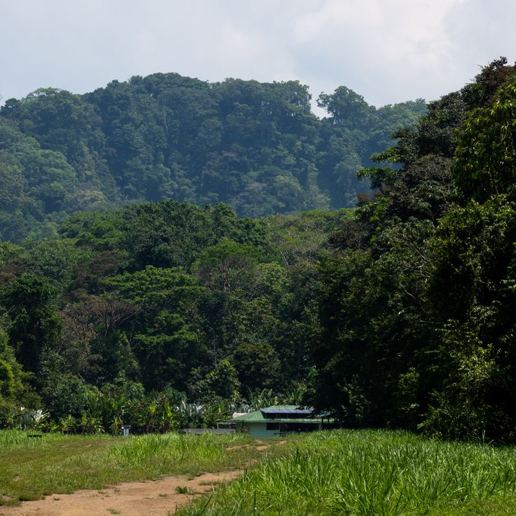
Costa Rica spans 19,700 square miles (51,100 square kilometers) between the Pacific Ocean and Caribbean Sea, offering photographers a concentration of varied landscapes within a compact area. The country maintains over 30 national parks and protected areas, including Arenal Volcano, whose near-perfect cone rises 5,479 feet (1,670 meters) above surrounding rainforest, and Monteverde Cloud Forest, where mist drifts through canopy vegetation supporting rare species such as the resplendent quetzal. Rio Celeste flows through Tenorio Volcano National Park, displaying its characteristic turquoise color from volcanic minerals, while Tabacon Hot Springs delivers naturally heated water from underground sources.
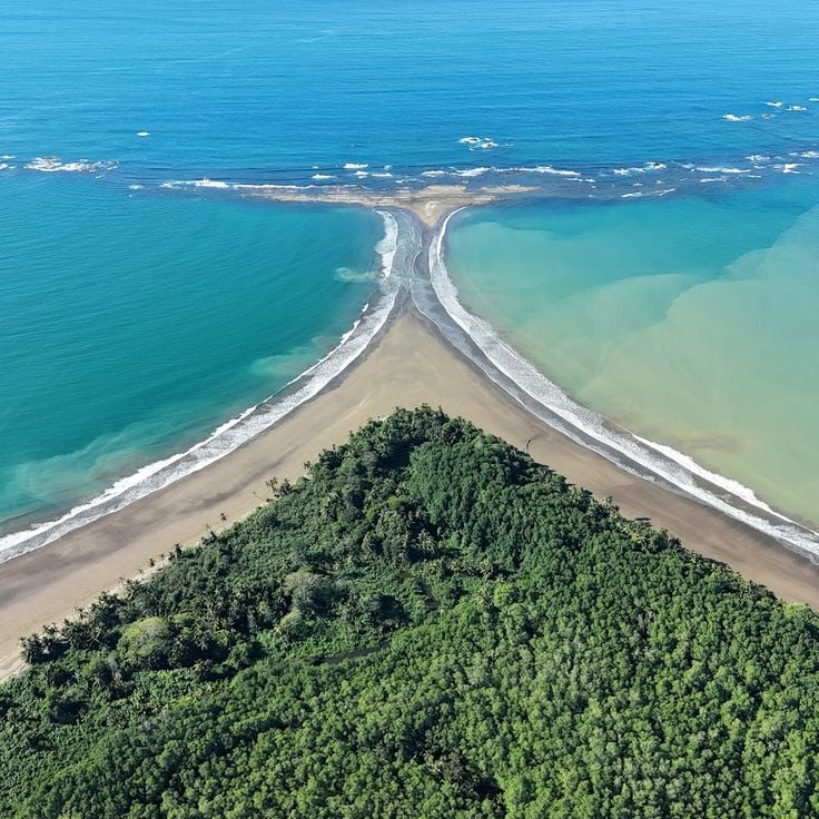
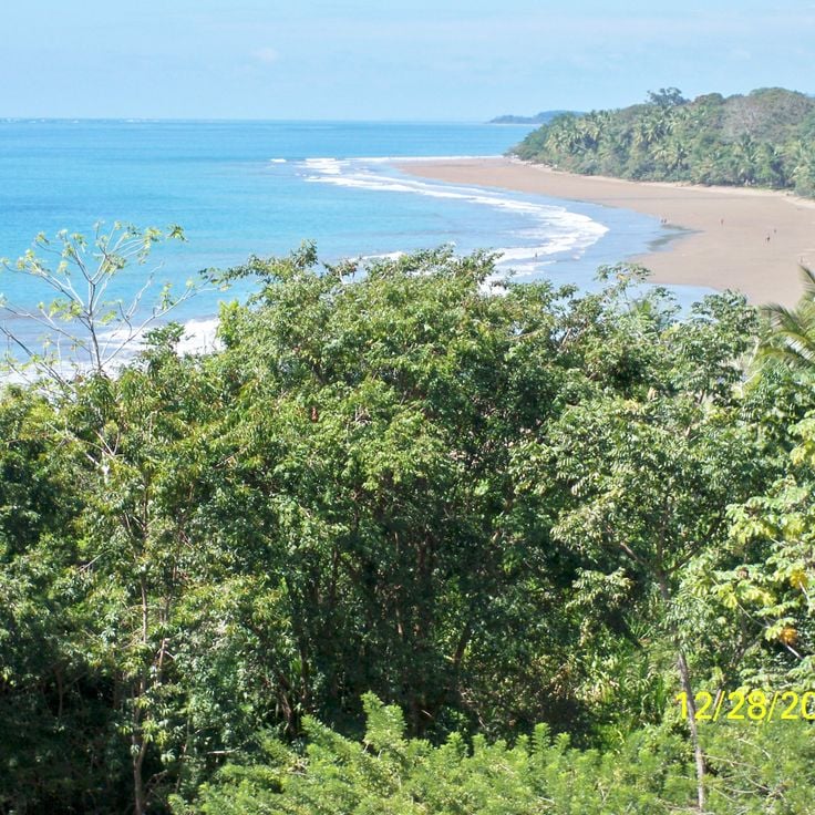
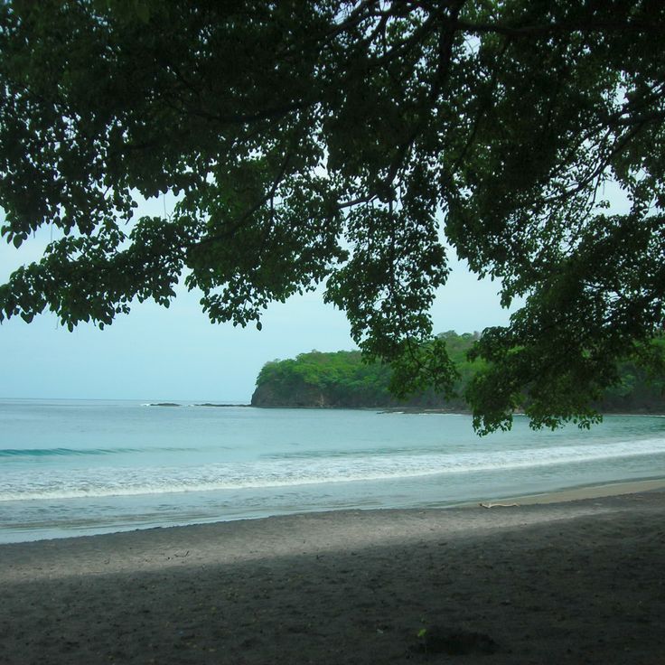
Coastal regions present diverse subjects, from the beaches of Manuel Antonio National Park, where white-faced capuchin monkeys move through trees, to Cahuita National Park on the Caribbean coast with its coral reefs. The Nicoya Peninsula and Papagayo Peninsula provide access to Tamarindo Beach and Santa Teresa Beach, while the southern zone includes Marino Ballena National Park, named for its whale-shaped sandbar visible at low tide. Tortuga Island, off the coast of Puntarenas, serves as a day-trip destination. Inland, San Jose Central Market documents daily commerce, the National Theater displays neoclassical architecture from 1897, and Guayabo National Monument preserves pre-Columbian ruins. Cerro Chirripó rises to 12,533 feet (3,820 meters) as the country's highest point, offering views of both oceans in clear conditions.
Costa Rica spans 19,700 square miles (51,100 square kilometers) between the Pacific Ocean and Caribbean Sea, offering photographers a concentration of varied landscapes within a compact area. The country maintains over 30 national parks and protected areas, including Arenal Volcano, whose near-perfect cone rises 5,479 feet (1,670 meters) above surrounding rainforest, and Monteverde Cloud Forest, where mist drifts through canopy vegetation supporting rare species such as the resplendent quetzal. Rio Celeste flows through Tenorio Volcano National Park, displaying its characteristic turquoise color from volcanic minerals, while Tabacon Hot Springs delivers naturally heated water from underground sources.
Coastal regions present diverse subjects, from the beaches of Manuel Antonio National Park, where white-faced capuchin monkeys move through trees, to Cahuita National Park on the Caribbean coast with its coral reefs. The Nicoya Peninsula and Papagayo Peninsula provide access to Tamarindo Beach and Santa Teresa Beach, while the southern zone includes Marino Ballena National Park, named for its whale-shaped sandbar visible at low tide. Tortuga Island, off the coast of Puntarenas, serves as a day-trip destination. Inland, San Jose Central Market documents daily commerce, the National Theater displays neoclassical architecture from 1897, and Guayabo National Monument preserves pre-Columbian ruins. Cerro Chirripó rises to 12,533 feet (3,820 meters) as the country's highest point, offering views of both oceans in clear conditions.
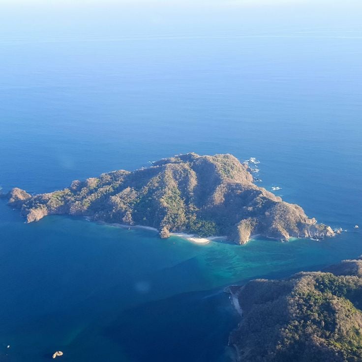
This island off the coast of Puntarenas features a 1,600-foot (500-meter) stretch of sand beach and supports water sports activities in the Pacific. The waters surrounding Tortuga Island allow for snorkeling and diving, where visitors observe marine biodiversity. The island is accessible by boat from the mainland and displays typical Pacific coast vegetation with palms and tropical plants. As a photography subject, this location combines coastal landscape with underwater environments and documents Costa Rica's marine ecosystems.
This national park protects roughly 600 hectares of coral reef containing 35 coral species and supports populations of capuchin monkeys, sloths, and 135 fish species. Cahuita National Park offers photographic opportunities ranging from coastal landscapes to underwater scenes with marine life and wildlife encounters in the rainforest along Costa Rica's Caribbean shore.
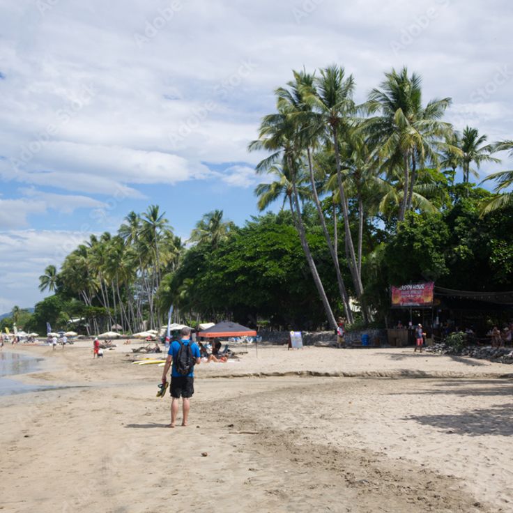
This 3.5-mile (5.6-kilometer) sand beach along the Pacific coast offers consistent waves that draw surfers of all skill levels, from beginners to experienced wave riders. Tamarindo Beach ranks among the most recognized surf destinations in Guanacaste and provides photography opportunities that capture water sports, coastal scenery and the active beach life that defines this region of Costa Rica.
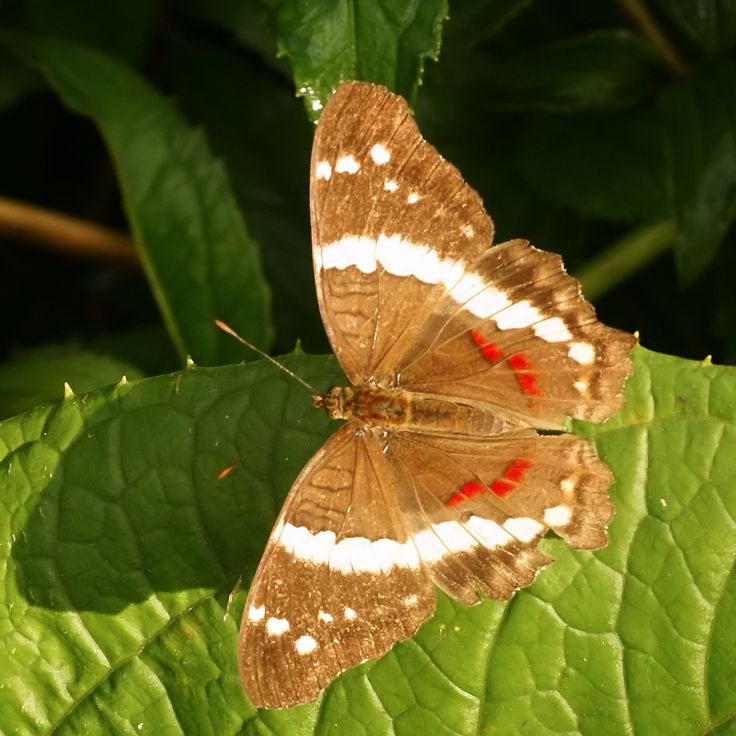
The Butterfly Conservatory houses over 50 species across four distinct climate zones, allowing visitors to observe different stages of insect metamorphosis and learn about butterfly life cycles through guided tours that explain reproduction, feeding habits, and the ecological role these insects play in Costa Rican ecosystems.
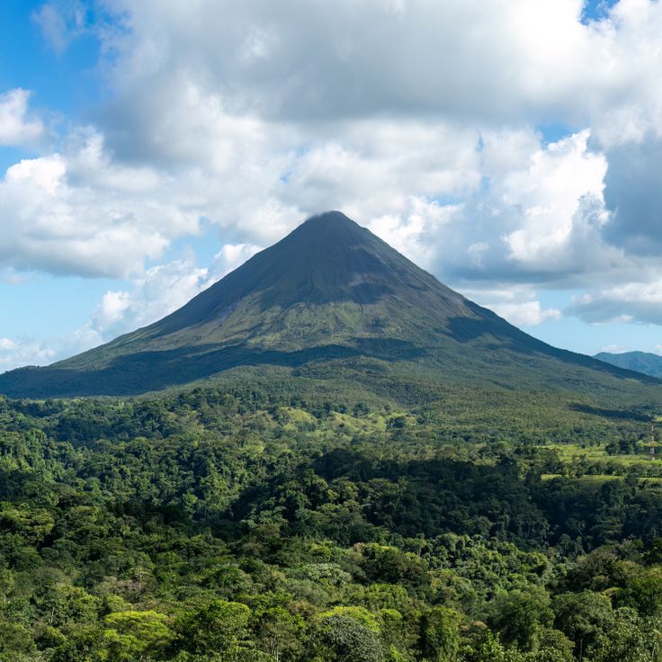
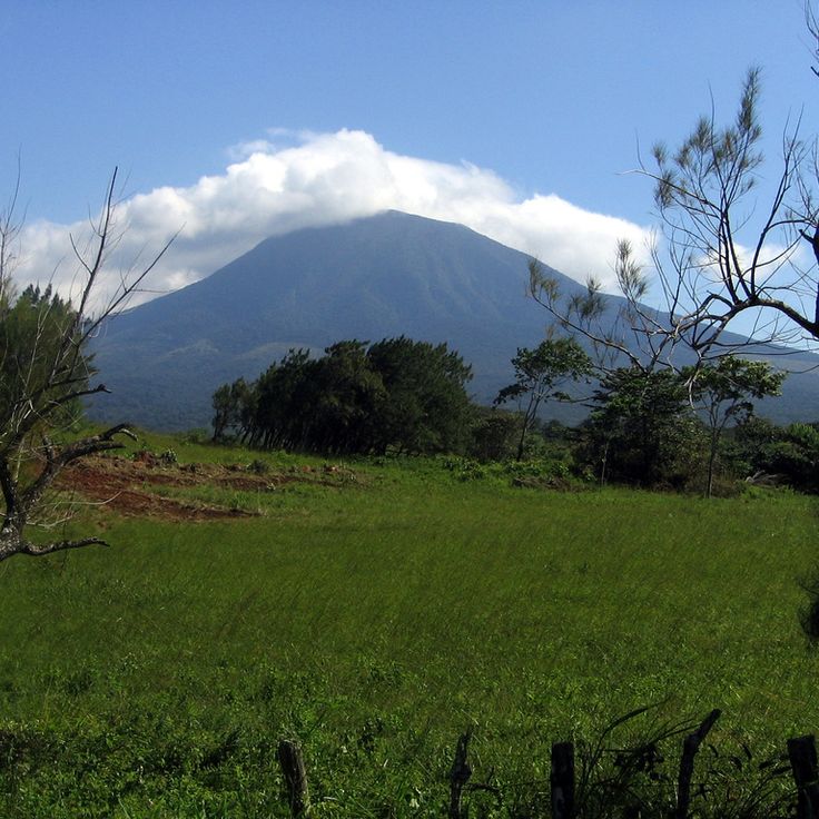
Arenal Volcano rises 5,355 feet (1,633 meters) above sea level and ranks among the most recognizable volcanic formations in Costa Rica. Dense rainforest with tree ferns and bromeliads covers the lower slopes of the cone, creating a marked contrast with the volcanic structure. This location offers photographers the opportunity to capture the relationship between active geology and tropical vegetation across multiple elevations.
This national park combines three white sand beaches with tropical rainforest inhabited by howler monkeys, capuchin monkeys and sloths. The coast provides access to coral reefs while forested slopes reach directly to the ocean. Photographers find subjects where Pacific coastline and dense forest meet in close proximity, complemented by frequent wildlife sightings along trails and beaches.
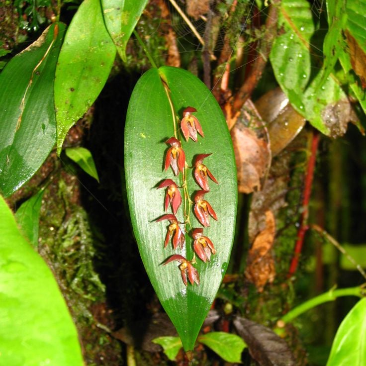
This mountain forest in Puntarenas supports 2,500 plant species and 400 bird species living among the canopy layers. Clouds envelop the vegetation during most daylight hours, creating a moist microclimate that sustains epiphytic plants, mosses and ferns. Trails traverse different elevations of the forest, where photographers can document the mist-shrouded trees and resident wildlife species. The Monteverde Cloud Forest represents one of Costa Rica's most biodiverse ecosystems, displaying characteristic vegetation of tropical high-altitude zones.
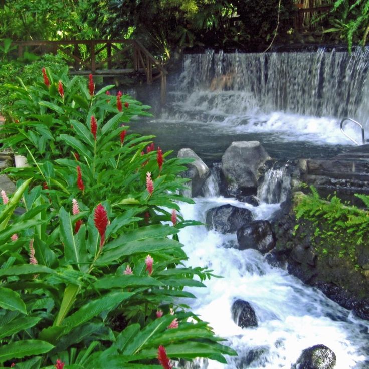
These hot springs draw their water directly from volcanic activity at Arenal Volcano. The water reaches temperatures of 122 degrees Fahrenheit (50 degrees Celsius) and flows through a series of pools and cascades within the rainforest. The hot springs offer photographers compositions featuring steaming pools, tropical vegetation and the volcanic source of the mineral-rich water.
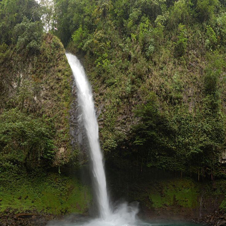
This 230-foot (70-meter) waterfall drops into a natural pool within the rainforest near the town of Arenal, providing photographers with a dramatic scene of cascading water and dense tropical vegetation. La Fortuna Waterfall sits on the slopes of Arenal Volcano and is accessed by a steep trail with approximately 500 steps. The pool at the base of the waterfall allows for swimming, while the surrounding vegetation hosts numerous bird species and other wildlife.
This national park protects an active volcano and its surroundings rising to 6,217 feet (1,895 meters). Geothermal activity feeds numerous hot springs and mud pools across the terrain, while the slopes support tropical dry forest and cloud forest ecosystems. Multiple trails lead to waterfalls, fumaroles and viewpoints that offer photographers volcanic landscapes and wildlife observation opportunities throughout the reserve.
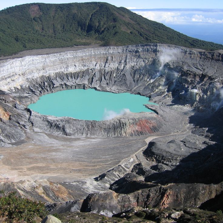
This volcano sits 23 miles (37 kilometers) north of San José and forms one of Central America's most accessible craters. The main crater measures 4,330 feet (1,320 meters) across and holds one of the world's most acidic lakes, with a pH near zero. Sulfurous geysers erupt regularly from the turquoise water, reaching heights up to 820 feet (250 meters). The national park encompasses multiple vegetation zones from cloud forest to volcanic debris fields, giving photographers shifting perspectives on the geological activity.
This national park spans 424 square kilometers (164 square miles) of rainforest on the Osa Peninsula. The vegetation includes 500 tree species, while birdwatchers have documented 367 different species. The park's remote location protects one of Central America's last remaining large tracts of primary rainforest. Trails lead through dense forest to the Pacific coast, where mangrove estuaries meet sandy beaches. This site offers photographers subjects ranging from coatis to tapirs in their natural habitat.
This historic market in downtown San José houses over 200 vendor stalls selling fresh produce, spices, handicrafts and traditional Costa Rican dishes. The Mercado Central has served as a gathering place for locals since opening in 1880 and offers insight into daily life in the capital. The covered corridors wind through sections dedicated to meat, fish, fruits, vegetables and souvenirs, while small sodas serve typical foods like casado and gallo pinto.
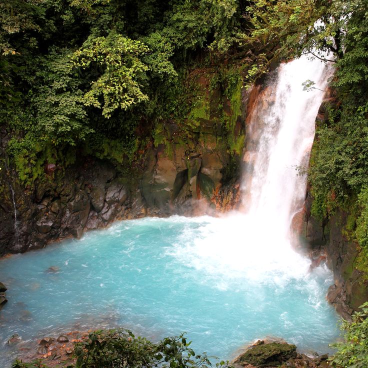
This river displays an intense blue color caused by a chemical reaction between sulfur and calcium carbonate. The Rio Celeste flows through Tenorio Volcano National Park and provides photographers with striking subjects at several viewpoints along the trail system. The most photographed section lies at the confluence of two tributaries, where the characteristic coloring becomes most apparent and a waterfall cascades over volcanic rock formations.
The Nicoya Peninsula extends along the Pacific coast for 80 kilometers (50 miles), featuring expansive sand beaches, protected mangrove forests and established surf zones. This region combines several coastal landscapes, from sheltered bays to wave-exposed stretches that suit different photographic compositions. Vegetation ranges from dry forest inland to coastal mangroves, while the beaches present varying light conditions and tidal patterns. The peninsula sits within Guanacaste province and represents one of Costa Rica's more accessible coastal sections for documenting the country's Pacific shoreline and marine environments.
The Osa Peninsula contains a nature reserve holding 2.5 percent of global biodiversity, with 463 bird species and 140 mammal species. This area provides photographers opportunities to capture tropical rainforest, coastal landscapes, and rare wildlife within one of Costa Rica's most biologically diverse habitats.
This park along the southern Pacific coast protects a natural sand formation that takes the shape of a whale's tail at low tide. Waters offshore provide habitat for humpback whales, dolphins, sea turtles and various reef fish. Coral reefs and mangrove forests add to the marine biodiversity. The grounds include several beaches and tidal zones that offer access to different perspectives on the coastal landscape.
This beach offers consistent surf conditions and attracts visitors who practice yoga and meditation. The area extends along the southern Nicoya Peninsula and ranks among the more accessible surf destinations on Costa Rica's Pacific coast. Waves suit various skill levels, while the relaxed setting provides space for wellness activities. The shoreline alternates between rocky and sandy sections that yield different compositions under varying tide conditions.
This national park protects the Tenorio Volcano and surrounding rainforests in northern Guanacaste. The Rio Celeste flows through the preserve and displays a turquoise blue coloration caused by volcanic minerals in the water. Trails lead to the waterfall and to points where the color forms through the mixing of different tributaries. The area ranges from 2,000 to 6,300 feet (600 to 1,900 meters) in elevation and supports tapirs, pumas, and over 250 bird species.
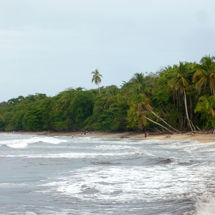
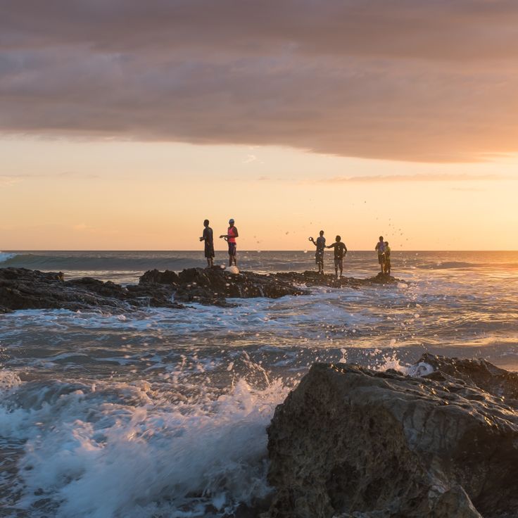
This Caribbean coastal town draws photographers to its palm-lined beaches and Caribbean character. Puerto Viejo de Talamanca offers subjects from beachfront scenes to local culture, with the town's relaxed setting showcasing Costa Rica's Caribbean side. The beaches extend along the coast, combining sand, palms and tropical vegetation with the turquoise waters of the Caribbean Sea.
Cerro Chirripó rises to 12,533 feet (3,820 meters) and offers climbers a challenging route through multiple vegetation zones. On clear days, this summit provides views of both the Pacific and Atlantic oceans, a rare vantage point in Central America. Photography here captures the changing landscapes from cloud forest to alpine páramo vegetation and the glacial lakes that formed during past ice ages. The ascent typically takes two days with an overnight stay at a mountain shelter, and photographers favor the early morning hours for the clearest visibility.
This stretch of coast provides whale sightings between July and October and forms a whale tail shape at low tide. The long sandbar extends into the ocean and connects the mainland to an offshore rock formation. The area sits along the central Pacific coast and offers access to offshore waters where humpback whales rest during their annual migration. The geological feature and seasonal marine life make Uvita Beach a suitable photography subject for Costa Rica's coastal landscapes and ocean wildlife.
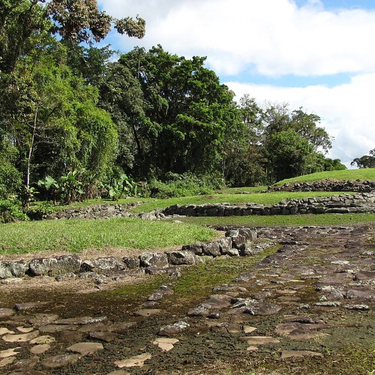
This archaeological site preserves stone structures, aqueducts and roads from a settlement dating to 800 CE, recognized as Costa Rica's most important pre-Columbian site. The ruins at Guayabo National Monument reveal complex water management systems and cobbled pathways that demonstrate advanced engineering techniques. Located on the slopes of Turrialba Volcano, the site offers photographers stone foundations amid tropical vegetation and details of hydraulic systems that remain unique in this region.
This peninsula along the Pacific coast spans 2,300 acres (930 hectares) and includes 31 sand beaches, several hotels and an 18-hole golf course. The protected location creates calm waters suitable for swimming and snorkeling. Photographers find subjects including coastal landscapes, sunsets over the Pacific and the tropical vegetation of the region. The peninsula offers various viewpoints along the coastline and access to multiple coves with different lighting conditions throughout the day.
This botanical garden in Monteverde houses over 400 orchid species from Costa Rica and other tropical regions. Guided tours explain the different varieties, their natural habitats and the specific growing conditions each plant requires. The facility allows close examination of miniature orchids as well as larger specimens, demonstrating the diversity of this plant family in the Central American cloud forest.
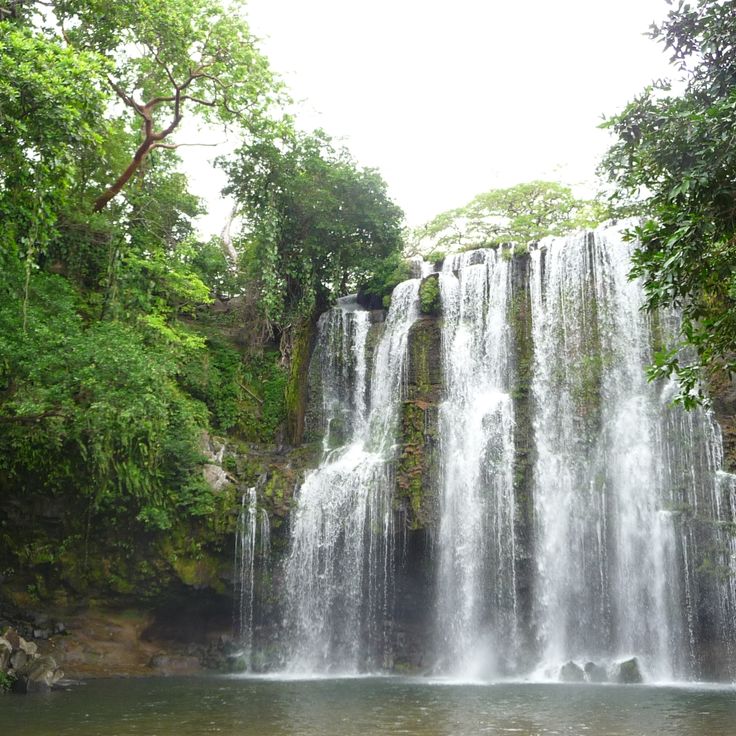
This waterfall drops 40 feet (12 meters) into a natural pool and sits about 16 miles (25 kilometers) north of Bagaces. The site provides changing rooms and a parking area. Access follows a short trail through dry forest. The pool accommodates swimming. The waterfall carries the most water during the rainy season from May through November. The surroundings consist of rock formations and vegetation typical of the Guanacaste region.
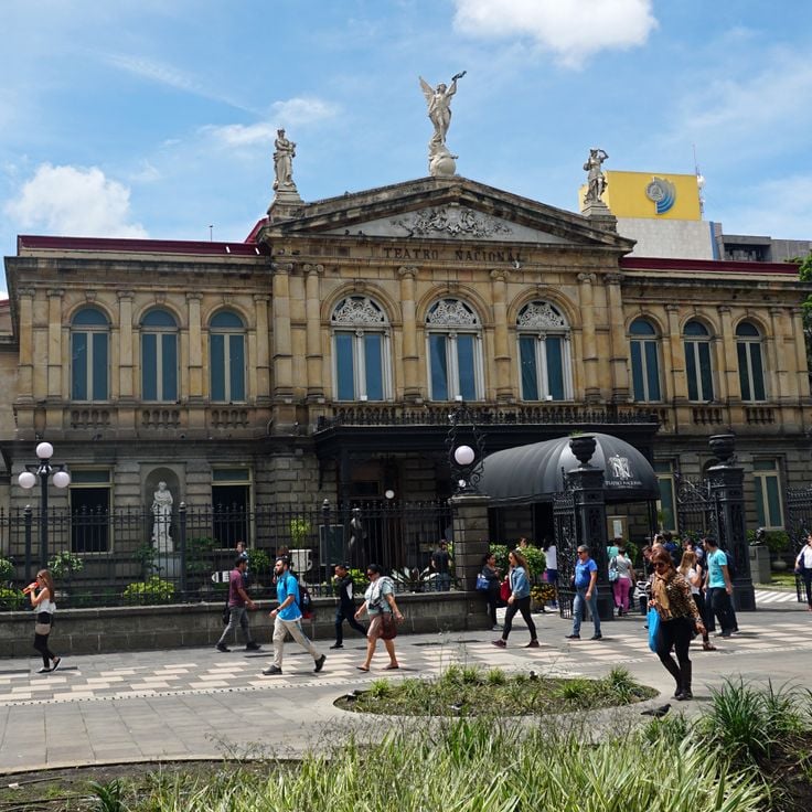
This theater in central San José was built in 1897 following European models and displays neoclassical architecture with Italian marble and French furniture. The National Theater hosts regular performances and documents Costa Rica's cultural development in the late 19th century, while its detailed facade and historic interiors provide photographic subjects that complement the country's natural landscapes.
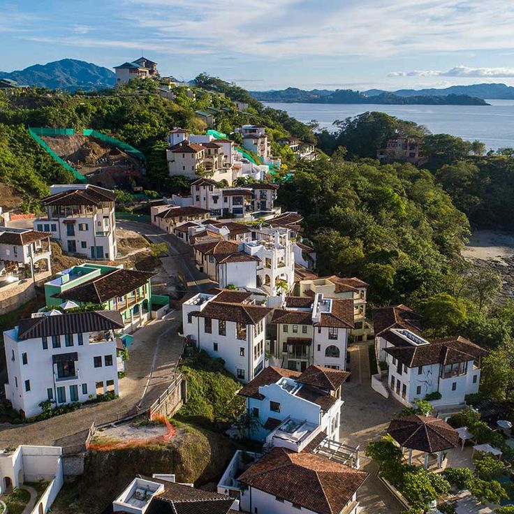
This planned coastal town combines pedestrian zones with direct beach access. Las Catalinas offers hiking trails through dry tropical forest, several restaurants, and shops housed in Mediterranean-style buildings. The car-free streets lead to beaches like Playa Danta, where photographers can document sea turtles and sunsets over the Pacific. Development began in 2006, creating a walkable community within Costa Rica's dry forest region.
This island off the coast of Puntarenas features a 1,600-foot (500-meter) stretch of sand beach and supports water sports activities in the Pacific. The waters surrounding Tortuga Island allow for snorkeling and diving, where visitors observe marine biodiversity. The island is accessible by boat from the mainland and displays typical Pacific coast vegetation with palms and tropical plants. As a photography subject, this location combines coastal landscape with underwater environments and documents Costa Rica's marine ecosystems.
This national park protects roughly 600 hectares of coral reef containing 35 coral species and supports populations of capuchin monkeys, sloths, and 135 fish species. Cahuita National Park offers photographic opportunities ranging from coastal landscapes to underwater scenes with marine life and wildlife encounters in the rainforest along Costa Rica's Caribbean shore.
This 3.5-mile (5.6-kilometer) sand beach along the Pacific coast offers consistent waves that draw surfers of all skill levels, from beginners to experienced wave riders. Tamarindo Beach ranks among the most recognized surf destinations in Guanacaste and provides photography opportunities that capture water sports, coastal scenery and the active beach life that defines this region of Costa Rica.
The Butterfly Conservatory houses over 50 species across four distinct climate zones, allowing visitors to observe different stages of insect metamorphosis and learn about butterfly life cycles through guided tours that explain reproduction, feeding habits, and the ecological role these insects play in Costa Rican ecosystems.
Arenal Volcano rises 5,355 feet (1,633 meters) above sea level and ranks among the most recognizable volcanic formations in Costa Rica. Dense rainforest with tree ferns and bromeliads covers the lower slopes of the cone, creating a marked contrast with the volcanic structure. This location offers photographers the opportunity to capture the relationship between active geology and tropical vegetation across multiple elevations.
This national park combines three white sand beaches with tropical rainforest inhabited by howler monkeys, capuchin monkeys and sloths. The coast provides access to coral reefs while forested slopes reach directly to the ocean. Photographers find subjects where Pacific coastline and dense forest meet in close proximity, complemented by frequent wildlife sightings along trails and beaches.
This mountain forest in Puntarenas supports 2,500 plant species and 400 bird species living among the canopy layers. Clouds envelop the vegetation during most daylight hours, creating a moist microclimate that sustains epiphytic plants, mosses and ferns. Trails traverse different elevations of the forest, where photographers can document the mist-shrouded trees and resident wildlife species. The Monteverde Cloud Forest represents one of Costa Rica's most biodiverse ecosystems, displaying characteristic vegetation of tropical high-altitude zones.
These hot springs draw their water directly from volcanic activity at Arenal Volcano. The water reaches temperatures of 122 degrees Fahrenheit (50 degrees Celsius) and flows through a series of pools and cascades within the rainforest. The hot springs offer photographers compositions featuring steaming pools, tropical vegetation and the volcanic source of the mineral-rich water.
This 230-foot (70-meter) waterfall drops into a natural pool within the rainforest near the town of Arenal, providing photographers with a dramatic scene of cascading water and dense tropical vegetation. La Fortuna Waterfall sits on the slopes of Arenal Volcano and is accessed by a steep trail with approximately 500 steps. The pool at the base of the waterfall allows for swimming, while the surrounding vegetation hosts numerous bird species and other wildlife.
This national park protects an active volcano and its surroundings rising to 6,217 feet (1,895 meters). Geothermal activity feeds numerous hot springs and mud pools across the terrain, while the slopes support tropical dry forest and cloud forest ecosystems. Multiple trails lead to waterfalls, fumaroles and viewpoints that offer photographers volcanic landscapes and wildlife observation opportunities throughout the reserve.
This volcano sits 23 miles (37 kilometers) north of San José and forms one of Central America's most accessible craters. The main crater measures 4,330 feet (1,320 meters) across and holds one of the world's most acidic lakes, with a pH near zero. Sulfurous geysers erupt regularly from the turquoise water, reaching heights up to 820 feet (250 meters). The national park encompasses multiple vegetation zones from cloud forest to volcanic debris fields, giving photographers shifting perspectives on the geological activity.
This national park spans 424 square kilometers (164 square miles) of rainforest on the Osa Peninsula. The vegetation includes 500 tree species, while birdwatchers have documented 367 different species. The park's remote location protects one of Central America's last remaining large tracts of primary rainforest. Trails lead through dense forest to the Pacific coast, where mangrove estuaries meet sandy beaches. This site offers photographers subjects ranging from coatis to tapirs in their natural habitat.
This historic market in downtown San José houses over 200 vendor stalls selling fresh produce, spices, handicrafts and traditional Costa Rican dishes. The Mercado Central has served as a gathering place for locals since opening in 1880 and offers insight into daily life in the capital. The covered corridors wind through sections dedicated to meat, fish, fruits, vegetables and souvenirs, while small sodas serve typical foods like casado and gallo pinto.
This river displays an intense blue color caused by a chemical reaction between sulfur and calcium carbonate. The Rio Celeste flows through Tenorio Volcano National Park and provides photographers with striking subjects at several viewpoints along the trail system. The most photographed section lies at the confluence of two tributaries, where the characteristic coloring becomes most apparent and a waterfall cascades over volcanic rock formations.
The Nicoya Peninsula extends along the Pacific coast for 80 kilometers (50 miles), featuring expansive sand beaches, protected mangrove forests and established surf zones. This region combines several coastal landscapes, from sheltered bays to wave-exposed stretches that suit different photographic compositions. Vegetation ranges from dry forest inland to coastal mangroves, while the beaches present varying light conditions and tidal patterns. The peninsula sits within Guanacaste province and represents one of Costa Rica's more accessible coastal sections for documenting the country's Pacific shoreline and marine environments.
The Osa Peninsula contains a nature reserve holding 2.5 percent of global biodiversity, with 463 bird species and 140 mammal species. This area provides photographers opportunities to capture tropical rainforest, coastal landscapes, and rare wildlife within one of Costa Rica's most biologically diverse habitats.
This park along the southern Pacific coast protects a natural sand formation that takes the shape of a whale's tail at low tide. Waters offshore provide habitat for humpback whales, dolphins, sea turtles and various reef fish. Coral reefs and mangrove forests add to the marine biodiversity. The grounds include several beaches and tidal zones that offer access to different perspectives on the coastal landscape.
This beach offers consistent surf conditions and attracts visitors who practice yoga and meditation. The area extends along the southern Nicoya Peninsula and ranks among the more accessible surf destinations on Costa Rica's Pacific coast. Waves suit various skill levels, while the relaxed setting provides space for wellness activities. The shoreline alternates between rocky and sandy sections that yield different compositions under varying tide conditions.
This national park protects the Tenorio Volcano and surrounding rainforests in northern Guanacaste. The Rio Celeste flows through the preserve and displays a turquoise blue coloration caused by volcanic minerals in the water. Trails lead to the waterfall and to points where the color forms through the mixing of different tributaries. The area ranges from 2,000 to 6,300 feet (600 to 1,900 meters) in elevation and supports tapirs, pumas, and over 250 bird species.
This Caribbean coastal town draws photographers to its palm-lined beaches and Caribbean character. Puerto Viejo de Talamanca offers subjects from beachfront scenes to local culture, with the town's relaxed setting showcasing Costa Rica's Caribbean side. The beaches extend along the coast, combining sand, palms and tropical vegetation with the turquoise waters of the Caribbean Sea.
Cerro Chirripó rises to 12,533 feet (3,820 meters) and offers climbers a challenging route through multiple vegetation zones. On clear days, this summit provides views of both the Pacific and Atlantic oceans, a rare vantage point in Central America. Photography here captures the changing landscapes from cloud forest to alpine páramo vegetation and the glacial lakes that formed during past ice ages. The ascent typically takes two days with an overnight stay at a mountain shelter, and photographers favor the early morning hours for the clearest visibility.
This stretch of coast provides whale sightings between July and October and forms a whale tail shape at low tide. The long sandbar extends into the ocean and connects the mainland to an offshore rock formation. The area sits along the central Pacific coast and offers access to offshore waters where humpback whales rest during their annual migration. The geological feature and seasonal marine life make Uvita Beach a suitable photography subject for Costa Rica's coastal landscapes and ocean wildlife.
This archaeological site preserves stone structures, aqueducts and roads from a settlement dating to 800 CE, recognized as Costa Rica's most important pre-Columbian site. The ruins at Guayabo National Monument reveal complex water management systems and cobbled pathways that demonstrate advanced engineering techniques. Located on the slopes of Turrialba Volcano, the site offers photographers stone foundations amid tropical vegetation and details of hydraulic systems that remain unique in this region.
This peninsula along the Pacific coast spans 2,300 acres (930 hectares) and includes 31 sand beaches, several hotels and an 18-hole golf course. The protected location creates calm waters suitable for swimming and snorkeling. Photographers find subjects including coastal landscapes, sunsets over the Pacific and the tropical vegetation of the region. The peninsula offers various viewpoints along the coastline and access to multiple coves with different lighting conditions throughout the day.
This botanical garden in Monteverde houses over 400 orchid species from Costa Rica and other tropical regions. Guided tours explain the different varieties, their natural habitats and the specific growing conditions each plant requires. The facility allows close examination of miniature orchids as well as larger specimens, demonstrating the diversity of this plant family in the Central American cloud forest.
This waterfall drops 40 feet (12 meters) into a natural pool and sits about 16 miles (25 kilometers) north of Bagaces. The site provides changing rooms and a parking area. Access follows a short trail through dry forest. The pool accommodates swimming. The waterfall carries the most water during the rainy season from May through November. The surroundings consist of rock formations and vegetation typical of the Guanacaste region.
This theater in central San José was built in 1897 following European models and displays neoclassical architecture with Italian marble and French furniture. The National Theater hosts regular performances and documents Costa Rica's cultural development in the late 19th century, while its detailed facade and historic interiors provide photographic subjects that complement the country's natural landscapes.
This planned coastal town combines pedestrian zones with direct beach access. Las Catalinas offers hiking trails through dry tropical forest, several restaurants, and shops housed in Mediterranean-style buildings. The car-free streets lead to beaches like Playa Danta, where photographers can document sea turtles and sunsets over the Pacific. Development began in 2006, creating a walkable community within Costa Rica's dry forest region.