Enable Location

We need your location to show you interesting places around you

Discover nearby places

Find interesting locations and hidden gems around you

Precise directions

Get accurate directions and distances to places

Your location is never shared with other users. It's only used when you tap the location button.

Tenorio Volcano National Park

Log in to your account

Start exploring — it's free

Trusted by 63,163 travelers worldwide

Continue with Google
Continue with Apple
or

We will send you a code to connect

By continuing, you accept our Terms and Conditions and our Privacy Policy

Check your inbox

We've sent a pincode in your inbox. Please enter the code below.

Tenorio Volcano National Park
Discussion Reviews 2 Photos 1 Collections
9.1k Popularity

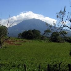
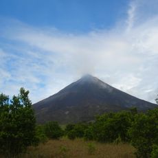
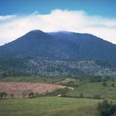
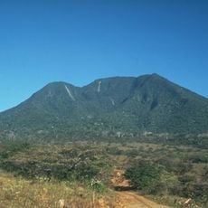
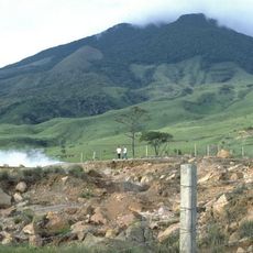
Tenorio Volcano National Park, Protected rainforest and volcano area in Guanacaste Province, Costa Rica.

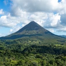
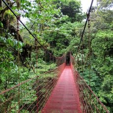
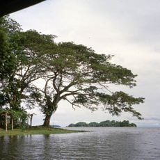
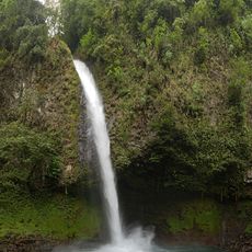
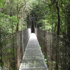
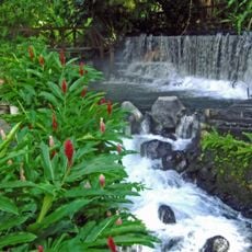
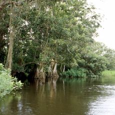
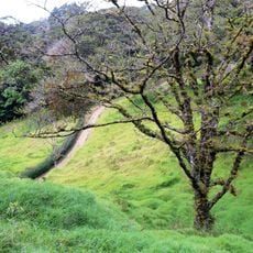
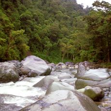
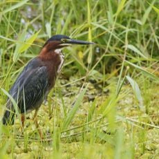
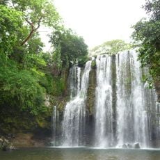
Tenorio Volcano National Park is a protected rainforest area in Guanacaste centered around an active volcano with multiple natural environments. The park features a network of trails that lead to waterfalls, thermal springs, and the distinctive Rio Celeste waterway.

The park was established in 1995 to protect the active volcano and its surrounding natural areas from damage and development. Its creation reflected Costa Rica's commitment to preserving critical rainforest ecosystems.

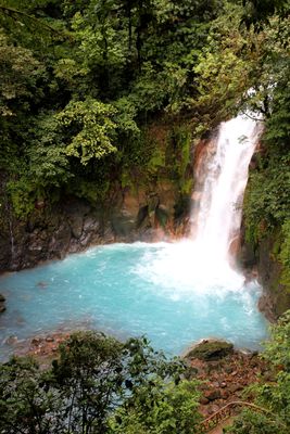
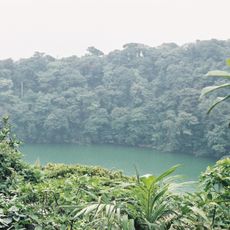
The Rio Celeste's striking blue water is so remarkable that it has inspired local stories about its celestial origins passed down through generations. This natural phenomenon connects the river to cultural identity and attracts people seeking to understand the place's distinct character.

The park is open during daylight hours and visitors should prepare for wet conditions since rain is frequent and trails can become slippery. Sturdy footwear and water-resistant clothing are recommended to stay safe and comfortable while exploring the area.

At El Teñidero, two clear streams merge and their waters transform into brilliant blue through a chemical interaction between sulfur and calcium carbonate compounds in the rock. This dramatic color change happens right before visitors' eyes as the waters combine.

The community of curious travelers

AroundUs brings together thousands of curated places, local tips, and hidden gems, enriched daily by 60,000 contributors worldwide.

Start exploring
Inception
1976
Operator
Area de Conservación Arenal Tempisque (ACAT)
GPS coordinates
10.66667,-85.00000
Latest update
December 6, 2025 16:04
Photo locations in Costa Rica

Costa Rica spans 19,700 square miles (51,100 square kilometers) between the Pacific Ocean and Caribbean Sea, offering photographers a concentration of varied landscapes within a compact area. The country maintains over 30 national parks and protected areas, including Arenal Volcano, whose...

Reviews
Share your experience

No review yet

Discussions
Start a discussion...

No discussion yet

« Tenorio Volcano National Park - Protected rainforest and volcano area in Guanacaste Province, Costa Rica » is provided by Around Us (aroundus.com). Images and texts are derived from Wikimedia project under a Creative Commons license. You are allowed to copy, distribute, and modify copies of this page, under the conditions set by the license, as long as this note is clearly visible.

Discover hidden gems everywhere you go!

From secret cafés to breathtaking viewpoints, skip the crowded tourist spots and find places that match your style. Our app makes it easy with voice search, smart filtering, route optimization, and insider tips from travelers worldwide. Download now for the complete mobile experience.

Around Us App Screenshot

A unique approach to discovering new places

Le Figaro

All the places worth exploring

France Info

A tailor-made excursion in just a few clicks

20 Minutes

Around Us
Travel Guide & Maps
Download

Send to your phone

QR Code
1

Open the camera app on your mobile.

2

Point at the QR code with your camera. A notification will appear.

3

Tap the notification to open the link.