Enable Location

We need your location to show you interesting places around you

Discover nearby places

Find interesting locations and hidden gems around you

Precise directions

Get accurate directions and distances to places

Your location is never shared with other users. It's only used when you tap the location button.

Serra do Rio do Rastro

Log in to your account

Start exploring — it's free

Trusted by 61,499 travelers worldwide

Continue with Google
Continue with Apple
or

We will send you a code to connect

By continuing, you accept our Terms and Conditions and our Privacy Policy

Check your inbox

We've sent a pincode in your inbox. Please enter the code below.

Serra do Rio do Rastro

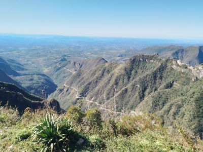
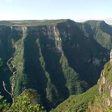
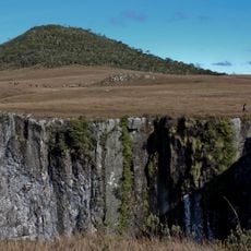
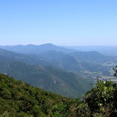
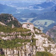
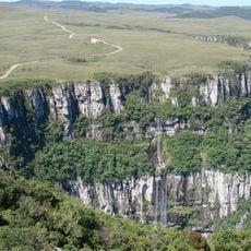
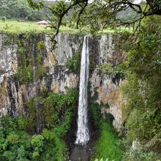
Serra do Rio do Rastro, Mountain cliff in Bom Jardim da Serra, Brazil.

Description

Serra do Rio do Rastro is a steep mountain road winding through 284 hairpin curves to reach 1460 meters elevation across the coastal mountain range. The road passes through rugged terrain and connects the high plateau with lower regions below.

History

The road was built in 1932 and served as a key transport route for coal from mountain mines to ports on southern Santa Catarina's coast. This connection was essential to the region's economic development during the industrial period.

Culture

Local communities rely on traditional crafts like cheese and wine production passed down through generations. These products form part of the everyday economy and identity of the mountain villages.

Practical

The summit has an observation point with restrooms, a colonial-style cafe, small shops, and parking spaces. The road is steep and requires careful driving, especially in poor weather conditions.

Did you know?

Winter months bring a dramatic temperature difference between the mountain peak and the coast, creating frequent snow and ice along the road. This seasonal transformation makes the drive distinctly different depending on when you visit.

Address
Serra do Rio do Rastro - Guatá, Lauro Müller - State of Santa Catarina, 88880-000, Brazil
GPS coordinates
-28.35159,-49.54352
Latest update
December 8, 2025 20:03

AroundUs brings together thousands of curated places, local tips, and hidden gems, enriched daily by 60,000 contributors worldwide. Discover all places nearby (Bom Jardim da Serra).

« Serra do Rio do Rastro - Mountain cliff in Bom Jardim da Serra, Brazil » is provided by Around Us (aroundus.com). Images and texts are derived from Wikimedia project under a Creative Commons license. You are allowed to copy, distribute, and modify copies of this page, under the conditions set by the license, as long as this note is clearly visible.

Discover hidden gems everywhere you go!

From secret cafés to breathtaking viewpoints, skip the crowded tourist spots and find places that match your style. Our app makes it easy with voice search, smart filtering, route optimization, and insider tips from travelers worldwide. Download now for the complete mobile experience.

Around Us App Screenshot

A unique approach to discovering new places

Le Figaro

All the places worth exploring

France Info

A tailor-made excursion in just a few clicks

20 Minutes

Around Us
Travel Guide & Maps
Download

Send to your phone

QR Code
1

Open the camera app on your mobile.

2

Point at the QR code with your camera. A notification will appear.

3

Tap the notification to open the link.