
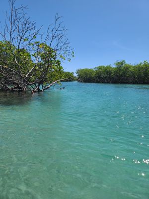
Guilligan's Island, Small cay in Guánica, Puerto Rico
Gilligan's Island features mangrove-lined shores and shallow waters with coral formations where numerous fish species swim through clear waters.
The island, officially named Cayo Aurora, experienced structural changes from seismic activities, which altered parts of its natural landscape.
Local families and visitors gather at the designated picnic areas with barbecue pits to prepare traditional Puerto Rican meals by the water.
The cay maintains operating hours from 9 AM to 5 PM six days per week, with access available through kayak rentals or ferry service.
A roped-off swimming zone on the northern section protects swimmers while offering views of marine life in the surrounding waters.
Location: Puerto Rico
Address: Gilligans Island, Guánica 00653, Puerto Rico 00653
GPS coordinates: 17.94189,-66.87283
Latest update: March 4, 2025 05:54

Puerto Rico offers more than the beaches and colonial fortresses of San Juan. The island contains dozens of natural swimming pools, remote coastal sections and protected forest reserves. The northern coast holds limestone caves with pre-Columbian petroglyphs, while the southwest region includes bioluminescent bays and extensive salt flats. The interior features waterfalls cascading over volcanic rock and hiking trails through mountain canyons with native vegetation. Historic sites include 19th-century lighthouses on rocky promontories, Spanish fortifications guarding harbor entrances and archaeological sites like the indigenous ceremonial center of Tibes near Ponce. Coastal areas offer natural swimming holes separated from the sea at low tide, including Las Paylas in Luquillo and Pozo de Jacinto in Isabela. The dry coastal forests of Guánica and the wet rainforest of El Yunque show the range of the island's ecosystems. Visitors reach these locations via local roads that are often unpaved and poorly marked. Many natural pools and waterfalls require short hikes over uneven terrain. The best conditions occur during the dry season from December through April, when river flows run lower. Some locations like Reserva Natural Las Cabezas de San Juan require advance booking for guided tours, while others remain freely accessible year-round.
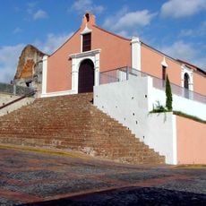
Porta Coeli
24.1 km
Guánica State Forest
2.7 km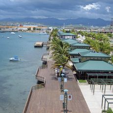
Paseo Tablado La Guancha
27.2 km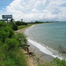
El Tuque
20.9 km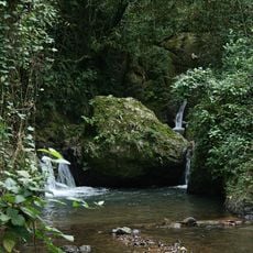
Maricao State Forest
22.8 km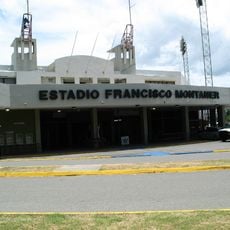
Estadio Francisco Montaner
26.4 km
La Guancha
27.2 km
Parque del Retiro (Ponce)
27.2 km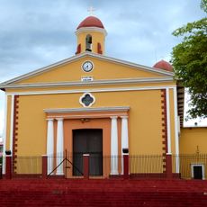
San Isidro Labrador y Santa María de la Cabeza Church
18.1 km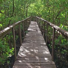
Boquerón State Forest
26.7 km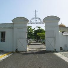
San Vicente de Paul Catholic Cemetery
26.6 km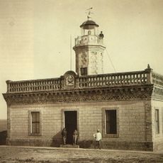
Guánica Light
3.4 km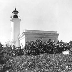
Cardona Island Light
25.2 km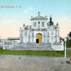
San Germán de Auxerre Church
24.1 km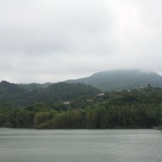
Monte Guilarte
24.8 km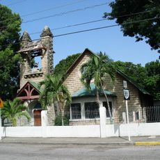
McCabe Memorial Church
27.1 km
Logia Masónica Hijos de la Luz
10.6 km
Hacienda Santa Rita
7.5 km
Monumento a los heroes de El Polvorín (tomb)
26.6 km
Casa Franceschi Antongiorgi
10.8 km
Teatro Ideal
10.6 km
Filardi House
10.7 km
Chalet Amill
11 km
Agostini House
10.6 km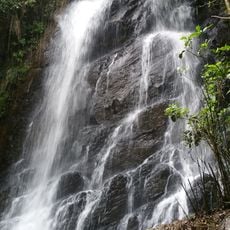
La Soplaera Waterfall
22.4 km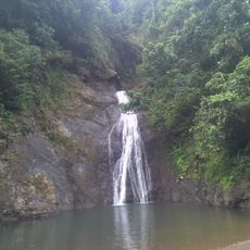
Salto Curet Waterfall
26.3 km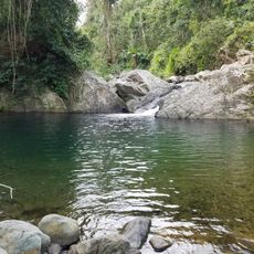
Mangó Waterfall
26.5 km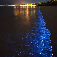
La Bahia Fosforescente
13.3 kmReviews
Visited this place? Tap the stars to rate it and share your experience / photos with the community! Try now! You can cancel it anytime.
Discover hidden gems everywhere you go!
From secret cafés to breathtaking viewpoints, skip the crowded tourist spots and find places that match your style. Our app makes it easy with voice search, smart filtering, route optimization, and insider tips from travelers worldwide. Download now for the complete mobile experience.

A unique approach to discovering new places❞
— Le Figaro
All the places worth exploring❞
— France Info
A tailor-made excursion in just a few clicks❞
— 20 Minutes