Chest opened
+${chestReward.xp} XP
Explorer
NOUVEAU ×${chestReward.collectible.quantity}
tapez pour fermer
Chest locked

Open chests in the app

Around Us is built for your phone — chests unlock when you walk, explore and capture nearby places.

Enable Location

We need your location to show you interesting places around you

Discover nearby places

Find interesting locations and hidden gems around you

Precise directions

Get accurate directions and distances to places

Your location is never shared with other users. It's only used when you tap the location button.

Log in to your account

Start exploring — it's free

Trusted by 72,885 travelers worldwide

Continue with Google
Continue with Apple
or

We will send you a code to connect

By continuing, you accept our Terms and Conditions and our Privacy Policy

Check your inbox

We've sent a pincode in your inbox. Please enter the code below.

Bitter Spring
Discussion Reviews Photo
1.5k Popularity

Bitter Spring, Natural spring in San Bernardino County, United States.

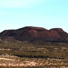
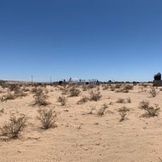
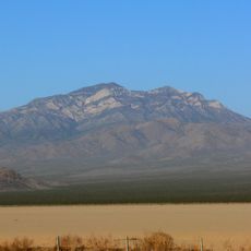
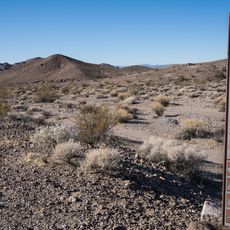
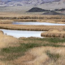
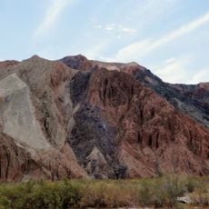
Bitter Spring is a natural spring located at about 4,400 feet (1,340 m) elevation within a military training area, surrounded by several mountain ranges. Despite its name, the water was brackish rather than bitter, and the surrounding landscape featured substantial grassland.

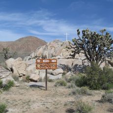
The spring became an important waypoint between 1847 and 1848 when Jefferson Hunt and Mormon pioneers developed it as part of the Old Spanish Trail route. This passage served wagon trains traveling between the eastern United States and California.

Native American communities relied on this water source for survival and trade routes. Travelers left messages carved into mesquite wood for others following the same path.

This location sits within a military training area with restricted access, so advance planning is necessary. Check with local authorities about visitor access policies before attempting to visit the site.

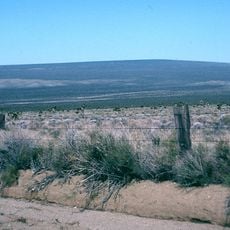
The spring connects to a network of trails extending dozens of kilometers in different directions, linking it to other water sources across the desert landscape. These pathways once formed critical supply routes for travelers crossing the arid region.

The community of curious travelers

AroundUs brings together thousands of curated places, local tips, and hidden gems, enriched daily by 60,000 contributors worldwide.

Start exploring
GPS coordinates
35.22696,-116.43152
Latest update
December 14, 2025 14:21
Around this place
Deep Space Network
United States of America

Deep Space Network

47.2 km
Lake Dolores Waterpark
United States of America

Lake Dolores Waterpark

38.8 km
Goldstone Deep Space Communications Complex
United States of America

Goldstone Deep Space Communications Complex

47.2 km
Calico Early Man Site
United States of America

Calico Early Man Site

43.2 km
Kelso Dunes
United States of America

Kelso Dunes

69.9 km
Pisgah Crater
United States of America

Pisgah Crater

53.7 km
World's Tallest Thermometer
United States of America

World's Tallest Thermometer

32.9 km
Mitchell Caverns
United States of America

Mitchell Caverns

89.4 km
Mojave Trails National Monument
United States of America

Mojave Trails National Monument

77.8 km
Rainbow Basin
United States of America

Rainbow Basin

59.4 km
Lavic Lake volcanic field
United States of America

Lavic Lake volcanic field

53.7 km
Liberty Sculpture Park
United States of America

Liberty Sculpture Park

51.6 km
Mojave Memorial Cross
United States of America

Mojave Memorial Cross

80.7 km
Cima Dome & Volcanic Field National Natural Landmark
United States of America

Cima Dome & Volcanic Field National Natural Landmark

62 km
Goldstone Solar System Radar
United States of America

Goldstone Solar System Radar

47.2 km
Clark Mountain
United States of America

Clark Mountain

83.4 km
Calico and Odessa Railroad
United States of America

Calico and Odessa Railroad

50.1 km
Western America Railroad Museum
United States of America

Western America Railroad Museum

64.8 km
Saddle Peak Hills Wilderness
United States of America

Saddle Peak Hills Wilderness

62.6 km
Saratoga Springs
United States of America

Saratoga Springs

50.6 km
Desert Lighthouse
United States of America

Desert Lighthouse

77.2 km
Bagdad Cafe
United States of America

Bagdad Cafe

49.3 km
Jubilee Pass
United States of America

Jubilee Pass

77.2 km
DSS 14
United States of America

DSS 14

47.1 km
Salsberry Pass
United States of America

Salsberry Pass

77.8 km
DSS 13
United States of America

DSS 13

47.1 km
Calikage Playhouse
United States of America

Calikage Playhouse

50.1 km
Afton Canyon
United States of America

Afton Canyon

24.3 km
Show the full map
Reviews
Share your experience

No review yet

Discussions
Start a discussion...

No discussion yet

« Bitter Spring - Natural spring in San Bernardino County, United States » is provided by Around Us (aroundus.com). Images and texts are derived from Wikimedia project under a Creative Commons license. You are allowed to copy, distribute, and modify copies of this page, under the conditions set by the license, as long as this note is clearly visible.

Discover hidden gems everywhere you go!

From secret cafés to breathtaking viewpoints, skip the crowded tourist spots and find places that match your style. Our app makes it easy with voice search, smart filtering, route optimization, and insider tips from travelers worldwide. Download now for the complete mobile experience.

Around Us App Screenshot

A unique approach to discovering new places

Le Figaro

All the places worth exploring

France Info

A tailor-made excursion in just a few clicks

20 Minutes

Around Us
Travel Guide & Maps
Download

Send to your phone

QR Code
1

Open the camera app on your mobile.

2

Point at the QR code with your camera. A notification will appear.

3

Tap the notification to open the link.