Chest opened
+${chestReward.xp} XP
Explorer
NOUVEAU ×${chestReward.collectible.quantity}
tapez pour fermer
Chest locked

Open chests in the app

Around Us is built for your phone — chests unlock when you walk, explore and capture nearby places.

Enable Location

We need your location to show you interesting places around you

Discover nearby places

Find interesting locations and hidden gems around you

Precise directions

Get accurate directions and distances to places

Your location is never shared with other users. It's only used when you tap the location button.

Log in to your account

Start exploring — it's free

Trusted by 72,928 travelers worldwide

Continue with Google
Continue with Apple
or

We will send you a code to connect

By continuing, you accept our Terms and Conditions and our Privacy Policy

Check your inbox

We've sent a pincode in your inbox. Please enter the code below.

Folsom South Canal
Discussion Reviews Photo
2.9k Popularity

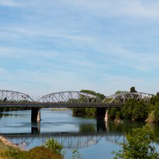
Folsom South Canal, Aqueduct in Sacramento County, California, United States.

The Folsom South Canal is an irrigation waterway that extends southward from Nimbus Dam through Sacramento County. The structure features concrete walls and moves water through a stable, engineered channel to serve agricultural lands.

Construction began in 1952 with the inlet channel, while the main canal was built between 1970 and 1973. This project modernized water delivery across the county and established the backbone of local irrigation systems.

The waterway supports farming communities across the region by delivering irrigation water that sustains crop production year-round. Residents and farmers alike depend on this system as a backbone of the local economy and agricultural tradition.

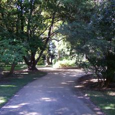
A recreation trail runs alongside the waterway with access points for parking at multiple locations. The morning or late afternoon hours tend to be cooler and less crowded for visiting.

The waterway uses a trapezoidal design that allows water to flow efficiently across long distances without major loss. This engineering approach becomes visible when you walk alongside it and notice how the walls angle inward.

The community of curious travelers

AroundUs brings together thousands of curated places, local tips, and hidden gems, enriched daily by 60,000 contributors worldwide.

Start exploring
Location
GPS coordinates
38.46472,-121.23000
Latest update
December 12, 2025 12:06
Around this place
Mather Air Force Base
United States of America

Mather Air Force Base

11.5 km
U.S. Route 50 in California
United States of America

U.S. Route 50 in California

21 km
Heart Health Park
United States of America

Heart Health Park

22.9 km
Hornet Stadium
United States of America

Hornet Stadium

19.6 km
SeaQuest Folsom
United States of America

SeaQuest Folsom

22.8 km
Fair Oaks Bridge
United States of America

Fair Oaks Bridge

19.3 km
Julia Morgan House
United States of America

Julia Morgan House

22.6 km
Guy West Bridge
United States of America

Guy West Bridge

19.8 km
Sacramento State University Library
United States of America

Sacramento State University Library

19.9 km
Safetyville USA
United States of America

Safetyville USA

13.4 km
Libby, McNeil and Libby Cannery
United States of America

Libby, McNeil and Libby Cannery

23.4 km
University Arboretum at California State University, Sacramento
United States of America

University Arboretum at California State University, Sacramento

20.6 km
United States of America

Carpenter Hill

23.4 km
IHOP
United States of America

IHOP

23.8 km
SMUD Headquarters Building
United States of America

SMUD Headquarters Building

20.2 km
Brighton School
United States of America

Brighton School

14.3 km
McKinley Park
United States of America

McKinley Park

23.6 km
Jensen Botanical Gardens
United States of America

Jensen Botanical Gardens

21 km
American River Grange Hall No. 172
United States of America

American River Grange Hall No. 172

15.6 km
Theodore Judah School
United States of America

Theodore Judah School

23 km
J. C. Carly House
United States of America

J. C. Carly House

23.4 km
Sacramento Children's Museum
United States of America

Sacramento Children's Museum

14.6 km
Alta Mesa Farm Bureau Hall
United States of America

Alta Mesa Farm Bureau Hall

8.7 km
Babylon City Market
United States of America

Babylon City Market

19.9 km
Raging Waters Sacramento
United States of America

Raging Waters Sacramento

22.8 km
Deterding Park
United States of America

Deterding Park

19.8 km
H Street Bridge
United States of America

H Street Bridge

20.4 km
Isador Cohen
United States of America

Isador Cohen

16.2 km
Show the full map
Reviews
Share your experience

No review yet

Discussions
Start a discussion...

No discussion yet

« Folsom South Canal - Aqueduct in Sacramento County, California, United States » is provided by Around Us (aroundus.com). Images and texts are derived from Wikimedia project under a Creative Commons license. You are allowed to copy, distribute, and modify copies of this page, under the conditions set by the license, as long as this note is clearly visible.

Discover hidden gems everywhere you go!

From secret cafés to breathtaking viewpoints, skip the crowded tourist spots and find places that match your style. Our app makes it easy with voice search, smart filtering, route optimization, and insider tips from travelers worldwide. Download now for the complete mobile experience.

Around Us App Screenshot

A unique approach to discovering new places

Le Figaro

All the places worth exploring

France Info

A tailor-made excursion in just a few clicks

20 Minutes

Around Us
Travel Guide & Maps
Download

Send to your phone

QR Code
1

Open the camera app on your mobile.

2

Point at the QR code with your camera. A notification will appear.

3

Tap the notification to open the link.