Chest opened
+${chestReward.xp} XP
Explorer
NOUVEAU ×${chestReward.collectible.quantity}
tapez pour fermer

See the monuments around you in AR Open chests in the app

Around Us is built for your phone — point your camera at the streets and discover the monuments and places around you in augmented reality. Around Us is built for your phone — chests unlock when you walk, explore and capture nearby places.

Enable Location

We need your location to show you interesting places around you

Discover nearby places

Find interesting locations and hidden gems around you

Precise directions

Get accurate directions and distances to places

Your location is never shared with other users. It's only used when you tap the location button.

Big Horn Mountains Wilderness

Log in to your account

Start exploring — it's free

Trusted by 82,685 travelers worldwide

Continue with Google
Continue with Apple
or

We will send you a code to connect

By continuing, you accept our Terms and Conditions and our Privacy Policy

Check your inbox

We've sent a pincode in your inbox. Please enter the code below.

Discussion Reviews 1 Photos
1.1k Popularity

Big Horn Mountains Wilderness, Protected area in Maricopa County, Arizona

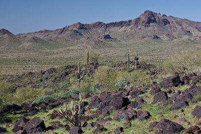
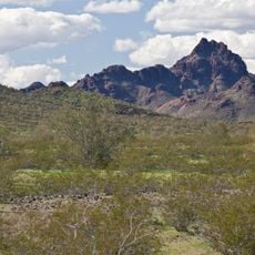
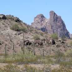
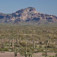
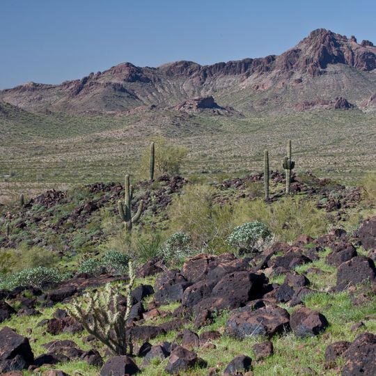
Big Horn Mountains Wilderness is a wilderness area in Arizona featuring rugged ridges, steep cliffs, and an expansive network of canyons. The terrain covers roughly 21,000 acres and is defined by a nine-mile ridgeline marked by Big Horn Peak, a bare monolith that stands as a dominant landmark.

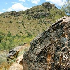
The area was inhabited by Native Americans and later used by early settlers, with Hummingbird Springs serving as a historic water source marked by an old windmill. The wilderness was officially protected by federal law in 1990 and has been managed by the Bureau of Land Management since then.

The mountains take their name from the desert bighorn sheep that inhabit the rocky slopes and are commonly spotted by visitors. The landscape reflects how wildlife and vegetation have adapted to survive in harsh desert conditions.

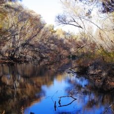
Access is via Salome Road, from which dirt jeep trails lead into the area and require a vehicle with good ground clearance. Visitors should carry maps, check road conditions before heavy rain, and be prepared for flash floods in arroyos.

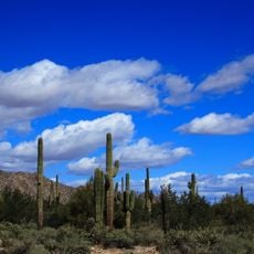
The area harbors a variety of desert animals including Gila monsters, desert tortoises, and several birds of prey that nest in the rock cliffs. This diversity makes it of interest to wildlife watchers seeking to observe animals in their natural habitat.

The community of curious travelers

AroundUs brings together thousands of curated places, local tips, and hidden gems, enriched daily by 60,000 contributors worldwide.

Start exploring
Location
Inception
1990
Operator
BLM
Shares border with
Hummingbird Springs Wilderness
GPS coordinates
33.60252,-113.11364
Latest update
August 12, 2026 11:38
Around this place
White Tank Mountains
United States of America

White Tank Mountains

49.7 km
White Tank Mountain Regional Park
United States of America

White Tank Mountain Regional Park

51 km
Hassayampa River Preserve
United States of America

Hassayampa River Preserve

53.5 km
United States of America

Our Lady of Solitude Monastery

22.6 km
Sugarloaf Mountain
United States of America

Sugarloaf Mountain

10.2 km
Eagletail Mountains Wilderness
United States of America

Eagletail Mountains Wilderness

31.7 km
Hummingbird Springs Wilderness
United States of America

Hummingbird Springs Wilderness

9 km
Hassayampa Bridge
United States of America

Hassayampa Bridge

46.1 km
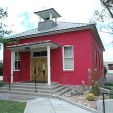
Garcia School
United States of America

Garcia School

54.1 km
United States of America

Signal Mountain Wilderness

47.1 km
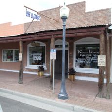
Old Brick Post Office
United States of America

Old Brick Post Office

54.1 km
United States of America

Red Cliff

48.6 km
United States of America

Agua Fria Railroad Bridge

52.2 km
United States of America

Columbus Peak

40.9 km
United States of America

Wickenburg Massacre Historical Monument

49.7 km
United States of America

Whitetank Mountain Regional Park

50.1 km
United States of America

Wickenburg Country Club

52.7 km
United States of America

Copper Canyon - Vista/Lake Course

45.9 km
United States of America

Copper Canyon - Lake/Mountain Course

46.1 km
United States of America

Los Caballeros Golf Club

48.8 km
United States of America

Copper Canyon - Mountain/Vista Course

46.1 km
United States of America

Natural Arch

46 km
United States of America

The Labrynth

22.6 km
United States of America

Saint Joseph

22.5 km
United States of America

Blessed Mother Mary

22.6 km
Welcome to Wickenburg
United States of America

Welcome to Wickenburg

54 km
United States of America

Statue, Work of art

22.6 km
Statue
United States of America

Statue

54.1 km
Show the full map
Reviews
Share your experience

No review yet

Discussions
Start a discussion...

No discussion yet

« Big Horn Mountains Wilderness - Protected area in Maricopa County, Arizona » is provided by Around Us (aroundus.com). Images and texts are derived from Wikimedia project under a Creative Commons license. You are allowed to copy, distribute, and modify copies of this page, under the conditions set by the license, as long as this note is clearly visible.

Discover hidden gems everywhere you go!

From secret cafés to breathtaking viewpoints, skip the crowded tourist spots and find places that match your style. Our app makes it easy with voice search, smart filtering, route optimization, and insider tips from travelers worldwide. Download now for the complete mobile experience.

Around Us App Screenshot

A unique approach to discovering new places

Le Figaro

All the places worth exploring

France Info

A tailor-made excursion in just a few clicks

20 Minutes

Around Us
Travel Guide & Maps
Download

Send to your phone

QR Code
1

Open the camera app on your mobile.

2

Point at the QR code with your camera. A notification will appear.

3

Tap the notification to open the link.