Chest opened
+${chestReward.xp} XP
Explorer
NOUVEAU ×${chestReward.collectible.quantity}
tapez pour fermer
Chest locked

Open chests in the app

Around Us is built for your phone — chests unlock when you walk, explore and capture nearby places.

Enable Location

We need your location to show you interesting places around you

Discover nearby places

Find interesting locations and hidden gems around you

Precise directions

Get accurate directions and distances to places

Your location is never shared with other users. It's only used when you tap the location button.

Log in to your account

Start exploring — it's free

Trusted by 72,986 travelers worldwide

Continue with Google
Continue with Apple
or

We will send you a code to connect

By continuing, you accept our Terms and Conditions and our Privacy Policy

Check your inbox

We've sent a pincode in your inbox. Please enter the code below.

Desert Station
Discussion Reviews Photo
1.4k Popularity

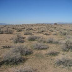
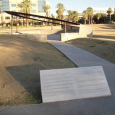
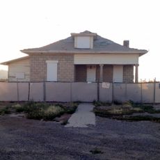
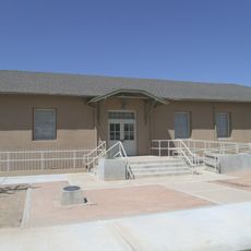
Desert Station, Historic waypoint station in Maricopa County, Arizona, US.

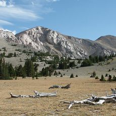
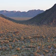
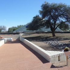
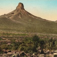
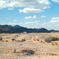
Desert Station is a waypoint in Maricopa County situated near a bend of the Gila River, surrounded by arid land with native desert plants. The site had water tanks that provided refreshment for horses and travelers during their journey through this dry region.

The station was established in 1859 as part of the Butterfield Overland Mail route, connecting various points across the region. It played an important role in the transportation network of the time, supporting long-distance travel and commerce.

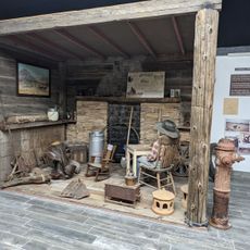
The place served as a meeting point where travelers exchanged information and supplies while crossing the desert landscape. People used this stop to rest before continuing their journey and to gather news about road conditions ahead.

The site is located in an isolated area and is best visited during daylight hours when navigation is easier. Visitors should prepare for extreme heat and bring plenty of water and sun protection for the desert environment.

During the American Civil War, this location held strategic importance as federal and Confederate forces moved through the region. The outposts in this area played a role in military operations between 1861 and 1863.

The community of curious travelers

AroundUs brings together thousands of curated places, local tips, and hidden gems, enriched daily by 60,000 contributors worldwide.

Start exploring
Location
GPS coordinates
33.06678,-112.35855
Latest update
December 14, 2025 17:03
Around this place
Phoenix Raceway
United States of America

Phoenix Raceway

34.6 km
Basin and Range Province
United States of America

Basin and Range Province

34.3 km
Arizona State Capitol
United States of America

Arizona State Capitol

49 km
Mystery Castle
United States of America

Mystery Castle

42.5 km
Desert Sky Pavilion
United States of America

Desert Sky Pavilion

46.6 km
South Mountain Park
United States of America

South Mountain Park

40.3 km
Sonoran Desert National Monument
United States of America

Sonoran Desert National Monument

25.6 km
Wesley Bolin Memorial Plaza
United States of America

Wesley Bolin Memorial Plaza

49.1 km
Hohokam Pima National Monument
United States of America

Hohokam Pima National Monument

42.8 km
Gillespie Dam Highway Bridge
United States of America

Gillespie Dam Highway Bridge

42.3 km
Islamic Community Center of Phoenix
United States of America

Islamic Community Center of Phoenix

45.9 km
Jain Center of Greater Phoenix
United States of America

Jain Center of Greater Phoenix

42.8 km
9/11 Memorial in Arizona
United States of America

9/11 Memorial in Arizona

49.1 km
Cartwright Elementary School District
United States of America

Cartwright Elementary School District

48.7 km
Arizona Mining and Mineral Museum
United States of America

Arizona Mining and Mineral Museum

49.2 km
House of the Future
United States of America

House of the Future

44.6 km
Isanaklesh Peaks
United States of America

Isanaklesh Peaks

26.6 km
Rawhide
United States of America

Rawhide

41.6 km
Gatlin Site
United States of America

Gatlin Site

33.3 km
Arizona Capitol Museum
United States of America

Arizona Capitol Museum

48.9 km
Hassayampa Bridge
United States of America

Hassayampa Bridge

46.1 km
Dunbar School
United States of America

Dunbar School

48.8 km
Sachs-Webster House
United States of America

Sachs-Webster House

36.7 km
Del Monte Market
United States of America

Del Monte Market

39.9 km
Urban Air Trampoline and Adventure Park
United States of America

Urban Air Trampoline and Adventure Park

44.1 km
Laveen School Auditorium
United States of America

Laveen School Auditorium

37.4 km
Wigwam Resort
United States of America

Wigwam Resort

48.4 km
Gila Bend Visitor Center and Museum
United States of America

Gila Bend Visitor Center and Museum

37.2 km
Show the full map
Reviews
Share your experience

No review yet

Discussions
Start a discussion...

No discussion yet

« Desert Station - Historic waypoint station in Maricopa County, Arizona, US » is provided by Around Us (aroundus.com). Images and texts are derived from Wikimedia project under a Creative Commons license. You are allowed to copy, distribute, and modify copies of this page, under the conditions set by the license, as long as this note is clearly visible.

Discover hidden gems everywhere you go!

From secret cafés to breathtaking viewpoints, skip the crowded tourist spots and find places that match your style. Our app makes it easy with voice search, smart filtering, route optimization, and insider tips from travelers worldwide. Download now for the complete mobile experience.

Around Us App Screenshot

A unique approach to discovering new places

Le Figaro

All the places worth exploring

France Info

A tailor-made excursion in just a few clicks

20 Minutes

Around Us
Travel Guide & Maps
Download

Send to your phone

QR Code
1

Open the camera app on your mobile.

2

Point at the QR code with your camera. A notification will appear.

3

Tap the notification to open the link.