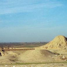
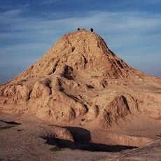
Tell al-Fakhar, Archaeological settlement mound in Kirkuk Governorate, Iraq.
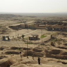
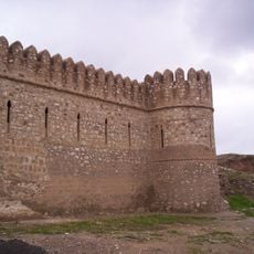
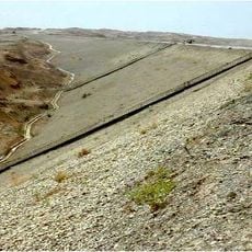
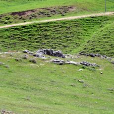
Tell al-Fakhar is an archaeological settlement mound in Kirkuk Governorate that covers roughly 200 meters in length and 135 meters in width, rising about 4.5 meters above the surrounding agricultural plains. The site contains remains from two distinct occupation periods with building foundations, scattered artifacts, and the archive of clay tablets housed within a structure known as the Green Palace.
The site was inhabited during the Mitanni period and later during the Neo-Assyrian era, spanning the second and first millennia before the common era. The earlier Mitanni occupation came to an abrupt and violent conclusion, after which a new population established itself during the subsequent period.
This settlement served as a record-keeping center where ancient Mesopotamian communities documented their administrative affairs and social organization on clay tablets. The practice of maintaining such archives reveals how systematically people managed their communities and preserved knowledge for future generations.
The best time to visit is during the cooler winter months, when summer heat in the region becomes intense. The location lies roughly 45 kilometers northeast of Kirkuk and requires private transportation or arranged transport to reach and explore the exposed remains.
Excavations uncovered 34 human skeletons alongside military weapons buried within a palace structure, revealing a traumatic end to early settlement life. This discovery tells the story of a sudden upheaval that marked the conclusion of the earlier occupation phase.
The community of curious travelers
AroundUs brings together thousands of curated places, local tips, and hidden gems, enriched daily by 60,000 contributors worldwide.