Enable Location

We need your location to show you interesting places around you

Discover nearby places

Find interesting locations and hidden gems around you

Precise directions

Get accurate directions and distances to places

Your location is never shared with other users. It's only used when you tap the location button.

Paramonga District

Log in to your account

Start exploring — it's free

Trusted by 60,662 travelers worldwide

Continue with Google
Continue with Apple
or

We will send you a code to connect

By continuing, you accept our Terms and Conditions and our Privacy Policy

Check your inbox

We've sent a pincode in your inbox. Please enter the code below.

Paramonga District

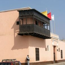
Paramonga District, Administrative district in Barranca Province, Peru

Description

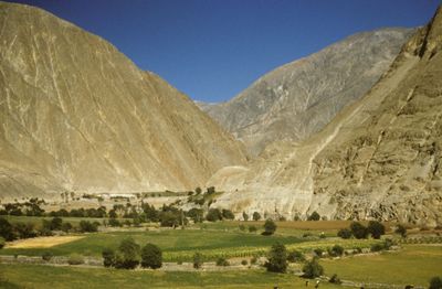
Paramonga District is an administrative area in Barranca Province covering central Peru's coastal plains. The landscape consists of urban settlements mixed with farmland, shaped by large-scale sugarcane processing facilities and irrigation systems.

History

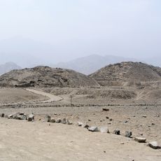
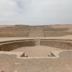
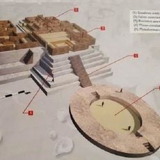
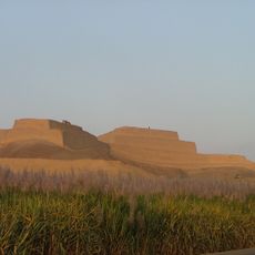
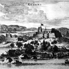
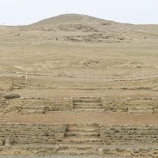
The area was officially established as a district in 1976, building on a long history of settlement and archaeological significance. Before modern development, the region was known for its pre-Columbian ruins and structures left by earlier civilizations.

Culture

The name Paramonga comes from the Mochica language, where "para" means vassals and "monga" means here, reflecting indigenous roots that still appear in local traditions and place names today.

Practical

Visitors can explore the district easily by car or public transport, as the flat terrain makes navigation straightforward. Since the area is most active during daylight hours, arriving early allows you to see the landscape and local activities clearly.

Did you know?

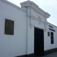
The area was one of the first places in Peru where sugarcane was processed on an industrial scale, founding an economic tradition that still shapes local identity today. The large factories and plantations remain visible, showing how industrial development transformed the landscape and community.

Capital city
Paramonga
Elevation above the sea
13 m
Shares border with
Huarmey District, Colquioc District, San Pedro District, Pativilca District
GPS coordinates
-10.66667,-77.83333
Latest update
December 7, 2025 10:07

AroundUs brings together thousands of curated places, local tips, and hidden gems, enriched daily by 60,000 contributors worldwide. Discover all places nearby (Barranca Province).

« Paramonga District - Administrative district in Barranca Province, Peru » is provided by Around Us (aroundus.com). Images and texts are derived from Wikimedia project under a Creative Commons license. You are allowed to copy, distribute, and modify copies of this page, under the conditions set by the license, as long as this note is clearly visible.

Discover hidden gems everywhere you go!

From secret cafés to breathtaking viewpoints, skip the crowded tourist spots and find places that match your style. Our app makes it easy with voice search, smart filtering, route optimization, and insider tips from travelers worldwide. Download now for the complete mobile experience.

Around Us App Screenshot

A unique approach to discovering new places

Le Figaro

All the places worth exploring

France Info

A tailor-made excursion in just a few clicks

20 Minutes

Around Us
Travel Guide & Maps
Download

Send to your phone

QR Code
1

Open the camera app on your mobile.

2

Point at the QR code with your camera. A notification will appear.

3

Tap the notification to open the link.