Cueva de las Manos, Prehistoric rock art cave in Santa Cruz, Argentina
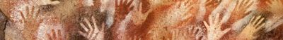
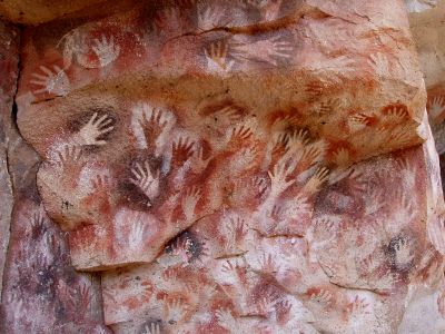
Cueva de las Manos is a prehistoric cave in Santa Cruz Province in southern Argentina, known for its extraordinary rock paintings spanning several millennia. The walls show not only hand prints but also depictions of animals, hunting scenes, and abstract patterns applied in different shades of ochre.
People began leaving hand prints at this site about 9300 years ago, with the oldest layers reaching back to the eighth millennium before Christ. The cave was used by successive groups of hunters over millennia until artistic activity ended around 700 AD.
The hand prints were made by placing palms against the rock and blowing pigment over them through hollow bones, creating negative impressions. Besides the hands, the walls show hunting scenes with guanacos and geometric patterns that likely held ritual or symbolic meaning.
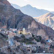
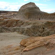
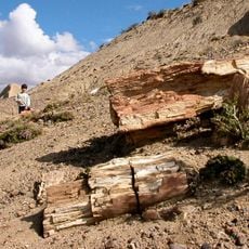
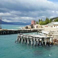
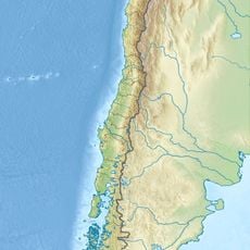
Access to the cave follows a gravel road branching off Ruta 40, passable only with a vehicle that has higher ground clearance. Visitors should bring enough water and supplies, as there are no facilities in the surrounding area.
Most of the hand prints come from left hands, suggesting the artists used their right hand to blow the pigments. Some prints also show missing or deformed fingers, whose meaning remains puzzling to this day.
Location: Santa Cruz Province
Location: Lago Buenos Aires
Made from material: ignimbrite
GPS coordinates: -47.15527,-70.65597
Latest update: December 12, 2025 17:41
Patagonia extends across the southern reaches of Chile and Argentina, encompassing a range of natural landscapes from active glaciers to volcanic peaks. The region presents a mixture of ice, stone and water, with national parks protecting thousands of square miles of undeveloped terrain. The land...
Catedral de Mármol
159 km
Perito Moreno National Park
140.4 km
Balmaceda, Chile
160 km
Patagonia National Park
124.6 km
Bosques Petrificados de Jaramillo National Park
196 km
Villa O'Higgins
204 km
Puerto Río Tranquilo
164.7 km
Petrified Forest of José de Ormachea
201.1 km
Monumento natural Bosques Petrificados
204.1 km
Puerto Ingeniero Ibáñez
137.1 km
Cerro San Lorenzo
133.9 km
Parque Nacional Cerro Castillo
173.8 km
Petrified Forest
192.7 km
Villa Cerro Castillo
162.3 km
Exploradores Glacier
204.7 km
Nef Glacier
198.2 km
Campamento minero Puerto Cristal
147.6 km
Lago Jeinimeni National Reserve
111.8 km
Lago Cochrane Nature Reserve
134.3 km
Colonia Glacier
200.2 km
Museo Regional de Aysén
205.2 km
Cerro Pico Truncado
194.6 km
Calluqueo Glacier
142.1 km
Construcciones de la Sociedad Industrial de Aysén
205.3 km
Bodegas portuarias del río Ibáñez
136.7 km
Leones Glacier
199.7 km
Museo De Arqueología Carlos Gradin
65.9 km
Glaciar Exploradores
204 kmVisited this place? Tap the stars to rate it and share your experience / photos with the community! Try now! You can cancel it anytime.
Discover hidden gems everywhere you go!
From secret cafés to breathtaking viewpoints, skip the crowded tourist spots and find places that match your style. Our app makes it easy with voice search, smart filtering, route optimization, and insider tips from travelers worldwide. Download now for the complete mobile experience.
A unique approach to discovering new places❞
— Le Figaro
All the places worth exploring❞
— France Info
A tailor-made excursion in just a few clicks❞
— 20 Minutes