Canchaque District, Administrative district in Huancabamba Province, Peru
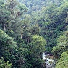
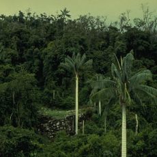
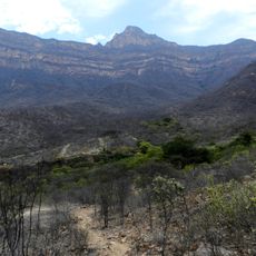
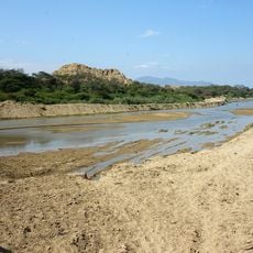
Canchaque District is an administrative area in Huancabamba Province in northern Peru that spans diverse geographical landscapes. The territory is characterized by mountainous terrain and connects several communities across the region.
The district was founded on September 5, 1904, marking the start of its administrative role in the province. This establishment integrated the area into the formal governance structure of the region.
The community keeps alive traditional expressions through music, regional dances, and seasonal festivals tied to mountain heritage. These practices shape daily life and local identity.
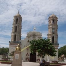
The area connects to neighboring regions through a network of roads, with the municipal office located in central Canchaque. Visitors should expect mountain roads and plan accordingly for travel times.
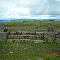
The area is defined by several notable mountain formations including Cerro Mishahuaca and Cerro Santa Rosa, which shape the regional landscape. These natural landmarks play an important role in the visual identity of the place.
Location: Huancabamba Province
Capital city: Canchaque
Elevation above the sea: 1,198 m
Shares border with: Huancabamba District, Lalaquiz District, San Miguel de El Faique District, Sondorillo District, Salitral District, San Juan de Bigote District
GPS coordinates: -5.37635,-79.60629
Latest update: December 8, 2025 13:44
Podocarpus National Park
139 km
Túcume
129.6 km
Cutervo National Park
129 km
Pómac Forest Historical Sanctuary
123.6 km
Batán Grande
123.5 km
Laquipampa Wildlife Refuge
109.2 km
Pacopampa
125.2 km
Yacurí National Park
79.3 km
Bernal Municipal Stadium
125.9 km
Narihualá
120.1 km
Poechos Reservoir
126.9 km
Estadio Miguel Grau
113.9 km
Private Conservation Area Chaparrí
149.5 km
Pongo de Rentema
117.8 km
Casa Museo Gran Almirante Grau
114.9 km
Pagaibamba Protection Forest
129.2 km
Puente Bolognesi
114.6 km
Iglesia San Martín de Tours de Sechura
136.3 km
Iglesia San Juan Bautista, Catacaos
119.7 km
Museo de Sitio Túcume
129.8 km
Church of Our Lady of the Pillar
82.8 km
Jardín botánico Reinaldo Espinosa
150.7 km
Sicán National Museum
140.3 km
La Leche River
122.9 kmÑaupe River
55.3 km
Macará River
135.2 km
Cataratas Numparket
141.6 km
Cueva de las Tres Naranjas
142 kmVisited this place? Tap the stars to rate it and share your experience / photos with the community! Try now! You can cancel it anytime.
Discover hidden gems everywhere you go!
From secret cafés to breathtaking viewpoints, skip the crowded tourist spots and find places that match your style. Our app makes it easy with voice search, smart filtering, route optimization, and insider tips from travelers worldwide. Download now for the complete mobile experience.
A unique approach to discovering new places❞
— Le Figaro
All the places worth exploring❞
— France Info
A tailor-made excursion in just a few clicks❞
— 20 Minutes