Itamarati, Municipality in Amazonas, Brazil
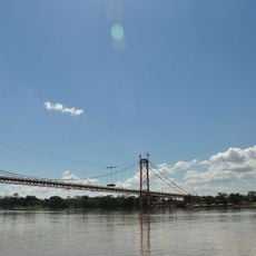
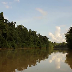
Itamarati is a municipality in Amazonas situated within the dense Amazon rainforest at an elevation of around 160 meters (525 feet). The area is defined by its river systems, which serve as the primary transportation routes and vital connections for residents.
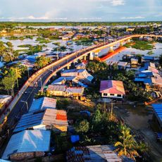
The municipality was established during Brazil's process of territorial organization as an administrative structure to manage settlements in the Amazonas region. This development was part of the broader colonization and management of the Amazon basin over time.
The community maintains ties to indigenous traditions through regional festivals, local food preparation methods, and gatherings that shape daily life throughout the year. These practices remain woven into how people celebrate together and prepare meals using plants from their surroundings.
Access is primarily by river transportation along the Amazon waterways, as the municipality depends heavily on water-based routes. Visitors should prepare for longer travel times on water and maintain flexible plans, since transport availability can be limited.
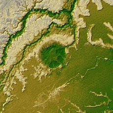
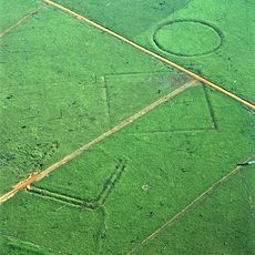
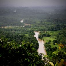
The area borders several unexplored sections of rainforest where native plant species and wildlife remain in relatively undisturbed form. This location makes it a starting point for exploring parts of the Amazon basin that lie away from typical tourist routes.
Location: Amazonas
Elevation above the sea: 160 m
Shares border with: Eirunepé, Carauari, Envira, Jutaí, Lábrea, Pauini, Tapauá
Address: Itamarati - State of Amazonas, 69510-000, Brazil
GPS coordinates: -6.42500,-68.25278
Latest update: December 8, 2025 13:44
Madeira-Mamoré Railroad
545.7 km
Javari Valley
501.8 km
Amacayacu National Park
392.2 km
Casa de Fierro
628.4 km
Palácio Rio Branco
398.2 km
Serra do Divisor National Park
610 km
President Guillermo Billinghurst Bridge
693.7 km
Manuripi-Heath Amazonian Wildlife National Reserve
611.6 km
Ex Hotel Palace
628.3 km
Santa Rosa Island
309 km
Mamirauá Sustainable Development Reserve
544.5 km
Tamshiyacu Tahuayo Regional Conservation Area
601.1 km
Iturralde Crater
688.8 km
Museu da Borracha Governador Geraldo Mesquita
397.8 km
Acre geoglyphs
384.9 km
Casa Morey
628.4 km
Purús Communal Reserve
521 km
Chico Mendes' house
394.4 km
Estádio José de Melo
397.7 km
Mapinguari National Park
484.5 km
Central Amazon Ecological Corridor
346.5 km
Estádio Antônio Aquino Lopes
400.4 km
Chandless State Park
462.9 km
Paraíso bridge
627.4 km
Médio Juruá Extractive Reserve
112.9 km
Museo Amazónico
628.3 km
Ituxi Extractive Reserve
374.7 km
Tefé National Forest
487 kmVisited this place? Tap the stars to rate it and share your experience / photos with the community! Try now! You can cancel it anytime.
Discover hidden gems everywhere you go!
From secret cafés to breathtaking viewpoints, skip the crowded tourist spots and find places that match your style. Our app makes it easy with voice search, smart filtering, route optimization, and insider tips from travelers worldwide. Download now for the complete mobile experience.
A unique approach to discovering new places❞
— Le Figaro
All the places worth exploring❞
— France Info
A tailor-made excursion in just a few clicks❞
— 20 Minutes