
Tolukowuk Bluffs, cliff in Nome Census Area, United States of America
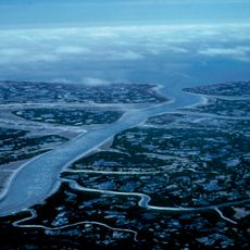
Yukon Delta National Wildlife Refuge
288.2 km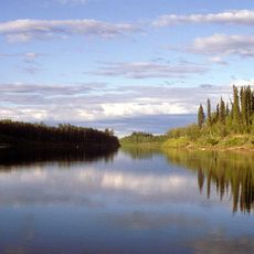
Nowitna River
348.8 km
Innoko National Wildlife Refuge
146.5 km
Trail Creek Caves
276.5 km
Koyukuk National Wildlife Refuge
329.9 km
Selawik National Wildlife Refuge
361.1 km
Innoko Wilderness
157.5 km
Pilgrim Hot Springs
249.9 km
Cape Nome Mining District Discovery Sites
231 km
Unalakleet River
90 km
Old St. Joseph's Catholic Church
229.1 km
Nome River
231.9 km
Snake River
239 km
Chamisso Wilderness
307.3 km
Kougarok River
274.3 km
Kuzitrin River
252 km
Christ Church Mission
107.6 km
Swanberg Dredge
227 km
Solomon Roadhouse
193.6 km
Niukluk River
205.3 km
Iyatayet Site
104.7 km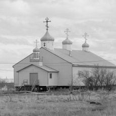
St. Jacob's Church
308.4 km
Kugruk River
275.5 km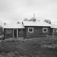
St. Seraphim Chapel
223.9 km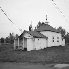
Presentation of Our Lord Chapel
364.2 km
Noxapaga River
270 km
Bureau of Indian Affairs Unalakleet School
52.3 km
Johnson River
232.1 kmReviews
Visited this place? Tap the stars to rate it and share your experience / photos with the community! Try now! You can cancel it anytime.
Discover hidden gems everywhere you go!
From secret cafés to breathtaking viewpoints, skip the crowded tourist spots and find places that match your style. Our app makes it easy with voice search, smart filtering, route optimization, and insider tips from travelers worldwide. Download now for the complete mobile experience.

A unique approach to discovering new places❞
— Le Figaro
All the places worth exploring❞
— France Info
A tailor-made excursion in just a few clicks❞
— 20 Minutes