Chest opened
+${chestReward.xp} XP
Explorer
NOUVEAU ×${chestReward.collectible.quantity}
tapez pour fermer
Chest locked

Open chests in the app

Around Us is built for your phone — chests unlock when you walk, explore and capture nearby places.

Enable Location

We need your location to show you interesting places around you

Discover nearby places

Find interesting locations and hidden gems around you

Precise directions

Get accurate directions and distances to places

Your location is never shared with other users. It's only used when you tap the location button.

Log in to your account

Start exploring — it's free

Trusted by 73,057 travelers worldwide

Continue with Google
Continue with Apple
or

We will send you a code to connect

By continuing, you accept our Terms and Conditions and our Privacy Policy

Check your inbox

We've sent a pincode in your inbox. Please enter the code below.

Yukon-Kuskokwim Delta
Discussion Reviews Photo
18.7k Popularity

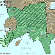
Yukon-Kuskokwim Delta, River delta in western Alaska, United States

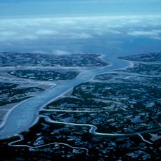
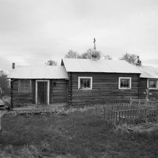
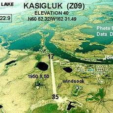
The Yukon-Kuskokwim Delta is a vast lowland area in western Alaska where the Yukon and Kuskokwim rivers empty into the Bering Sea. The landscape consists of marshes, lakes, and winding waterways that thread through roughly 56 villages and settlements.

The region became a trading hub starting in the 1870s when Bethel developed as a marketplace for local communities. This commerce brought people and goods together, shaping how settlements in the delta grew and connected with one another.

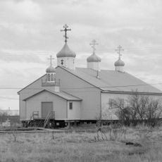
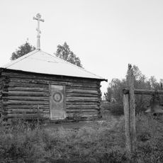
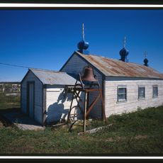
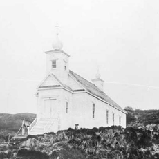
The region has long been home to Yup'ik and other Alaska Native peoples who continue traditional hunting, fishing, and gathering in their daily lives. These practices shape how communities interact with the land and one another today.

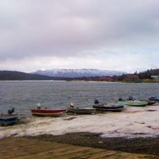
Getting here requires flying from Anchorage to Bethel, then traveling by small aircraft or boat to reach individual villages in the region. Infrastructure is limited, so planning ahead and being flexible with timing is important.

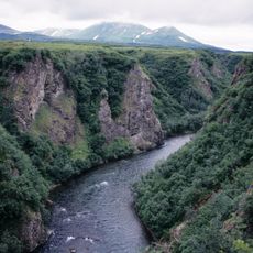
During winter months the rivers and waterways freeze solid and become natural routes for travel by snowmobile between villages. These frozen pathways offer ways to reach places that would be difficult or impossible to access when the water thaws.

The community of curious travelers

AroundUs brings together thousands of curated places, local tips, and hidden gems, enriched daily by 60,000 contributors worldwide.

Start exploring
Location
GPS coordinates
61.36670,-163.71700
Latest update
December 7, 2025 10:08
Around this place
Yukon Delta National Wildlife Refuge
United States of America

Yukon Delta National Wildlife Refuge

56 km
Wood-Tikchik State Park
United States of America

Wood-Tikchik State Park

311.1 km
Togiak National Wildlife Refuge
United States of America

Togiak National Wildlife Refuge

296 km
Innoko National Wildlife Refuge
United States of America

Innoko National Wildlife Refuge

350.4 km
Togiak Wilderness
United States of America

Togiak Wilderness

272.4 km
Innoko Wilderness
United States of America

Innoko Wilderness

338.3 km
Pilgrim Hot Springs
United States of America

Pilgrim Hot Springs

419.1 km
Cape Nome Mining District Discovery Sites
United States of America

Cape Nome Mining District Discovery Sites

365.6 km
Unalakleet River
United States of America

Unalakleet River

349.9 km
Old St. Joseph's Catholic Church
United States of America

Old St. Joseph's Catholic Church

359.1 km
Nome River
United States of America

Nome River

373.3 km
Snake River
United States of America

Snake River

374.5 km
Kougarok River
United States of America

Kougarok River

459 km
Kuzitrin River
United States of America

Kuzitrin River

440.5 km
Christ Church Mission
United States of America

Christ Church Mission

233 km
Swanberg Dredge
United States of America

Swanberg Dredge

357.8 km
Solomon Roadhouse
United States of America

Solomon Roadhouse

357.3 km
Niukluk River
United States of America

Niukluk River

397.3 km
Iyatayet Site
United States of America

Iyatayet Site

356.6 km
St. Jacob's Church
United States of America

St. Jacob's Church

128.3 km
Sts. Constantine and Helen Chapel
United States of America

Sts. Constantine and Helen Chapel

441.6 km
St. Seraphim Chapel
United States of America

St. Seraphim Chapel

179.5 km
St. John the Baptist Chapel
United States of America

St. John the Baptist Chapel

474.2 km
Transfiguration of Our Lord Chapel
United States of America

Transfiguration of Our Lord Chapel

395.2 km
Noxapaga River
United States of America

Noxapaga River

471 km
Bureau of Indian Affairs Unalakleet School
United States of America

Bureau of Indian Affairs Unalakleet School

316.6 km
Johnson River
United States of America

Johnson River

106.9 km
Kemuk River
United States of America

Kemuk River

291.6 km
Show the full map
Reviews
Share your experience

No review yet

Discussions
Start a discussion...

No discussion yet

« Yukon-Kuskokwim Delta - River delta in western Alaska, United States » is provided by Around Us (aroundus.com). Images and texts are derived from Wikimedia project under a Creative Commons license. You are allowed to copy, distribute, and modify copies of this page, under the conditions set by the license, as long as this note is clearly visible.

Discover hidden gems everywhere you go!

From secret cafés to breathtaking viewpoints, skip the crowded tourist spots and find places that match your style. Our app makes it easy with voice search, smart filtering, route optimization, and insider tips from travelers worldwide. Download now for the complete mobile experience.

Around Us App Screenshot

A unique approach to discovering new places

Le Figaro

All the places worth exploring

France Info

A tailor-made excursion in just a few clicks

20 Minutes

Around Us
Travel Guide & Maps
Download

Send to your phone

QR Code
1

Open the camera app on your mobile.

2

Point at the QR code with your camera. A notification will appear.

3

Tap the notification to open the link.