Chest opened
+${chestReward.xp} XP
Explorer
NOUVEAU ×${chestReward.collectible.quantity}
tapez pour fermer
Chest locked

Open chests in the app

Around Us is built for your phone — chests unlock when you walk, explore and capture nearby places.

Enable Location

We need your location to show you interesting places around you

Discover nearby places

Find interesting locations and hidden gems around you

Precise directions

Get accurate directions and distances to places

Your location is never shared with other users. It's only used when you tap the location button.

Log in to your account

Start exploring — it's free

Trusted by 73,044 travelers worldwide

Continue with Google
Continue with Apple
or

We will send you a code to connect

By continuing, you accept our Terms and Conditions and our Privacy Policy

Check your inbox

We've sent a pincode in your inbox. Please enter the code below.

California's 30th congressional district
Discussion Reviews Photo
28k Popularity

California's 30th congressional district, Congressional district in Los Angeles County, United States.

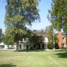
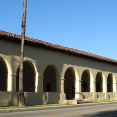
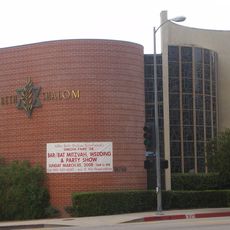
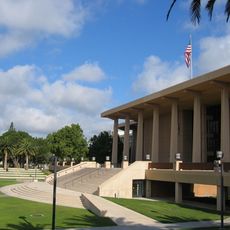
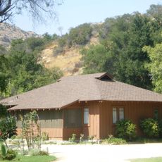
California's 30th congressional district includes Burbank and Glendale, parts of Pasadena, and several Los Angeles neighborhoods including Hollywood, West Hollywood, and Echo Park. The area combines entertainment industry facilities with residential neighborhoods and commercial zones.

The district was established in 1953 and has undergone several boundary changes since then that have adjusted its borders multiple times. These changes reflect the region's growth and demographic shifts across the decades.

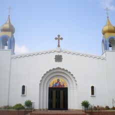
The district is home to people from many different backgrounds who shape daily life in these neighborhoods. You can see this diversity in how the area looks, in local businesses, and in the gathering places throughout the community.

You can explore the different neighborhoods that range from commercial areas to quieter residential zones at your own pace. It makes sense to travel by car or public transportation since the district covers a fairly large area.

The area is a major center for film and television production with numerous studios and production facilities visible throughout. This industry presence shapes daily life and the economy in ways that go beyond what you might expect in a typical urban district.

The community of curious travelers

AroundUs brings together thousands of curated places, local tips, and hidden gems, enriched daily by 60,000 contributors worldwide.

Start exploring
Location
Inception
January 3, 1953
GPS coordinates
34.20194,-118.54694
Latest update
December 20, 2025 13:07
Around this place
Spahn Ranch
United States of America

Spahn Ranch

10.5 km
Mulholland Drive
United States of America

Mulholland Drive

9.5 km
Mission San Fernando Rey de España
United States of America

Mission San Fernando Rey de España

11.2 km
Sepulveda Dam
United States of America

Sepulveda Dam

7.9 km
Grace Community Church
United States of America

Grace Community Church

11.7 km
Leonis Adobe
United States of America

Leonis Adobe

9.9 km
Santa Susana Pass State Historic Park
United States of America

Santa Susana Pass State Historic Park

10 km
Bel Air Presbyterian Church
United States of America

Bel Air Presbyterian Church

9.8 km
The Japanese Garden
United States of America

The Japanese Garden

6.4 km
Shepherd of the Hills Church
United States of America

Shepherd of the Hills Church

8.2 km
Orcutt Ranch Horticulture Center
United States of America

Orcutt Ranch Horticulture Center

8.8 km
Los Encinos State Historic Park
United States of America

Los Encinos State Historic Park

6.4 km
Matadome
United States of America

Matadome

4.9 km
Chatsworth Nature Preserve
United States of America

Chatsworth Nature Preserve

8.3 km
Rómulo Pico Adobe
United States of America

Rómulo Pico Adobe

10.4 km
Shadow Ranch
United States of America

Shadow Ranch

6.8 km
United States of America

Van Nuys City Hall

9.4 km
Convento Building
United States of America

Convento Building

11.2 km
Valley Beth Shalom
United States of America

Valley Beth Shalom

8.3 km
California State University Northridge Botanic Garden
United States of America

California State University Northridge Botanic Garden

4.5 km
Minnie Hill Palmer House
United States of America

Minnie Hill Palmer House

9.1 km
Cathedral of St. Mary Byzantine Catholic Church
United States of America

Cathedral of St. Mary Byzantine Catholic Church

8.3 km
Old Trapper's Lodge
United States of America

Old Trapper's Lodge

3.9 km
Van Nuys Branch
United States of America

Van Nuys Branch

9.2 km
Eagle Rock
United States of America

Eagle Rock

10.7 km
Valley Relics Museum
United States of America

Valley Relics Museum

4.5 km
Leonis Adobe
United States of America

Leonis Adobe

9.9 km
Munch Box
United States of America

Munch Box

7.8 km
Show the full map
Reviews
Share your experience

No review yet

Discussions
Start a discussion...

No discussion yet

« California's 30th congressional district - Congressional district in Los Angeles County, United States » is provided by Around Us (aroundus.com). Images and texts are derived from Wikimedia project under a Creative Commons license. You are allowed to copy, distribute, and modify copies of this page, under the conditions set by the license, as long as this note is clearly visible.

Discover hidden gems everywhere you go!

From secret cafés to breathtaking viewpoints, skip the crowded tourist spots and find places that match your style. Our app makes it easy with voice search, smart filtering, route optimization, and insider tips from travelers worldwide. Download now for the complete mobile experience.

Around Us App Screenshot

A unique approach to discovering new places

Le Figaro

All the places worth exploring

France Info

A tailor-made excursion in just a few clicks

20 Minutes

Around Us
Travel Guide & Maps
Download

Send to your phone

QR Code
1

Open the camera app on your mobile.

2

Point at the QR code with your camera. A notification will appear.

3

Tap the notification to open the link.