Chest opened
+${chestReward.xp} XP
Explorer
NOUVEAU ×${chestReward.collectible.quantity}
tapez pour fermer
Chest locked

Open chests in the app

Around Us is built for your phone — chests unlock when you walk, explore and capture nearby places.

Enable Location

We need your location to show you interesting places around you

Discover nearby places

Find interesting locations and hidden gems around you

Precise directions

Get accurate directions and distances to places

Your location is never shared with other users. It's only used when you tap the location button.

Wildlife WayStation

Log in to your account

Start exploring — it's free

Trusted by 72,956 travelers worldwide

Continue with Google
Continue with Apple
or

We will send you a code to connect

By continuing, you accept our Terms and Conditions and our Privacy Policy

Check your inbox

We've sent a pincode in your inbox. Please enter the code below.

Discussion Reviews 1 Photos
4.4k Popularity

Wildlife WayStation, Animal sanctuary in Los Angeles County, United States

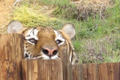
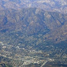
The Wildlife WayStation was an animal sanctuary situated in the forested terrain of Los Angeles County, spanning across woodland in the San Gabriel Mountains. It housed over 400 wild and exotic animals in naturalistic enclosures and specialized habitats designed for their needs.

The facility was founded in 1976 by a woman who left her career in costume design to establish a refuge for rescued animals. Over several decades it grew into one of the largest operations of its kind on the West Coast before closing in 2019.

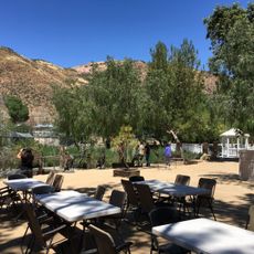
The place served as a refuge for animals rescued from difficult circumstances, particularly from closed research facilities and private ownership situations. Visitors could observe how displaced wildlife adapted to life in a protected environment away from exploitation.

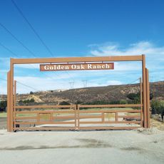
The site was accessible via forest roads and trails marked for visitors of different mobility levels. Bringing appropriate footwear and water was recommended, as pathways led through both open areas and wooded sections of the property.

The facility held one of the largest groups of chimpanzees anywhere on the West Coast, many of which came from closed biomedical research laboratories. These animals found a place to recover from their previous experiences and live in community with others of their kind.

The community of curious travelers

AroundUs brings together thousands of curated places, local tips, and hidden gems, enriched daily by 60,000 contributors worldwide.

Start exploring
Founders
Martine Colette
Address
14831 Little Tujunga Canyon Rd, Sylmar, CA 91342, USA
GPS coordinates
34.33139,-118.34444
Latest update
December 18, 2025 11:40
Around this place
Mission San Fernando Rey de España
United States of America

Mission San Fernando Rey de España

12.5 km
Golden Oak Ranch
United States of America

Golden Oak Ranch

13.2 km
Verdugo Mountains
United States of America

Verdugo Mountains

13.9 km
The Master's Seminary
United States of America

The Master's Seminary

14.2 km
Nethercutt Collection
United States of America

Nethercutt Collection

11.3 km
Shambala Preserve
United States of America

Shambala Preserve

14.8 km
Mount Lukens, California
United States of America

Mount Lukens, California

11.9 km
Chili John's
United States of America

Chili John's

16.9 km
Placerita Canyon State Park
United States of America

Placerita Canyon State Park

10.6 km
Portal of the Folded Wings Shrine to Aviation
United States of America

Portal of the Folded Wings Shrine to Aviation

15.8 km
Big Tujunga Dam
United States of America

Big Tujunga Dam

15 km
Pacoima Dam
United States of America

Pacoima Dam

4.8 km
Rómulo Pico Adobe
United States of America

Rómulo Pico Adobe

13.3 km
Convento Building
United States of America

Convento Building

12.5 km
Bolton Hall
United States of America

Bolton Hall

10.2 km
O'Melveny Park
United States of America

O'Melveny Park

16.4 km
Sylmar Converter Station
United States of America

Sylmar Converter Station

12.7 km
Lopez Adobe
United States of America

Lopez Adobe

10.6 km
San Fernando Pioneer Memorial Cemetery
United States of America

San Fernando Pioneer Memorial Cemetery

9.6 km
J.W. Schaffer House
United States of America

J.W. Schaffer House

15.6 km
Burbank City Hall
United States of America

Burbank City Hall

17 km
Briggs Terrace
United States of America

Briggs Terrace

14.8 km
St. Leon Cathedral
United States of America

St. Leon Cathedral

13.9 km
Vasquez Rocks
United States of America

Vasquez Rocks

16.7 km
Vasquez Rocks Park
United States of America

Vasquez Rocks Park

16.8 km
Griffith Ranch Historical Monument
United States of America

Griffith Ranch Historical Monument

7.7 km
Chandler Valley Center Studios
United States of America

Chandler Valley Center Studios

15.9 km
Batman Statue in Burbank
United States of America

Batman Statue in Burbank

17 km
Show the full map
Reviews
Share your experience

No review yet

Discussions
Start a discussion...

No discussion yet

« Wildlife WayStation - Animal sanctuary in Los Angeles County, United States » is provided by Around Us (aroundus.com). Images and texts are derived from Wikimedia project under a Creative Commons license. You are allowed to copy, distribute, and modify copies of this page, under the conditions set by the license, as long as this note is clearly visible.

Discover hidden gems everywhere you go!

From secret cafés to breathtaking viewpoints, skip the crowded tourist spots and find places that match your style. Our app makes it easy with voice search, smart filtering, route optimization, and insider tips from travelers worldwide. Download now for the complete mobile experience.

Around Us App Screenshot

A unique approach to discovering new places

Le Figaro

All the places worth exploring

France Info

A tailor-made excursion in just a few clicks

20 Minutes

Around Us
Travel Guide & Maps
Download

Send to your phone

QR Code
1

Open the camera app on your mobile.

2

Point at the QR code with your camera. A notification will appear.

3

Tap the notification to open the link.