Chest opened
+${chestReward.xp} XP
Explorer
NOUVEAU ×${chestReward.collectible.quantity}
tapez pour fermer
Chest locked

Open chests in the app

Around Us is built for your phone — chests unlock when you walk, explore and capture nearby places.

Enable Location

We need your location to show you interesting places around you

Discover nearby places

Find interesting locations and hidden gems around you

Precise directions

Get accurate directions and distances to places

Your location is never shared with other users. It's only used when you tap the location button.

Seven Oaks Dam

Log in to your account

Start exploring — it's free

Trusted by 72,880 travelers worldwide

Continue with Google
Continue with Apple
or

We will send you a code to connect

By continuing, you accept our Terms and Conditions and our Privacy Policy

Check your inbox

We've sent a pincode in your inbox. Please enter the code below.

Seven Oaks Dam
Discussion Reviews 1 Photos
8.5k Popularity

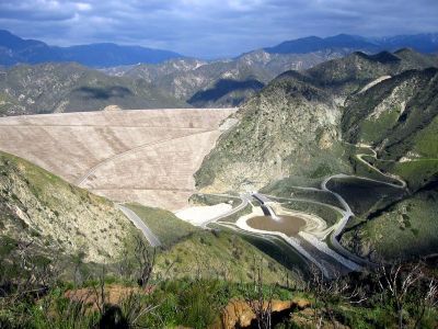
Seven Oaks Dam, Embankment dam in San Bernardino County, United States.

Seven Oaks Dam is an earthen embankment dam built across the Santa Ana River in the San Bernardino Mountains of California. It rises about 550 feet (167 m) above the riverbed, making it one of the tallest dams of its type in the country.

Construction began in the early 1990s after a series of severe floods caused widespread damage in the lowlands along the Santa Ana River. The US Army Corps of Engineers completed the dam in 1999, and it has been managing river flow ever since.

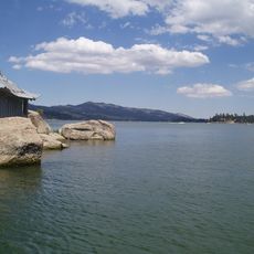
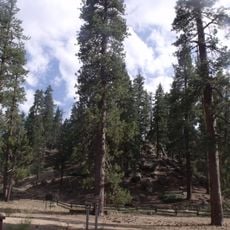
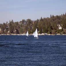
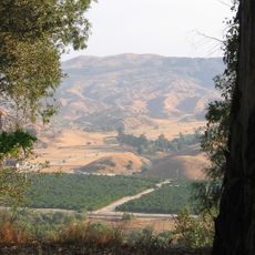
The dam sits at the edge of the San Bernardino National Forest, and the trails nearby draw hikers who follow the Santa Ana River upstream. For people living in the valleys below, the structure is a visible reminder that the land around them was shaped by repeated flooding.

The dam is reached by mountain roads that can be affected by weather conditions, so it is worth checking the route before setting out. Once there, the terrain is hilly and the elevation is noticeable, so comfortable footwear is a good idea.

The dam was built to withstand a major earthquake because it sits just a short distance from one of California's most active fault lines. This requirement made it one of the most technically demanding earthen dams ever built in the United States.

The community of curious travelers

AroundUs brings together thousands of curated places, local tips, and hidden gems, enriched daily by 60,000 contributors worldwide.

Start exploring
GPS coordinates
34.14580,-117.06200
Latest update
March 3, 2026 08:20
Around this place
San Gorgonio Mountain
United States of America

San Gorgonio Mountain

22.5 km
Big Bear Lake
United States of America

Big Bear Lake

13.3 km
San Bernardino National Forest
United States of America

San Bernardino National Forest

90.9 km
Lake Arrowhead Reservoir
United States of America

Lake Arrowhead Reservoir

16.8 km
Morey Mansion
United States of America

Morey Mansion

18 km
Santa's Village
United States of America

Santa's Village

14.3 km
Big Bear Solar Observatory
United States of America

Big Bear Solar Observatory

18 km
Kimberly Crest
United States of America

Kimberly Crest

15.8 km
San Timoteo Canyon
United States of America

San Timoteo Canyon

18.4 km
Big Bear Discovery Center
United States of America

Big Bear Discovery Center

19.5 km
San Bernardino County Court House
United States of America

San Bernardino County Court House

21.6 km
Barton Villa
United States of America

Barton Villa

17.8 km
Mill Creek Zanja
United States of America

Mill Creek Zanja

10.9 km
Redlands Santa Fe Depot District
United States of America

Redlands Santa Fe Depot District

14.8 km
A. K. Smiley Public Library
United States of America

A. K. Smiley Public Library

15.2 km
Smiley Park Historic District
United States of America

Smiley Park Historic District

15.3 km
Goode Solar Telescope
United States of America

Goode Solar Telescope

18 km
Auerbacher Home
United States of America

Auerbacher Home

16.1 km
Jepson Peak
United States of America

Jepson Peak

20.6 km
Rosa Parks Memorial Building
United States of America

Rosa Parks Memorial Building

21.8 km
Beverly Ranch
United States of America

Beverly Ranch

16.2 km
Norman F. Feldheym Library
United States of America

Norman F. Feldheym Library

21.9 km
Highland Historic District
United States of America

Highland Historic District

13.6 km
Henry Washington Survey Marker
United States of America

Henry Washington Survey Marker

12.6 km
Arboreto Heaps Peak
United States of America

Arboreto Heaps Peak

12.3 km
Lincoln Memorial Shrine
United States of America

Lincoln Memorial Shrine

15.2 km
Rathaus von San Bernardino
United States of America

Rathaus von San Bernardino

21.8 km
Mountain History Museum
United States of America

Mountain History Museum

18.8 km
Show the full map
Reviews
Share your experience

No review yet

Discussions
Start a discussion...

No discussion yet

« Seven Oaks Dam - Embankment dam in San Bernardino County, United States » is provided by Around Us (aroundus.com). Images and texts are derived from Wikimedia project under a Creative Commons license. You are allowed to copy, distribute, and modify copies of this page, under the conditions set by the license, as long as this note is clearly visible.

Discover hidden gems everywhere you go!

From secret cafés to breathtaking viewpoints, skip the crowded tourist spots and find places that match your style. Our app makes it easy with voice search, smart filtering, route optimization, and insider tips from travelers worldwide. Download now for the complete mobile experience.

Around Us App Screenshot

A unique approach to discovering new places

Le Figaro

All the places worth exploring

France Info

A tailor-made excursion in just a few clicks

20 Minutes

Around Us
Travel Guide & Maps
Download

Send to your phone

QR Code
1

Open the camera app on your mobile.

2

Point at the QR code with your camera. A notification will appear.

3

Tap the notification to open the link.