Enable Location

We need your location to show you interesting places around you

Discover nearby places

Find interesting locations and hidden gems around you

Precise directions

Get accurate directions and distances to places

Your location is never shared with other users. It's only used when you tap the location button.

San Bernardino National Forest

Log in to your account

Start exploring — it's free

Trusted by 61,999 travelers worldwide

Continue with Google
Continue with Apple
or

We will send you a code to connect

By continuing, you accept our Terms and Conditions and our Privacy Policy

Check your inbox

We've sent a pincode in your inbox. Please enter the code below.

San Bernardino National Forest, Nature reserve in Riverside County, United States.

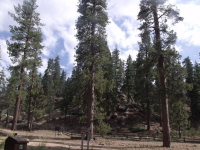
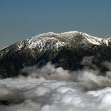
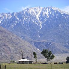
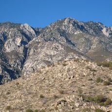
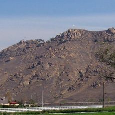
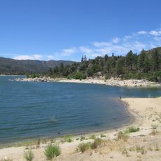
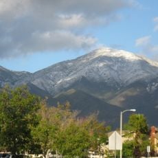
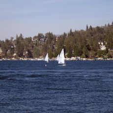
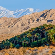
San Bernardino National Forest is a protected area spanning Riverside and San Bernardino counties, connecting desert lowlands with forested mountain ridges. The terrain rises through different elevations, creating varied natural settings depending on how far you travel into the mountain ranges.

The area was placed under protection by the United States Forest Service in 1907 after conservationists had advocated for preserving these landscapes. This early protection decision was part of a broader movement to secure natural regions for future generations.

Native American tribes maintained strong connections to this land, utilizing its resources for hunting, gathering materials, and conducting traditional ceremonies throughout generations.

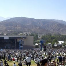
The area features a network of trails for walkers along with routes for cyclists and riders, offering various difficulty levels. The best time to explore is late spring through fall, when conditions are more stable and higher areas are easier to access.

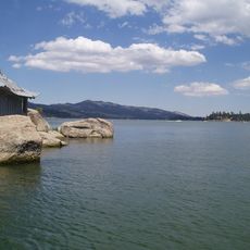
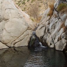
Seven wilderness zones protect old forests with rare conifer species and diverse wildlife that visitors often overlook. These remote areas harbor natural habitats that have remained largely unchanged for decades.

The community of curious travelers

AroundUs brings together thousands of curated places, local tips, and hidden gems, enriched daily by 60,000 contributors worldwide.

Start exploring
Location
Inception
February 25, 1893
Operator
United States Forest Service
GPS coordinates
33.52330,-116.42500
Latest update
December 20, 2025 13:20
Around this place
Riverside International Raceway
United States of America

Riverside International Raceway

91 km
Mount San Antonio
United States of America

Mount San Antonio

141.4 km
Auto Club Speedway
United States of America

Auto Club Speedway

117.7 km
Cabazon Dinosaurs
United States of America

Cabazon Dinosaurs

54.7 km
Palm Springs Aerial Tramway
United States of America

Palm Springs Aerial Tramway

39.1 km
Saddleback Church
United States of America

Saddleback Church

114.4 km
Kaufmann Desert House
United States of America

Kaufmann Desert House

37.7 km
San Jacinto Peak
United States of America

San Jacinto Peak

40.1 km
San Gorgonio Mountain
United States of America

San Gorgonio Mountain

74 km
Big Bear Lake
United States of America

Big Bear Lake

94.9 km
Mission Inn
United States of America

Mission Inn

101.6 km
United States of America

Ontario Motor Speedway

122.1 km
Cactus to Clouds Trail
United States of America

Cactus to Clouds Trail

35.6 km
Diamond Valley Lake
United States of America

Diamond Valley Lake

59.2 km
Riverside National Cemetery
United States of America

Riverside National Cemetery

88 km
San Gorgonio Pass
United States of America

San Gorgonio Pass

53.2 km
Mount Rubidoux
United States of America

Mount Rubidoux

103.2 km
Lake Mathews
United States of America

Lake Mathews

100.6 km
Glen Helen Amphitheater
United States of America

Glen Helen Amphitheater

117.9 km
Planes of Fame Air Museum
United States of America

Planes of Fame Air Museum

123.5 km
Lake Hemet
United States of America

Lake Hemet

29.6 km
Santiago Peak
United States of America

Santiago Peak

104.9 km
Deep Creek Hot Springs
United States of America

Deep Creek Hot Springs

114.4 km
Lake Arrowhead Reservoir
United States of America

Lake Arrowhead Reservoir

107.7 km
Sand to Snow National Monument
United States of America

Sand to Snow National Monument

64.7 km
Lake Norconian Club
United States of America

Lake Norconian Club

115.1 km
March Field Air Museum
United States of America

March Field Air Museum

87.6 km
Castle Park
United States of America

Castle Park

105.4 km
Show the full map
« San Bernardino National Forest - Nature reserve in Riverside County, United States » is provided by Around Us (aroundus.com). Images and texts are derived from Wikimedia project under a Creative Commons license. You are allowed to copy, distribute, and modify copies of this page, under the conditions set by the license, as long as this note is clearly visible.

Discover hidden gems everywhere you go!

From secret cafés to breathtaking viewpoints, skip the crowded tourist spots and find places that match your style. Our app makes it easy with voice search, smart filtering, route optimization, and insider tips from travelers worldwide. Download now for the complete mobile experience.

Around Us App Screenshot

A unique approach to discovering new places

Le Figaro

All the places worth exploring

France Info

A tailor-made excursion in just a few clicks

20 Minutes

Around Us
Travel Guide & Maps
Download

Send to your phone

QR Code
1

Open the camera app on your mobile.

2

Point at the QR code with your camera. A notification will appear.

3

Tap the notification to open the link.