Enable Location

We need your location to show you interesting places around you

Discover nearby places

Find interesting locations and hidden gems around you

Precise directions

Get accurate directions and distances to places

Your location is never shared with other users. It's only used when you tap the location button.

Fortynine Palms Oasis

Log in to your account

Start exploring — it's free

Trusted by 62,621 travelers worldwide

Continue with Google
Continue with Apple
or

We will send you a code to connect

By continuing, you accept our Terms and Conditions and our Privacy Policy

Check your inbox

We've sent a pincode in your inbox. Please enter the code below.

Fortynine Palms Oasis

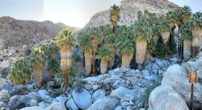
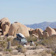
Fortynine Palms Oasis, trail through Joshua Tree National Park, California, US

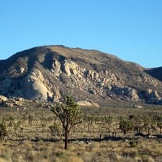
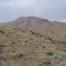
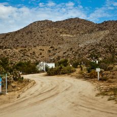
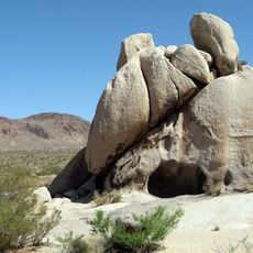
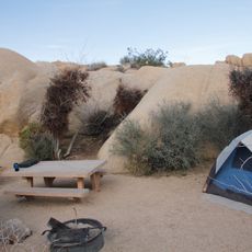
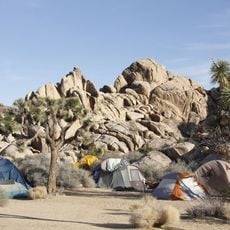
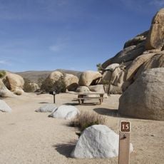
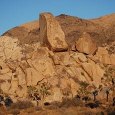
Fortynine Palms Oasis is a spring and trail in Joshua Tree National Park surrounded by large boulders with a cluster of fan palms growing around a water source. The three-mile round-trip path begins with gentle climbing through rocky terrain and descends to a grove of palms with small pools of water between the trees and rocks.

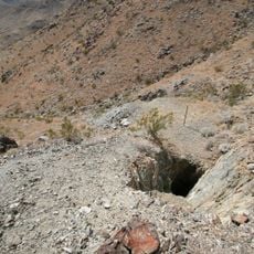
Miners used this spring long ago and planted the palms as trail markers. The oasis served as a vital water stop for early desert travelers and remains important today as a water source for wildlife during dry seasons.

The name comes from miners who long ago planted the palms to mark the location of the spring for navigation. Today, it serves as a place where visitors observe how green life persists in harsh conditions, making it a symbol of resilience and nature's adaptation in the desert.

The trail is free and requires no permit, but check conditions beforehand as it may close seasonally for repairs or wildlife protection. Bring at least one liter of water per person, wear sturdy boots for rocky terrain, and start early in the morning to avoid heat and crowds.

The palms were planted by miners and stand between giant boulders, but this detail often goes unnoticed as most visitors focus on the hike itself. Many overlook that the tiny pools at the oasis floor hold small ecosystems supporting insects, birds, and desert wildlife.

The community of curious travelers

AroundUs brings together thousands of curated places, local tips, and hidden gems, enriched daily by 60,000 contributors worldwide.

Start exploring
GPS coordinates
34.10556,-116.10528
Latest update
February 9, 2026 08:22
Around this place
Integratron
United States of America

Integratron

34.6 km
Rancho De La Luna
United States of America

Rancho De La Luna

20.5 km
Hidden Valley
United States of America

Hidden Valley

11.9 km
Keys Desert Queen Ranch
United States of America

Keys Desert Queen Ranch

8.9 km
Desert Queen Mine
United States of America

Desert Queen Mine

9.6 km
Ryan Mountain
United States of America

Ryan Mountain

13.6 km
Wall Street Mill
United States of America

Wall Street Mill

8.1 km
Quail Mountain
United States of America

Quail Mountain

16.7 km
Desert Christ Park
United States of America

Desert Christ Park

31 km
Malapai Hill
United States of America

Malapai Hill

18.5 km
Cow Camp
United States of America

Cow Camp

9.5 km
United States of America

Eureka Peak

24 km
Ryan House and Lost Horse Well
United States of America

Ryan House and Lost Horse Well

14.1 km
World Famous Crochet Museum
United States of America

World Famous Crochet Museum

19.5 km
Hi-Desert Nature Museum
United States of America

Hi-Desert Nature Museum

28.9 km
Joshua Tree National Park Visitor Center
United States of America

Joshua Tree National Park Visitor Center

5.5 km
Joshua Tree Visitor Center
United States of America

Joshua Tree Visitor Center

19.6 km
Black Rock Nature Center
United States of America

Black Rock Nature Center

26.6 km
Beauty Bubble Salon and Museum
United States of America

Beauty Bubble Salon and Museum

19.5 km
Hidden Valley Campground
United States of America

Hidden Valley Campground

11.1 km
White Tank Campground
United States of America

White Tank Campground

15.7 km
Jumbo Rocks Campground
United States of America

Jumbo Rocks Campground

13.3 km
Black Rock Campground
United States of America

Black Rock Campground

26.5 km
Sheep Pass Campground
United States of America

Sheep Pass Campground

11.9 km
Belle Campground
United States of America

Belle Campground

14 km
Ryan Campground
United States of America

Ryan Campground

14.4 km
Jumbo Rocks Campground Amphitheater
United States of America

Jumbo Rocks Campground Amphitheater

13.2 km
Indian Cove Campground
United States of America

Indian Cove Campground

5.1 km
Show the full map
« Fortynine Palms Oasis - trail through Joshua Tree National Park, California, US » is provided by Around Us (aroundus.com). Images and texts are derived from Wikimedia project under a Creative Commons license. You are allowed to copy, distribute, and modify copies of this page, under the conditions set by the license, as long as this note is clearly visible.

Discover hidden gems everywhere you go!

From secret cafés to breathtaking viewpoints, skip the crowded tourist spots and find places that match your style. Our app makes it easy with voice search, smart filtering, route optimization, and insider tips from travelers worldwide. Download now for the complete mobile experience.

Around Us App Screenshot

A unique approach to discovering new places

Le Figaro

All the places worth exploring

France Info

A tailor-made excursion in just a few clicks

20 Minutes

Around Us
Travel Guide & Maps
Download

Send to your phone

QR Code
1

Open the camera app on your mobile.

2

Point at the QR code with your camera. A notification will appear.

3

Tap the notification to open the link.