Enable Location

We need your location to show you interesting places around you

Discover nearby places

Find interesting locations and hidden gems around you

Precise directions

Get accurate directions and distances to places

Your location is never shared with other users. It's only used when you tap the location button.

Joshua Tree National Park

Log in to your account

Start exploring — it's free

Trusted by travelers worldwide

Continue with Google
Continue with Apple
or

We will send you a code to connect

By continuing, you accept our Terms and Conditions and our Privacy Policy

Check your inbox

We've sent a pincode in your inbox. Please enter the code below.

Joshua Tree National Park, National Park in California, United States

Description

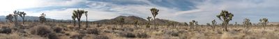
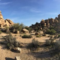
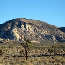
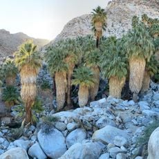
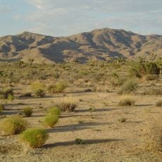
Joshua Tree National Park is a protected area in California covering 3196 square kilometers (1234 square miles) of dry terrain with distinct rock formations. The territory brings together sections of the Colorado and Mojave deserts, where different elevations support different plant and animal communities.

History

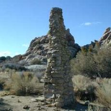
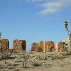
Native groups including the Serrano, Cahuilla, and Chemehuevi left rock art and pottery as evidence of their presence in the area. The territory became a national park in 1994 after decades of protection as a national monument.

Culture

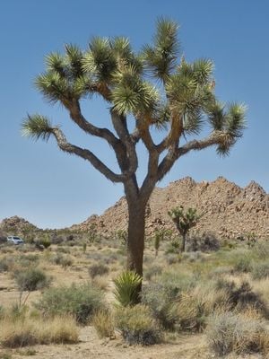
Mormon settlers gave the trees their name after seeing upward branches that reminded them of arms raised in prayer. This 19th-century interpretation still shapes how visitors think about and talk about the desert plants today.

Practical

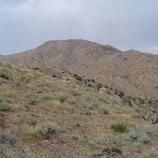
Nine campgrounds and several visitor centers spread across the desert terrain, along with more than 8000 kilometers (5000 miles) of trails suited to different skill levels. Summer visitors should plan to hike early in the morning or late in the afternoon, as midday heat can be intense.

Did you know?

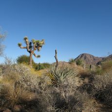
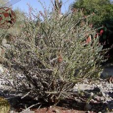
The trees that give the park its name can grow up to 15 meters (49 feet) tall and depend entirely on a single moth species, the yucca moth, to reproduce. Without these moths, the plants cannot form seeds, making their survival completely tied to this small insect.

Location
Inception
1994
Operator
National Park Service
Part of
deserts of California
GPS coordinates
33.74838,-115.81931
Latest update
December 14, 2025 20:54

AroundUs brings together thousands of curated places, local tips, and hidden gems, enriched daily by 60,000 contributors worldwide. Discover all places nearby (Riverside County).

Around this place
Sunnylands
United States of America

Sunnylands

54.9 km
United States of America

Forest Lawn Cemetery

58 km
Living Desert Zoo and Gardens
United States of America

Living Desert Zoo and Gardens

49.6 km
La Quinta Resort and Club
United States of America

La Quinta Resort and Club

45.4 km
Hidden Valley
United States of America

Hidden Valley

43.9 km
Coachella Valley National Wildlife Refuge
United States of America

Coachella Valley National Wildlife Refuge

46.6 km
Shields Date Gardens
United States of America

Shields Date Gardens

41.7 km
Keys Desert Queen Ranch
United States of America

Keys Desert Queen Ranch

46.3 km
United States of America

Thunderbird Country Club

56.2 km
Desert Queen Mine
United States of America

Desert Queen Mine

38.5 km
Ryan Mountain
United States of America

Ryan Mountain

39.4 km
United States of America

McCallum Theatre

52.8 km
Wall Street Mill
United States of America

Wall Street Mill

43.3 km
Fortynine Palms Oasis
United States of America

Fortynine Palms Oasis

47.7 km
Quail Mountain
United States of America

Quail Mountain

48.5 km
United States of America

Tamarisk Country Club

56.5 km
Desert Christ Park
United States of America

Desert Christ Park

71.3 km
Malapai Hill
United States of America

Malapai Hill

32.7 km
Cow Camp
United States of America

Cow Camp

45.5 km
United States of America

Eureka Peak

58.4 km
Ryan House and Lost Horse Well
United States of America

Ryan House and Lost Horse Well

40.3 km
Kenaston House
United States of America

Kenaston House

55.4 km
Sunnylands Center & Gardens
United States of America

Sunnylands Center & Gardens

54.7 km
Ruby Lee Mill Site
United States of America

Ruby Lee Mill Site

10 km
College of the Desert Arboretum
United States of America

College of the Desert Arboretum

52.6 km
Joshua Tree Wilderness
United States of America

Joshua Tree Wilderness

49.5 km
Museum of Ancient Wonders
United States of America

Museum of Ancient Wonders

59.1 km
Hi-Desert Nature Museum
United States of America

Hi-Desert Nature Museum

69.3 km
Show the full map
« Joshua Tree National Park - National Park in California, United States » is provided by Around Us (aroundus.com). Images and texts are derived from Wikimedia project under a Creative Commons license. You are allowed to copy, distribute, and modify copies of this page, under the conditions set by the license, as long as this note is clearly visible.

Discover hidden gems everywhere you go!

From secret cafés to breathtaking viewpoints, skip the crowded tourist spots and find places that match your style. Our app makes it easy with voice search, smart filtering, route optimization, and insider tips from travelers worldwide. Download now for the complete mobile experience.

Around Us App Screenshot

A unique approach to discovering new places

Le Figaro

All the places worth exploring

France Info

A tailor-made excursion in just a few clicks

20 Minutes

Around Us
Travel Guide & Maps
Download

Send to your phone

QR Code
1

Open the camera app on your mobile.

2

Point at the QR code with your camera. A notification will appear.

3

Tap the notification to open the link.