Enable Location

We need your location to show you interesting places around you

Discover nearby places

Find interesting locations and hidden gems around you

Precise directions

Get accurate directions and distances to places

Your location is never shared with other users. It's only used when you tap the location button.

Palo Verde Nuclear Generating Station

Log in to your account

Start exploring — it's free

Trusted by 62,611 travelers worldwide

Continue with Google
Continue with Apple
or

We will send you a code to connect

By continuing, you accept our Terms and Conditions and our Privacy Policy

Check your inbox

We've sent a pincode in your inbox. Please enter the code below.

Palo Verde Nuclear Generating Station

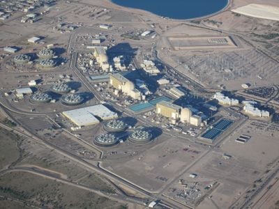
Palo Verde Nuclear Generating Station, Nuclear power plant in Wintersburg, Maricopa County, United States.

Palo Verde Nuclear Generating Station is a nuclear power plant in Tonopah, Maricopa County, Arizona, operating three pressurized water reactors. The facility supplies electricity to households across Arizona, California, New Mexico, and Texas.

Construction of the plant began in 1976 and the three reactors went online between January 1986 and January 1988. Commissioning followed roughly a decade of planning and building work in the Arizona desert.

The facility maintains strong connections with local communities through partnerships with STEM education programs and employs numerous military veterans among its workforce.

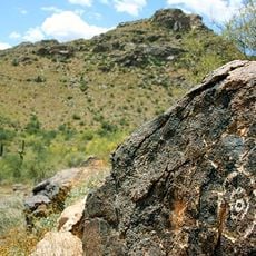
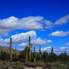
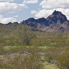
The plant sits in a remote desert area west of Phoenix and is not open to the public. Visitors can check the official website for occasional educational programs that are sometimes offered.

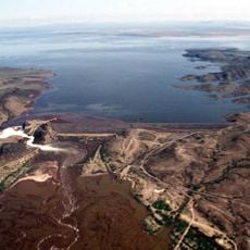
The plant uses treated municipal wastewater for cooling because natural water sources are absent in the desert. This system makes it the only nuclear facility worldwide that operates entirely without river or ocean water.

The community of curious travelers

AroundUs brings together thousands of curated places, local tips, and hidden gems, enriched daily by 60,000 contributors worldwide.

Start exploring
Location
Location
Location
Inception
April 24, 1986
Operator
Arizona Public Service
GPS coordinates
33.38920,-112.86500
Latest update
December 12, 2025 17:42
Nuclear power plants: history of atomic energy, major accidents, and geopolitics

This collection brings together nuclear power plants that have shaped the history of civilian nuclear energy. Some experienced accidents that changed the world’s view of nuclear energy. Chernobyl in Ukraine remains a symbol of the 1986 disaster, while Fukushima in Japan showed the risks of natural...

Around this place
White Tank Mountains
United States of America

White Tank Mountains

33.7 km
White Tank Mountain Regional Park
United States of America

White Tank Mountain Regional Park

35 km
Painted Rock Dam
United States of America

Painted Rock Dam

37.9 km
Gillespie Dam Highway Bridge
United States of America

Gillespie Dam Highway Bridge

20.1 km
United States of America

Our Lady of Solitude Monastery

19.9 km
Sugarloaf Mountain
United States of America

Sugarloaf Mountain

36.5 km
United States of America

Hummingbird Springs Wilderness

38.1 km
Hassayampa Bridge
United States of America

Hassayampa Bridge

14.1 km
United States of America

Big Horn Mountains Wilderness

35.8 km
Victory Steps at Verrado
United States of America

Victory Steps at Verrado

35.4 km
United States of America

Signal Mountain Wilderness

24.3 km
United States of America

Woolsey Peak

29 km
Verrado Golf Club- The Victory Course 4242 North Golf Club Drive Buckeye AZ 85396
United States of America

Verrado Golf Club- The Victory Course 4242 North Golf Club Drive Buckeye AZ 85396

36.3 km
United States of America

Powers Butte Wildlife Area

15.2 km
United States of America

Whitetank Mountain Regional Park

35 km
United States of America

Victory steps at Verrado

35.4 km
United States of America

Sundance Golf Club

30.5 km
United States of America

Raven Golf Club At Verrado

34.3 km
United States of America

Copper Canyon - Lake/Mountain Course

37.9 km
United States of America

Copper Canyon - Vista/Lake Course

38 km
United States of America

The Labrynth

20.2 km
United States of America

Copper Canyon - Mountain/Vista Course

38.1 km
United States of America

Pieta

19.9 km
United States of America

Saint Joseph

19.9 km
United States of America

Blessed Mother Mary

19.8 km
United States of America

Battlefield Cross

30 km
United States of America

Statue, Work of art

19.9 km
United States of America

Scenic viewpoint

35.3 km
Show the full map
« Palo Verde Nuclear Generating Station - Nuclear power plant in Wintersburg, Maricopa County, United States » is provided by Around Us (aroundus.com). Images and texts are derived from Wikimedia project under a Creative Commons license. You are allowed to copy, distribute, and modify copies of this page, under the conditions set by the license, as long as this note is clearly visible.

Discover hidden gems everywhere you go!

From secret cafés to breathtaking viewpoints, skip the crowded tourist spots and find places that match your style. Our app makes it easy with voice search, smart filtering, route optimization, and insider tips from travelers worldwide. Download now for the complete mobile experience.

Around Us App Screenshot

A unique approach to discovering new places

Le Figaro

All the places worth exploring

France Info

A tailor-made excursion in just a few clicks

20 Minutes

Around Us
Travel Guide & Maps
Download

Send to your phone

QR Code
1

Open the camera app on your mobile.

2

Point at the QR code with your camera. A notification will appear.

3

Tap the notification to open the link.