Hummingbird Springs Wilderness, Protected wilderness area in Maricopa County, Arizona
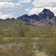
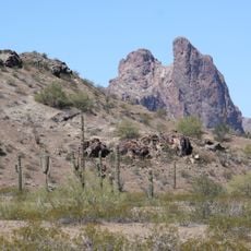
Hummingbird Springs Wilderness is a 31,200-acre (12,626 ha) Bureau of Land Management wilderness at the northwest end of the Belmont Mountains in northwest Maricopa County, Arizona. Its highest point is Sugarloaf Mountain, 3,418 feet (1,042 m). The photograph shows the bare reddish-brown and grey rock of the peak above slopes of green and tan scrub, with tall branched saguaro cacti scattered over gravelly desert floor in front.
The area gained protection status in 1990 when Congress passed the Arizona Desert Wilderness Act. This designation ensured the land would remain in its natural state without development.
Native desert plants like saguaro cacti and ocotillo shape the landscape and tell the story of survival in an arid environment. Walking through reveals how these plants define the character of the Sonoran Desert.
Bring plenty of water and navigation tools before entering, as there are no developed trails and the terrain is extremely dry. Preparation is crucial since help may be far away and getting lost is a real possibility.
Sugarloaf Mountain, at 3,418 feet (1,042 m), is the highest point of both the Hummingbird Springs Wilderness and the Belmont Mountains. The wilderness covers 31,200 acres (12,626 ha) at the northwest end of the range, and its southwest border meets the northeast border of the Big Horn Mountains Wilderness.
The community of curious travelers
AroundUs brings together thousands of curated places, local tips, and hidden gems, enriched daily by 94,777 contributors worldwide.