Chest opened
+${chestReward.xp} XP
Explorer
NOUVEAU ×${chestReward.collectible.quantity}
tapez pour fermer
Chest locked

Open chests in the app

Around Us is built for your phone — chests unlock when you walk, explore and capture nearby places.

Enable Location

We need your location to show you interesting places around you

Discover nearby places

Find interesting locations and hidden gems around you

Precise directions

Get accurate directions and distances to places

Your location is never shared with other users. It's only used when you tap the location button.

Fossil Creek

Log in to your account

Start exploring — it's free

Trusted by 72,878 travelers worldwide

Continue with Google
Continue with Apple
or

We will send you a code to connect

By continuing, you accept our Terms and Conditions and our Privacy Policy

Check your inbox

We've sent a pincode in your inbox. Please enter the code below.

Fossil Creek
Discussion Reviews 1 Photos
33.3k Popularity

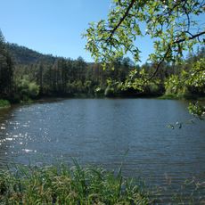
Fossil Creek, Stream in Gila County, Arizona, United States.

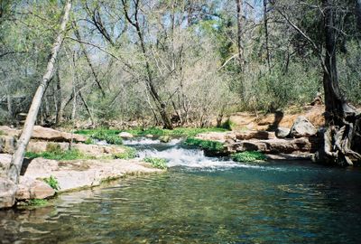
Fossil Creek is a year-round stream in Gila County that originates at Fossil Springs and flows through deep canyons in the high country. The water is cold and clear, moving steadily downhill past travertine formations and small cascades.

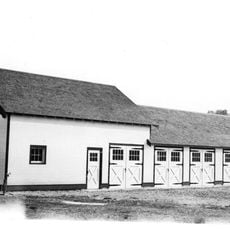
A power plant was built here in the early 1900s to supply electricity for mining operations across Arizona. The facility was removed after it was no longer needed, allowing the creek to return to its natural state.

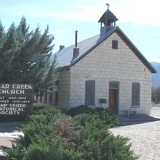
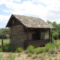
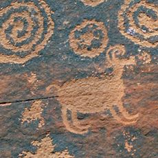
Indigenous peoples, particularly Western Apache and Yavapai communities, relied on this waterway and its resources for thousands of years as a vital part of their way of life. Visitors can still sense this deep historical connection to the land today.

The best time to visit is from late fall through early spring when weather is mild and crowds are smaller. The location is remote and requires proper preparation since roads can be rough and conditions change with the seasons.

The waters here contain high amounts of calcium that create white mineral deposits along the banks and coat the surrounding rock. This natural travertine formation gives the creek a distinctive pale appearance that is uncommon elsewhere in the region.

The community of curious travelers

AroundUs brings together thousands of curated places, local tips, and hidden gems, enriched daily by 60,000 contributors worldwide.

Start exploring
Location
GPS coordinates
34.30583,-111.67556
Latest update
December 19, 2025 23:43
Around this place
Cathedral Rock
United States of America

Cathedral Rock

58.2 km
Red Rock State Park
United States of America

Red Rock State Park

58.3 km
Tonto Natural Bridge
United States of America

Tonto Natural Bridge

20.2 km
Bell Rock
United States of America

Bell Rock

55.7 km
Blue Ridge Reservoir
United States of America

Blue Ridge Reservoir

50.3 km
Dead Horse Ranch State Park
United States of America

Dead Horse Ranch State Park

58.5 km
Out of Africa Wildlife Park
United States of America

Out of Africa Wildlife Park

41 km
Discovery Channel Telescope
United States of America

Discovery Channel Telescope

54.1 km
Wet Beaver Wilderness
United States of America

Wet Beaver Wilderness

2.8 km
Fort Verde State Historic Park
United States of America

Fort Verde State Historic Park

33.1 km
Horsethief Basin Lake
United States of America

Horsethief Basin Lake

59.6 km
Childs-Irving Hydroelectric Facilities
United States of America

Childs-Irving Hydroelectric Facilities

5.3 km
Courthouse Butte
United States of America

Courthouse Butte

55.6 km
V-Bar-V Heritage Site
United States of America

V-Bar-V Heritage Site

39.7 km
Mayer Red Brick Schoolhouse
United States of America

Mayer Red Brick Schoolhouse

52.9 km
Fossil Springs Wilderness
United States of America

Fossil Springs Wilderness

20 km
Verde River Sheep Bridge
United States of America

Verde River Sheep Bridge

25.6 km
Tonto Natural Bridge State Park
United States of America

Tonto Natural Bridge State Park

20.2 km
Fossil Creek Bridge
United States of America

Fossil Creek Bridge

10.7 km
Beaver Creek Ranger Station
United States of America

Beaver Creek Ranger Station

41 km
Cave Creek Museum
United States of America

Cave Creek Museum

58.7 km
Strawberry Schoolhouse
United States of America

Strawberry Schoolhouse

18.2 km
Clear Creek Church
United States of America

Clear Creek Church

28.1 km
Copper Creek Guard Station
United States of America

Copper Creek Guard Station

29.6 km
Master Mechanic's House
United States of America

Master Mechanic's House

57.4 km
Willard House
United States of America

Willard House

59.1 km
Verde Valley Archaeology Center and Museum
United States of America

Verde Valley Archaeology Center and Museum

33.7 km
Moqui Lookout
United States of America

Moqui Lookout

54.7 km
Show the full map
Reviews
Share your experience

No review yet

Discussions
Start a discussion...

No discussion yet

« Fossil Creek - Stream in Gila County, Arizona, United States » is provided by Around Us (aroundus.com). Images and texts are derived from Wikimedia project under a Creative Commons license. You are allowed to copy, distribute, and modify copies of this page, under the conditions set by the license, as long as this note is clearly visible.

Discover hidden gems everywhere you go!

From secret cafés to breathtaking viewpoints, skip the crowded tourist spots and find places that match your style. Our app makes it easy with voice search, smart filtering, route optimization, and insider tips from travelers worldwide. Download now for the complete mobile experience.

Around Us App Screenshot

A unique approach to discovering new places

Le Figaro

All the places worth exploring

France Info

A tailor-made excursion in just a few clicks

20 Minutes

Around Us
Travel Guide & Maps
Download

Send to your phone

QR Code
1

Open the camera app on your mobile.

2

Point at the QR code with your camera. A notification will appear.

3

Tap the notification to open the link.