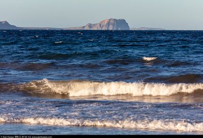
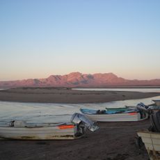
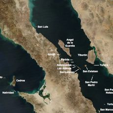
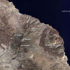
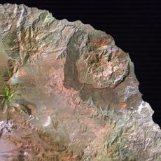
Punta Púlpito, Volcanic formation in Baja California Sur, Mexico.
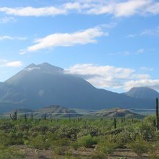
Punta Púlpito is a volcanic formation in Baja California Sur that rises with dark rocky layers visible along its sides. The structure displays the typical features of ancient volcanic activity and stands distinctly above the surrounding desert terrain.
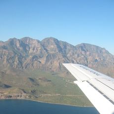
This volcanic formation resulted from multiple eruption phases in the distant past. The layering of rock visible today documents these repeated volcanic episodes that shaped the geological history of the peninsula.
Local people view this volcanic formation as part of their natural landscape and incorporate it into their daily awareness of the region. The surrounding communities have traditionally connected with this geological feature through their relationship with the desert environment.
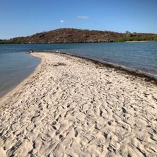
Visiting requires preparation for desert conditions and sturdy footwear for rocky, uneven terrain. Bring plenty of water and sun protection, as the area offers little shade or shelter.
The rock layers at this site visibly display different phases of volcanic events, which visitors can observe directly by examining the exposed surface carefully. Each distinct layer marks a separate eruption cycle from different time periods.
Location: Baja California Sur
GPS coordinates: 26.51700,-111.44400
Latest update: December 6, 2025 19:05
Baja California is a Mexican peninsula that offers striking contrasts in its landscapes. Desert valleys meet sandy beaches, while marine reserves protect coastal waters. The region holds ancient cave paintings, volcanic peaks, and colonial-era buildings that tell stories of human settlement. Canyons...
Rock Paintings of Sierra de San Francisco
201 km
Bahía de Loreto National Park
79.5 km
Islands and Protected Areas of the Gulf of California
139.5 km
Tres Vírgenes
155.5 km
San Ignacio Lagoon
176.7 km
Iglesia de Santa Bárbara
122.6 km
San Pedro Mártir Island
224.3 km
Iglesia de la Purísima Concepción
255.6 km
Arena Sonora
165.8 km
Sierra de Guadalupe cave paintings
199.2 km
La Reforma
144.9 km
Misión Santa Rosalía de Mulegé
67.7 km
Aguajito
159.4 km
Sacred Heart of Jesus Cathedral, Ciudad Obregón
185.4 km
Loreto
57 km
Álamos city hall
255.6 km
Plaza de Armas of Alamos
255.7 km
Capilla de Zapopan
255.5 km
Lake Oviáchic
214.4 km
Temple of Saint Rose of Lima
177.5 km
Biblioteca Doctor Alfonso Ortiz Tirado
255.7 km
Temple of Saint Joseph
249.5 km
Isla Espíritu Santo
254.4 km
Tabor Canyon
80.6 km
Jesuit Missions of Loreto Museum
57.3 km
Playa el Requesón
40.9 km
San Borjitas Cave
89.9 km
Visited this place? Tap the stars to rate it and share your experience / photos with the community! Try now! You can cancel it anytime.
Discover hidden gems everywhere you go!
From secret cafés to breathtaking viewpoints, skip the crowded tourist spots and find places that match your style. Our app makes it easy with voice search, smart filtering, route optimization, and insider tips from travelers worldwide. Download now for the complete mobile experience.
A unique approach to discovering new places❞
— Le Figaro
All the places worth exploring❞
— France Info
A tailor-made excursion in just a few clicks❞
— 20 Minutes