Enable Location

We need your location to show you interesting places around you

Discover nearby places

Find interesting locations and hidden gems around you

Precise directions

Get accurate directions and distances to places

Your location is never shared with other users. It's only used when you tap the location button.

Aguajito

Log in to your account

Start exploring — it's free

Trusted by 63,331 travelers worldwide

Continue with Google
Continue with Apple
or

We will send you a code to connect

By continuing, you accept our Terms and Conditions and our Privacy Policy

Check your inbox

We've sent a pincode in your inbox. Please enter the code below.

Aguajito
Discussion Reviews 1 Photos
1.9k Popularity

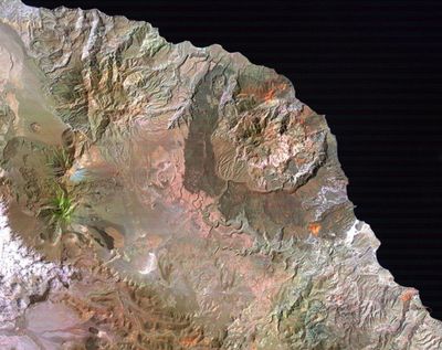
Aguajito, Dormant volcano in Baja California Sur, Mexico.

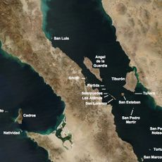
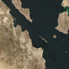
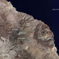
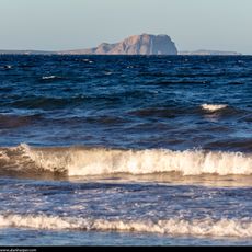
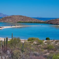
Aguajito is a volcanic caldera approximately 10 kilometers wide situated along the Gulf of California coast in Baja California Sur, featuring rhyolitic lava domes along its northern rim and active hot springs on its southern margin.

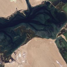
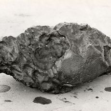
The massive caldera formed approximately 760,000 years ago during a super-volcanic eruption that deposited ignimbrites primarily into the Gulf of California, with subsequent lava dome formation occurring around 500,000 years ago on the northern boundary.

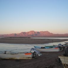
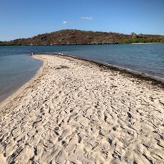
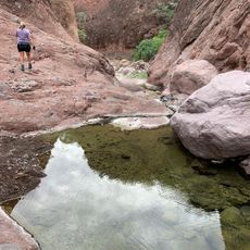
Local communities historically utilize the geothermal hot springs around Aguajito for bathing and relaxation, often attributing healing properties to these naturally heated waters that emerge from the volcanic system.

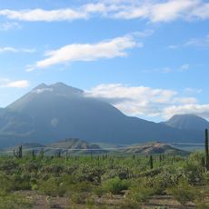
Accessing Aguajito requires navigating remote terrain with limited infrastructure, and visitors should prepare for rugged conditions while exercising caution due to ongoing geothermal activity and potential seismic instability in the area.

The volcano's caldera rim remains largely obscured and hidden beneath subsequent geological formations, making it one of the more challenging volcanic structures to study and interpret in the region.

The community of curious travelers

AroundUs brings together thousands of curated places, local tips, and hidden gems, enriched daily by 60,000 contributors worldwide.

Start exploring
GPS coordinates
27.55400,-112.55200
Latest update
July 24, 2025 11:19
Reviews
Share your experience

No review yet

Discussions
Start a discussion...

No discussion yet

« Aguajito - Dormant volcano in Baja California Sur, Mexico » is provided by Around Us (aroundus.com). Images and texts are derived from Wikimedia project under a Creative Commons license. You are allowed to copy, distribute, and modify copies of this page, under the conditions set by the license, as long as this note is clearly visible.

Discover hidden gems everywhere you go!

From secret cafés to breathtaking viewpoints, skip the crowded tourist spots and find places that match your style. Our app makes it easy with voice search, smart filtering, route optimization, and insider tips from travelers worldwide. Download now for the complete mobile experience.

Around Us App Screenshot

A unique approach to discovering new places

Le Figaro

All the places worth exploring

France Info

A tailor-made excursion in just a few clicks

20 Minutes

Around Us
Travel Guide & Maps
Download

Send to your phone

QR Code
1

Open the camera app on your mobile.

2

Point at the QR code with your camera. A notification will appear.

3

Tap the notification to open the link.