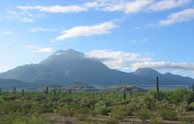
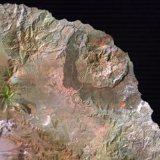
Tres Vírgenes, Stratovolcano in Mulegé, Mexico
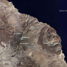
Tres Vírgenes is a volcanic complex in Mulegé consisting of three peaks aligned northeast to southwest, with the highest reaching 1,940 meters above sea level. The peaks are composed of andesite and form a coherent geological formation across this volcanic region.
The volcanic complex was documented by Croatian Jesuit missionary Ferdinand Konščak in 1746, who recorded an eruption on his map. This historical record demonstrates that volcanic activity here was observable in the early 18th century and caught the attention of early explorers.
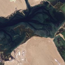
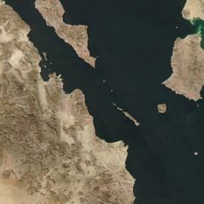
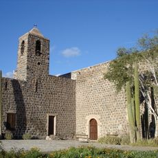
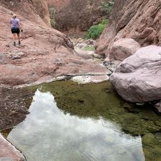
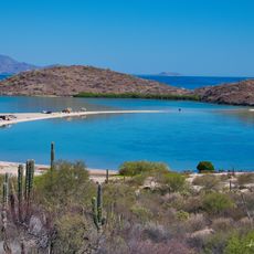
The volcanic complex sits within the El Vizcaíno Biosphere Reserve, serving as a landmark within this protected landscape of Baja California Sur. It forms part of how locals and visitors understand the geological identity of the region.
A geothermal energy plant operates in the northern section of the volcanic complex, near the edge of the El Aguajito caldera. Visitors should be aware of this industrial presence and respect marked boundaries in the area.
Beneath the younger volcanic materials lie Cretaceous granitic rocks that have been covered by andesite from the Santa Lucía Range. This layering reveals a deep geological history spanning millions of years.
Location: Baja California Sur
Elevation above the sea: 1,940 m
Made from material: andesite
GPS coordinates: 27.46970,-112.59100
Latest update: December 6, 2025 16:03
El Vizcaíno Biosphere Reserve
165.4 km
Rock Paintings of Sierra de San Francisco
48.3 km
Catedral de Hermosillo
239.8 km
Bahía de Loreto National Park
230.9 km
Archangel Island
212.3 km
Islands and Protected Areas of the Gulf of California
95.9 km
Estadio Sonora
232.9 km
Laguna Ojo de Liebre
166.6 km
San Ignacio Lagoon
89.8 km
Ecological Center of Sonora
235.9 km
Iglesia de Santa Bárbara
35.1 km
San Lorenzo Marine Archipelago National Park
150.4 km
Estrecho del Infiernillo
186.3 km
San Pedro Mártir Island
105.1 km
Government Palace of Sonora
239.9 km
Our Lady of Mount Carmel Church
240.6 km
Sierra de Guadalupe cave paintings
45.9 km
La Reforma
20.1 km
Misión Santa Rosalía de Mulegé
88.4 km
Aguajito
10.1 km
Sonora Museum of Art
239.6 km
Coronado (volcano)
201.1 km
Loreto
204.2 km
Tabor Canyon
223.9 km
Jesuit Missions of Loreto Museum
204.4 km
Punta Púlpito
155.5 km
Playa el Requesón
119.3 km
Reviews
Visited this place? Tap the stars to rate it and share your experience / photos with the community! Try now! You can cancel it anytime.
Discover hidden gems everywhere you go!
From secret cafés to breathtaking viewpoints, skip the crowded tourist spots and find places that match your style. Our app makes it easy with voice search, smart filtering, route optimization, and insider tips from travelers worldwide. Download now for the complete mobile experience.
A unique approach to discovering new places❞
— Le Figaro
All the places worth exploring❞
— France Info
A tailor-made excursion in just a few clicks❞
— 20 Minutes