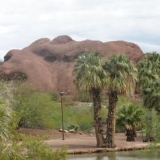
Tonto National Forest, National forest in central Arizona, United States.
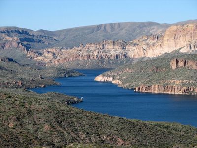
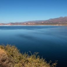
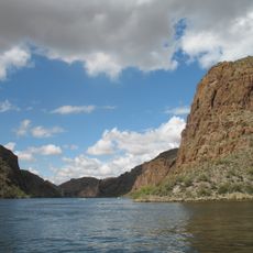
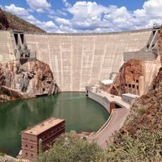
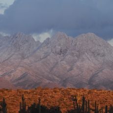
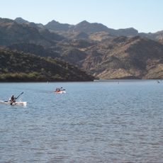
Tonto National Forest spans five counties across central Arizona, transitioning from low-lying desert scrub to high-elevation pine forests at different elevations. The forest offers over 900 miles of trails, eight wilderness areas, six reservoirs, and numerous campgrounds throughout its vast landscape.
The forest was established as a reserve in 1905 and granted official National Forest status two years later. This federal protection helped secure the region's natural resources from uncontrolled exploitation.
Archaeological sites throughout the forest contain evidence of prehistoric Indian groups and Hohokam settlements dating back more than one thousand years.
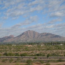
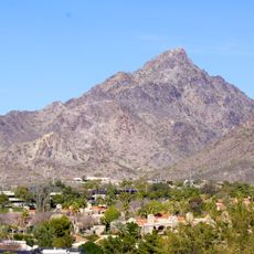
Visitors can access the forest through multiple ranger stations located in towns like Globe, Payson, and Scottsdale, where you can get trail information and guidance. Spring and fall are ideal seasons for hiking, as summer brings intense heat in lower areas and winter can affect higher elevations.
A major wildfire in 2020 scorched large portions of the forest, yet visitors can observe how nature is actively recovering from this disturbance. Many people overlook that these natural fires actually rejuvenate forest ecosystems and trigger seed germination.
Location: Gila County
Location: Coconino County
Location: Maricopa County
Location: Yavapai County
Location: Pinal County
Operator: United States Forest Service
Website: http://fs.usda.gov/tonto
GPS coordinates: 33.84430,-111.28500
Latest update: December 6, 2025 22:01
Canyon Lake
36.3 km
Lost Dutchman State Park
46.7 km
Four Peaks
18.2 km
Saguaro Lake
37.8 km
Weaver's Needle
46.4 km
Skeleton Cave
30.3 km
Salt River Canyon Wilderness
48.4 km
Mount McDowell
50.7 km
Sears-Kay Ruin
46 m
Stewart Mountain Dam
38.7 km
Mormon Flat Dam
35.4 km
Roosevelt Lake Bridge
22.4 km
Thompson Peak
53.6 km
Verde River Sheep Bridge
46.8 km
Peralta Canyon
52.1 km
Pinnacle Peak Park
54.9 km
Sierra Ancha Wilderness
37.7 km
Gold Canyon Golf Resort
54.8 km
Pleasant Valley Ranger Station
43.8 km
Fountain Hills Observatory
48.1 km
Las Sendas Golf Club
53.8 km
Tonto National Monument Visitor Center
27.3 km
Verde River Golf and Social Club
39.7 km
Desert Canyon Golf Course
49.1 km
Boulder Creek Bridge
36.9 km
Aztec Peak Lookout
35 km
Mormon Flat Bridge
37 km
Alchesay Canyon Bridge
22.8 kmReviews
Visited this place? Tap the stars to rate it and share your experience / photos with the community! Try now! You can cancel it anytime.
Discover hidden gems everywhere you go!
From secret cafés to breathtaking viewpoints, skip the crowded tourist spots and find places that match your style. Our app makes it easy with voice search, smart filtering, route optimization, and insider tips from travelers worldwide. Download now for the complete mobile experience.
A unique approach to discovering new places❞
— Le Figaro
All the places worth exploring❞
— France Info
A tailor-made excursion in just a few clicks❞
— 20 Minutes