Riscos de Momostenango

Log in to your account

AroundUs is a community-driven map of interesting places, built by curious explorers like you. It grows with every review, story, and photo you share.
Connect to save your favorite spots, contribute locations, and create personalized routes.
By continuing, you accept our Terms and Conditions and our Privacy Policy

Riscos de Momostenango

Add to collection
Map
Suggest a change
Share

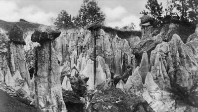
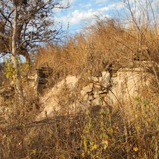
Riscos de Momostenango, National park with sandstone formations in Totonicapán Department, Guatemala.

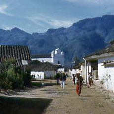
Riscos de Momostenango is a national park featuring distinctive sandstone rock formations in the Totonicapán highlands. The landscape displays red and orange-hued cliff structures rising from thick mountain forest, along with wide views across surrounding valleys.

The site was declared a national park by the Guatemalan government in 1955 through Governmental Agreement 26-05-55. This early protection recognized the geological importance of the sandstone formations to the country's conservation efforts.

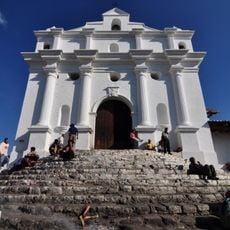
Local indigenous communities gather at the site for traditional ceremonies and meetings that follow the rhythm of the seasons. These practices reveal how the people maintain a close relationship with their highland home.

The park is open year-round for hiking and nature observation, with trails being most accessible during the dry season. Wear sturdy footwear and bring water, as the elevation demands effort and shaded rest spots are limited.

The rock structures display natural geometric patterns created by uneven erosion and weathering that resemble human architecture. These patterns become especially visible when sunlight hits them at specific angles during early morning or late afternoon hours.

Location: Totonicapán Department

Inception: 1955

GPS coordinates: 15.04417,-91.40917

Latest update: December 6, 2025 17:46

Photos
Photo locations in Guatemala

Guatemala contains several photographic subjects within its borders. Maya ruins such as Tikal, Yaxha and Quiriguá stand in the tropical forests of Petén and Izabal. Colonial architecture appears in Antigua Guatemala, where the Santa Catalina Arch and painted facades line cobblestone streets. Lake...

Reviews

Visited this place? Tap the stars to rate it and share your experience / photos with the community! Try now! You can cancel it anytime.

« Riscos de Momostenango - National park with sandstone formations in Totonicapán Department, Guatemala » is provided by Around Us (aroundus.com). Images and texts are derived from Wikimedia project under a Creative Commons license. You are allowed to copy, distribute, and modify copies of this page, under the conditions set by the license, as long as this note is clearly visible.

Discover hidden gems everywhere you go!

From secret cafés to breathtaking viewpoints, skip the crowded tourist spots and find places that match your style. Our app makes it easy with voice search, smart filtering, route optimization, and insider tips from travelers worldwide. Download now for the complete mobile experience.

Around Us App Screenshot

A unique approach to discovering new places

Le Figaro

All the places worth exploring

France Info

A tailor-made excursion in just a few clicks

20 Minutes