Chest opened
+${chestReward.xp} XP
Explorer
NOUVEAU ×${chestReward.collectible.quantity}
tapez pour fermer

See the monuments around you in AR Open chests in the app

Around Us is built for your phone — point your camera at the streets and discover the monuments and places around you in augmented reality. Around Us is built for your phone — chests unlock when you walk, explore and capture nearby places.

•

Enable Location

We need your location to show you interesting places around you

Discover nearby places

Find interesting locations and hidden gems around you

Precise directions

Get accurate directions and distances to places

Your location is never shared with other users. It's only used when you tap the location button.

Lake Güija

Log in to your account

Start exploring — it's free

Trusted by 92,758 travelers worldwide

Continue with Google
Continue with Apple
or

We will send you a code to connect

By continuing, you accept our Terms and Conditions and our Privacy Policy

Check your inbox

We've sent a pincode in your inbox. Please enter the code below.

Lake Güija, Natural lake between Jutiapa Department and Santa Ana Department, Guatemala and El Salvador

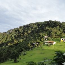
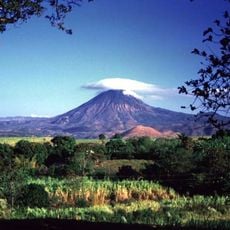
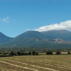
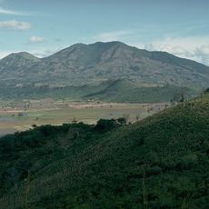
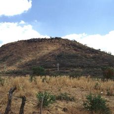
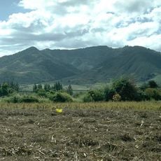
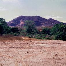
Lake Güija lies at 430 m on the Guatemala–El Salvador border, 45 km² in area, of which about 32 km² (74%) is Salvadoran. It formed when a basaltic lava flow from Volcán de San Diego dammed the Güija depression. Two large peninsulas narrow the water, and the Salvadoran side holds the islands of Teotipa, Cerro de Tule and Igualtepec. It drains via the río Desagüe into the Lempa at the Guajoyo hydroelectric dam.

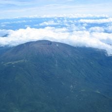
Lake Güija formed when a basaltic lava flow from the Volcán de San Diego blocked the drainage of the Güija depression. The Lenca, Xinca, Chʼortiʼ and Pipil lived around its shores; in the 16th century Diego García de Palacio noted two rocks used for sacrifice. Guatemala and El Salvador drew their border across the lake in 1938, and in 1957 they signed a water-sharing agreement.

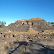
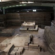
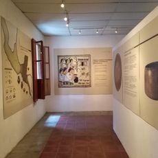
The name Güija comes from Náhuat: huitsi (thorn) plus a (abundance), meaning "where thorns abound." On Igualtepeque, a peninsula that becomes an island in the rainy season, the beach holds over 80 petroglyphs, one of the region's main rock-art sites. A green stone plaque found by a diver in the lake is identified as an Early Classic Maya Lowlands object.

The lake lies at 430 m between Santa Ana department and Jutiapa department; the Salvadoran share is about 32 km², the Guatemalan about 26%. The Ostúa, Angue and Cusmapa feed it, and it drains via the Desagüe into the Lempa at the Guajoyo hydroelectric dam. Igualtepeque becomes an island when the lake rises in the rainy season, so reach it by boat then.

Igualtepeque, a peninsula that becomes an island when the lake rises in the rainy season, holds more than 80 boulders with petroglyphs, one of the region's main rock-art sites. A diver found a green stone plaque in the lake, identified as an Early Classic Maya Lowlands object.

The community of curious travelers

AroundUs brings together thousands of curated places, local tips, and hidden gems, enriched daily by 92,758 contributors worldwide.

Start exploring
Elevation above the sea
430 m
GPS coordinates
14.26667,-89.51667
Latest update
October 25, 2026 06:05
Discover the major Sites of El Salvador

El Salvador presents a collection of places where history, nature, and culture meet. The country is shaped by volcanic landscapes, clear lakes, and Pacific beaches that blend with archaeological sites from pre-Columbian times. Visitors can explore ancient Maya temples like Tazumal and Joya de Cerén,...

Reviews
Share your experience

No review yet

Discussions
Start a discussion...

No discussion yet

« Lake Güija - Natural lake between Jutiapa Department and Santa Ana Department, Guatemala and El Salvador » is provided by Around Us (aroundus.com). Images and texts are derived from Wikimedia project under a Creative Commons license. You are allowed to copy, distribute, and modify copies of this page, under the conditions set by the license, as long as this note is clearly visible.

Discover hidden gems everywhere you go!

From secret cafés to breathtaking viewpoints, skip the crowded tourist spots and find places that match your style. Our app makes it easy with voice search, smart filtering, route optimization, and insider tips from travelers worldwide. Download now for the complete mobile experience.
Around Us App Screenshot
❝

A unique approach to discovering new places❞

— Le Figaro

❝

All the places worth exploring❞

— France Info

❝

A tailor-made excursion in just a few clicks❞

— 20 Minutes

Around Us
Travel Guide & Maps
Download

Send to your phone

QR Code
1

Open the camera app on your mobile.

2

Point at the QR code with your camera. A notification will appear.

3

Tap the notification to open the link.