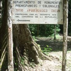
Nim Li Punit, Maya archaeological site in Toledo District, Belize
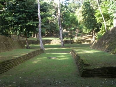
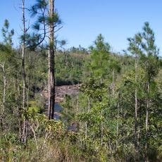
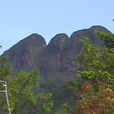
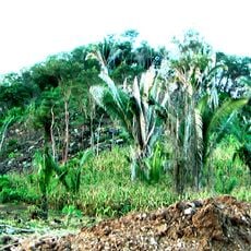
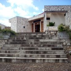
Nim Li Punit is a Maya archaeological site spread across hilltops with three main plazas, residential areas, and numerous stone monuments set within tropical forest. The structures are built into the landscape on different elevations, showing how the ancient community organized its spaces.
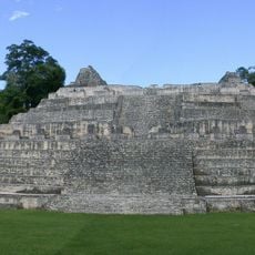
The settlement began in the early centuries and reached its peak between 600 and 900 CE when it was a major Maya city. The site was gradually abandoned over time before the ruins were rediscovered in modern times.
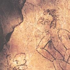
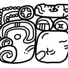
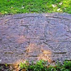
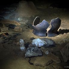
The name Nim Li Punit comes from the Kekchi Maya language and means 'Big Hat', named after the royal headdress shown in a carved stone monument at the site. Visitors can see this representation and understand why the ancient people called the place by this name.
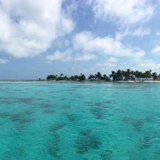
The site is located north of Punta Gorda and is accessible by car with fairly straightforward access. Visit during daytime hours and bring comfortable shoes and water, as you will be walking on uneven ground.
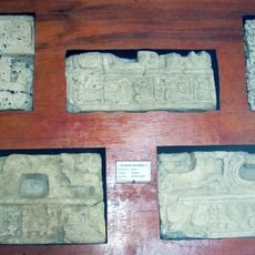
The site contains 32 stone stelae, including one particularly tall monument that ranks among the tallest carved stone pillars in the region. This monument demonstrates the skill and importance the ancient people placed on this location.
Location: Toledo District
Elevation above the sea: 37 m
GPS coordinates: 16.31667,-88.80000
Latest update: December 6, 2025 16:04
Guatemala contains several photographic subjects within its borders. Maya ruins such as Tikal, Yaxha and Quiriguá stand in the tropical forests of Petén and Izabal. Colonial architecture appears in Antigua Guatemala, where the Santa Catalina Arch and painted facades line cobblestone streets. Lake...
Caracol
60.2 km
Castillo de San Felipe de Lara
78.4 km
Cockscomb Basin Wildlife Sanctuary
64.1 km
Puente de Río Dulce
76.5 km
Mountain Pine Ridge Forest Reserve
73.1 km
Victoria Peak
58.4 km
Chocón Machacas
61.9 km
Naj Tunich
51 km
Ixkun
71.2 km
Laughing Bird Caye
65.9 km
Sacul
61.1 km
Bladen Nature Reserve
21.5 km
Ixtutz
51.6 km
Gladden Spit and Silk Cayes Marine Reserve
86.5 km
Ucanal
84.8 km
Xnaheb
0 m
Thousand Foot Falls
82.6 km
Ranguana Caye
69.3 km
South Water Caye Marine Reserve
80.8 km
Museo Regional del Sureste de Petén
69.4 km
Big Rock Falls
81.8 km
Che Chem Ha Cave
83.9 km
Playa Blanca
51.1 km
Kendall Bridge
71.5 km
Bugle Caye Light
54.3 km
Parque Nacional Río Dulce
63.8 km
Rio Dulce National Park
77.9 km
Calvario Poptun
66.2 kmVisited this place? Tap the stars to rate it and share your experience / photos with the community! Try now! You can cancel it anytime.
Discover hidden gems everywhere you go!
From secret cafés to breathtaking viewpoints, skip the crowded tourist spots and find places that match your style. Our app makes it easy with voice search, smart filtering, route optimization, and insider tips from travelers worldwide. Download now for the complete mobile experience.
A unique approach to discovering new places❞
— Le Figaro
All the places worth exploring❞
— France Info
A tailor-made excursion in just a few clicks❞
— 20 Minutes