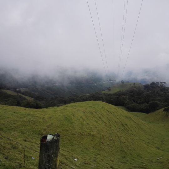
Alto de La Línea, Mountain pass between Tolima and Quindío departments, Colombia
Alto de La Línea is a mountain pass in the Cordillera Central at 3,265 meters, on the border of Quindío and Tolima departments. It connects Calarcá and Cajamarca and lies on National Route 40 between Armenia and Ibagué. The pass is a grassy summit with a weathered wooden post and wire fence; wooded hills and low cloud surround it.
The pass served as the main route connecting western Colombia to Bogotá for many years before the opening of a modern tunnel below the summit. The completion of this underground route in 2020 changed how traffic flows through the region.
The climb from Calarcá is 21.7 km long with an average gradient of 7.6% and a maximum of 13%; from Cajamarca it measures 23.4 km at 6.1% average, reaching 14%. The pass has often featured in the Vuelta a Colombia, but only five times as a stage finish.
The pass lies on National Route 40 between Calarcá (Quindío) and Cajamarca (Tolima), and the summit marks the departmental border. The climb from Calarcá is 21.7 km at an average 7.6% gradient, reaching 13% at points; from Cajamarca it is 23.4 km at 6.1%, up to 14%. Since September 2020 the Túnel de la Línea, 900 m below the summit, offers an alternative for through traffic.
The name "La Línea" comes from the railway line that was never built: in the 1920s an American company began boring a tunnel at 3,526 m, and locals said "the line will pass through here". The phrase stuck as the pass's name. The 2020 Túnel de la Línea runs 900 m below the summit and is the longest road tunnel in the Americas after 11 years of work.
The community of curious travelers
AroundUs brings together thousands of curated places, local tips, and hidden gems, enriched daily by 94,775 contributors worldwide.

