Talamanca Canton, Administrative canton in Limón Province, Costa Rica.
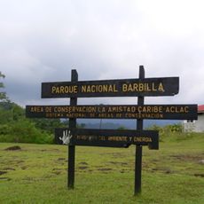
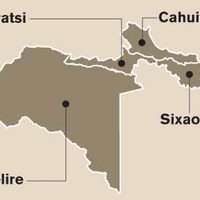
Talamanca Canton is an administrative region in Limón Province that combines coastal areas, mountain ranges, and protected natural reserves with different ecosystems. The territory includes several districts, with Bribri serving as the administrative center and Cahuita located on the Caribbean coast.
The canton was established in 1969 as a separate administrative district to better manage the diverse communities in southeastern Costa Rica. This creation reflected recognition of the region as a place with distinct social and geographic characteristics.
The Bribri and Cabécar communities form a significant part of the population and shape daily life through their languages, crafts, and traditional ways. Their presence is visible everywhere, from homes and local markets to the paths connecting villages.
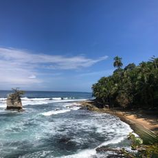
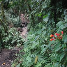
Visitors can reach the canton via National Route 36, which connects the main districts and makes traveling through easier. The region offers access to beaches, hiking routes, and nature reserves, though planning ahead is wise due to the rainy climate.
The territory contains one of Costa Rica's three official border crossings with Panama at Sixaola, a key point for international trade. This crossing connects not just two countries but also fosters exchange between different cultures and markets.
The community of curious travelers
AroundUs brings together thousands of curated places, local tips, and hidden gems, enriched daily by 60,000 contributors worldwide.