Enable Location

We need your location to show you interesting places around you

Discover nearby places

Find interesting locations and hidden gems around you

Precise directions

Get accurate directions and distances to places

Your location is never shared with other users. It's only used when you tap the location button.

Huapalcalco

Log in to your account

Start exploring — it's free

Trusted by 62,570 travelers worldwide

Continue with Google
Continue with Apple
or

We will send you a code to connect

By continuing, you accept our Terms and Conditions and our Privacy Policy

Check your inbox

We've sent a pincode in your inbox. Please enter the code below.

Huapalcalco

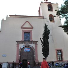
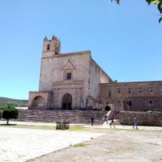
Huapalcalco, Archaeological site in Tulancingo de Bravo, Mexico.

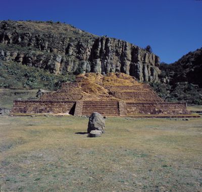
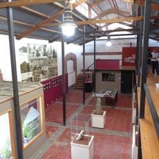
Huapalcalco is an archaeological site in Tulancingo de Bravo situated on the western slope of Cerro El Tecolote with pyramid-shaped structures and ancient ceremonial platforms. The complex spans multiple sectors with remains of buildings and caves that show evidence of different periods of habitation.

The settlement developed as a second center of Toltec civilization before the rise of Tula and represents a crucial phase of early habitation. Archaeological findings show continuous occupation of the region over millennia.

The cave paintings here depict human figures and celestial symbols created by the site's earliest inhabitants. These artworks reveal how ancient people understood their world and marked sacred meanings on stone surfaces.

The site is accessible via Federal Highway 130 from Pachuca, with local colectivos providing transport connections to the area. Visitors should wear sturdy shoes as the terrain is uneven and crosses forested slopes.

A three-sided pyramid with about 12 meters at its base and 8 meters in height stands on the grounds. This unusual construction was specifically designed for ceremonial offerings, making it distinct from typical Mesoamerican structures.

The community of curious travelers

AroundUs brings together thousands of curated places, local tips, and hidden gems, enriched daily by 60,000 contributors worldwide.

Start exploring
GPS coordinates
20.13333,-98.36667
Latest update
December 6, 2025 16:04
Natural and historical sites in Hidalgo Mexico

Hidalgo state sits northeast of Mexico City, connecting volcanic landscapes with more than two thousand years of human settlement. The region extends from high-altitude pine forests to semi-arid canyons, with geological processes having created basalt columns, cave systems with thermal springs, and...

« Huapalcalco - Archaeological site in Tulancingo de Bravo, Mexico » is provided by Around Us (aroundus.com). Images and texts are derived from Wikimedia project under a Creative Commons license. You are allowed to copy, distribute, and modify copies of this page, under the conditions set by the license, as long as this note is clearly visible.

Discover hidden gems everywhere you go!

From secret cafés to breathtaking viewpoints, skip the crowded tourist spots and find places that match your style. Our app makes it easy with voice search, smart filtering, route optimization, and insider tips from travelers worldwide. Download now for the complete mobile experience.

Around Us App Screenshot

A unique approach to discovering new places

Le Figaro

All the places worth exploring

France Info

A tailor-made excursion in just a few clicks

20 Minutes

Around Us
Travel Guide & Maps
Download

Send to your phone

QR Code
1

Open the camera app on your mobile.

2

Point at the QR code with your camera. A notification will appear.

3

Tap the notification to open the link.