Enable Location

We need your location to show you interesting places around you

Discover nearby places

Find interesting locations and hidden gems around you

Precise directions

Get accurate directions and distances to places

Your location is never shared with other users. It's only used when you tap the location button.

Huimanguillo

Log in to your account

Start exploring — it's free

Trusted by 62,145 travelers worldwide

Continue with Google
Continue with Apple
or

We will send you a code to connect

By continuing, you accept our Terms and Conditions and our Privacy Policy

Check your inbox

We've sent a pincode in your inbox. Please enter the code below.

Huimanguillo

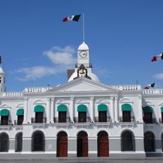
Huimanguillo, Municipal administrative division in Tabasco, Mexico.

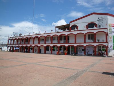
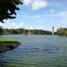
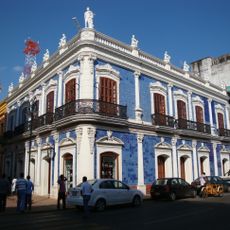
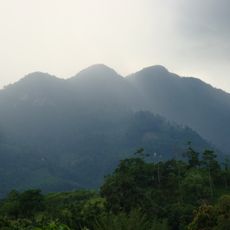
Huimanguillo is an administrative territory in southeastern Tabasco that covers a large area with diverse landscapes. The municipality connects agricultural zones with river regions and links to other parts of the state through two federal highways.

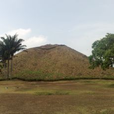
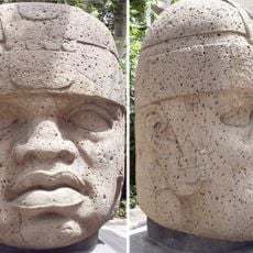
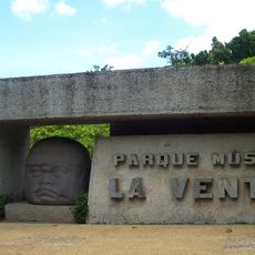
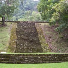
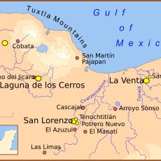
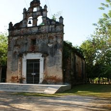
The region was settled by the Olmec people around 1000 BCE, who established major centers such as La Venta. Later, other cultures including the Zoque left their own architectural traditions throughout the area.

The name comes from the Nahuatl language and means 'place of the principal chief,' reflecting its role as a center of power in pre-Hispanic times. This linguistic heritage connects the modern municipality to the indigenous peoples who shaped the region.

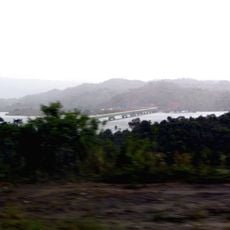
The territory is best explored by car, as the federal highways are the main access routes and public transport is limited. Visitors should prepare for tropical weather and pay attention to the rainy season, which can affect road conditions.

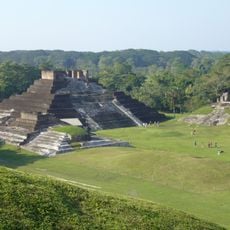
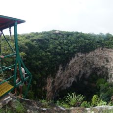
The Malpasito zone features Zoque cultural structures aligned on an unusual south-north axis. This distinct orientation sets it apart from typical building patterns of the era and offers insight into the different traditions of pre-Hispanic peoples.

The community of curious travelers

AroundUs brings together thousands of curated places, local tips, and hidden gems, enriched daily by 60,000 contributors worldwide.

Start exploring
GPS coordinates
17.76210,-93.66344
Latest update
December 7, 2025 20:43
« Huimanguillo - Municipal administrative division in Tabasco, Mexico » is provided by Around Us (aroundus.com). Images and texts are derived from Wikimedia project under a Creative Commons license. You are allowed to copy, distribute, and modify copies of this page, under the conditions set by the license, as long as this note is clearly visible.

Discover hidden gems everywhere you go!

From secret cafés to breathtaking viewpoints, skip the crowded tourist spots and find places that match your style. Our app makes it easy with voice search, smart filtering, route optimization, and insider tips from travelers worldwide. Download now for the complete mobile experience.

Around Us App Screenshot

A unique approach to discovering new places

Le Figaro

All the places worth exploring

France Info

A tailor-made excursion in just a few clicks

20 Minutes

Around Us
Travel Guide & Maps
Download

Send to your phone

QR Code
1

Open the camera app on your mobile.

2

Point at the QR code with your camera. A notification will appear.

3

Tap the notification to open the link.