Chest opened
+${chestReward.xp} XP
Explorer
NOUVEAU ×${chestReward.collectible.quantity}
tapez pour fermer
Chest locked

Open chests in the app

Around Us is built for your phone — chests unlock when you walk, explore and capture nearby places.

Enable Location

We need your location to show you interesting places around you

Discover nearby places

Find interesting locations and hidden gems around you

Precise directions

Get accurate directions and distances to places

Your location is never shared with other users. It's only used when you tap the location button.

Sabinas

Log in to your account

Start exploring — it's free

Trusted by 72,995 travelers worldwide

Continue with Google
Continue with Apple
or

We will send you a code to connect

By continuing, you accept our Terms and Conditions and our Privacy Policy

Check your inbox

We've sent a pincode in your inbox. Please enter the code below.

Sabinas
Discussion Reviews 1 Photos
16.7k Popularity

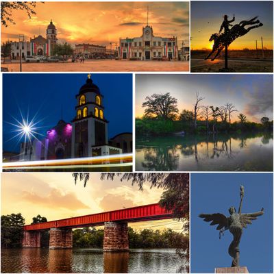
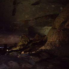
Sabinas, Coal mining city in Coahuila, Mexico.

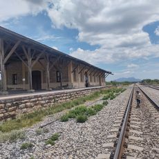
Sabinas is a city in northeastern Mexico situated in a valley along the Sabinas River, with its economy centered on coal extraction and processing. The city operates coking plants that transform coal for steel production elsewhere and maintains transportation connections by rail and air.

The city was founded in 1883 and grew as a transportation hub for coal from the surrounding region to reach processing facilities and markets. Its strategic location made it an important point in northeastern Mexico's industrial development.

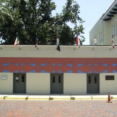
The Coal Museum displays objects and documents from mining families who lived and worked in the region for generations. Visitors can see tools, clothing, and household items that show how mining shaped everyday life in the community.

Visitors should prepare for a dry climate and heat, especially during the warmer months of the year. The most comfortable time to visit is between October and March when temperatures are more moderate.

Revolutionary leader Pancho Villa signed a peace agreement here in 1920, marking a crucial moment in modern Mexican history. This historical act gives the city a significance that visitors often overlook when passing through.

The community of curious travelers

AroundUs brings together thousands of curated places, local tips, and hidden gems, enriched daily by 60,000 contributors worldwide.

Start exploring
Location
Inception
June 29, 1883
GPS coordinates
27.84889,-101.12000
Latest update
December 7, 2025 19:26
Around this place
Fort Clark
United States of America

Fort Clark

176 km
Uni-Trade Stadium
United States of America

Uni-Trade Stadium

167.6 km
Amistad National Recreation Area
United States of America

Amistad National Recreation Area

176.9 km
Laredo Energy Arena
United States of America

Laredo Energy Arena

167.5 km
Fort Duncan
United States of America

Fort Duncan

112.4 km
Fort McIntosh
United States of America

Fort McIntosh

162.2 km
Estadio De Béisbol Monclova
Mexico

Estadio De Béisbol Monclova

109.6 km
Grutas de Bustamante
Mexico

Grutas de Bustamante

161.2 km
Eagle Pass – Piedras Negras International Bridge
Mexico

Eagle Pass – Piedras Negras International Bridge

112.5 km
Cathedral of San Agustin
United States of America

Cathedral of San Agustin

163.8 km
Camino Real International Bridge
United States of America

Camino Real International Bridge

111.8 km
Whitehead Memorial Museum
United States of America

Whitehead Memorial Museum

168.7 km
Estadio Nuevo Laredo
Mexico

Estadio Nuevo Laredo

156.1 km
Francisco I. Madero Monument at Monclova
Mexico

Francisco I. Madero Monument at Monclova

108.6 km
Mexico

Wells of Baján

150.5 km
Student Activity Complex
United States of America

Student Activity Complex

170.4 km
Republic of the Rio Grande Museum
United States of America

Republic of the Rio Grande Museum

163.7 km
Mexico

Rio San Rodrigo

126.7 km
Martyrs of Christ the King Cathedral, Piedras Negras
Mexico

Martyrs of Christ the King Cathedral, Piedras Negras

108.1 km
Asher and Mary Isabelle Richardson House
United States of America

Asher and Mary Isabelle Richardson House

148.7 km
Laredo United States Post Office, Court House and Custom House
United States of America

Laredo United States Post Office, Court House and Custom House

163.5 km
Webb County Courthouse
United States of America

Webb County Courthouse

163.6 km
Estación Del Tren
Mexico

Estación Del Tren

164.3 km
Popeye statue in Crystal City
United States of America

Popeye statue in Crystal City

156.8 km
Plaza Theater
United States of America

Plaza Theater

163.6 km
Aztec Theatre
United States of America

Aztec Theatre

113.2 km
Regal Laredo Stadium 14
United States of America

Regal Laredo Stadium 14

167.4 km
Tivoli Theatre
United States of America

Tivoli Theatre

163.6 km
Show the full map
Reviews
Share your experience

No review yet

Discussions
Start a discussion...

No discussion yet

« Sabinas - Coal mining city in Coahuila, Mexico » is provided by Around Us (aroundus.com). Images and texts are derived from Wikimedia project under a Creative Commons license. You are allowed to copy, distribute, and modify copies of this page, under the conditions set by the license, as long as this note is clearly visible.

Discover hidden gems everywhere you go!

From secret cafés to breathtaking viewpoints, skip the crowded tourist spots and find places that match your style. Our app makes it easy with voice search, smart filtering, route optimization, and insider tips from travelers worldwide. Download now for the complete mobile experience.

Around Us App Screenshot

A unique approach to discovering new places

Le Figaro

All the places worth exploring

France Info

A tailor-made excursion in just a few clicks

20 Minutes

Around Us
Travel Guide & Maps
Download

Send to your phone

QR Code
1

Open the camera app on your mobile.

2

Point at the QR code with your camera. A notification will appear.

3

Tap the notification to open the link.