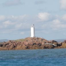
Piper Islands National Park, Nature reserve in Cook Shire, Australia
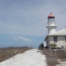
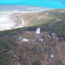
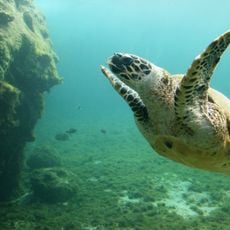
Piper Islands National Park comprises four small islands within the inner northern section of the Great Barrier Reef off the eastern coast of Cape York Peninsula. The islands are surrounded by marine habitats and support different vegetation types, including mangrove trees and Pisonia forests on their land areas.
The protected area was established in 1989 to preserve the natural habitats and wildlife populations of the region. Since then, it has served as a cornerstone of conservation in this part of the Great Barrier Reef.
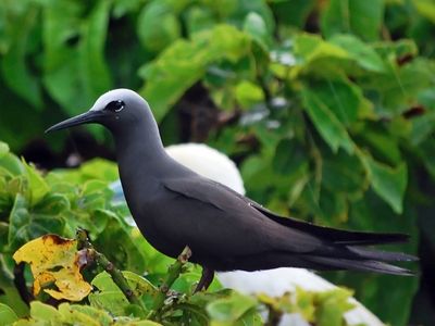
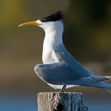
The park serves as a crucial breeding ground for seabirds, where visitors can observe large colonies of terns and other species during nesting season. Birdwatchers come to these islands to experience wildlife in its natural state and witness the cycles of animal life unfold throughout the year.
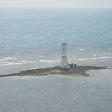
Visitors must arrive by boat and should gather information about travel routes and weather conditions beforehand, as the location on the water requires careful planning. Permission from local wildlife authorities is necessary before setting foot on the islands.
The islands harbor mangrove trees that grow on rocky shores under challenging conditions, helping stabilize the soils beneath them. These adaptable plants represent a remarkable example of how life adjusts to extreme marine environments.
Location: Cook Shire
Operator: Queensland Department of Environment and Science
GPS coordinates: -12.24404,143.22673
Latest update: December 14, 2025 13:05
Cape Melville National Park (Cape York Peninsula Aboriginal Land)
274.5 km
Kutini-Payamu National Park
43 km
Apudthama National Park
118.4 km
Booby Island Light
232.2 km
Goods Island Light
220.6 km
Oyala Thumotang National Park
155.7 km
Lama Lama National Park
243 km
Quetta Memorial Precinct
215.3 km
Our Lady of the Sacred Heart Church, Thursday Island
215.3 km
Claremont Isles National Park
196.9 km
Wenlock Goldfield
99 km
Eborac Island Light
189.6 km
Raine Island Beacon
114.2 km
Wuthathi (Saunders Islands) National Park (Cape York Peninsula Aboriginal Land)
54.8 km
Wyborn Reef Light
166.1 km
Sir Charles Hardy Group National Park
45.6 km
Musgrave Telegraph Station
284 km
Denham Group National Park
87.2 km
Coen Carrier Station
188.8 km
Thursday Island Customs House
214.9 km
Lockerbie Scrub
180.3 km
Ebagoola Township and Battery
229.1 km
Gordon's Mine and Mill
53 km
Possession Island National Park
191.7 km
KULLA (McIlwraith Range) National Park (Cape York Peninsula Aboriginal Land)
168.3 km
Green Hill Fort Coastal Artillery
215.5 km
Tuesday Islet Lighthouse
212.1 km
Lion's Lookout
215.1 kmVisited this place? Tap the stars to rate it and share your experience / photos with the community! Try now! You can cancel it anytime.
Discover hidden gems everywhere you go!
From secret cafés to breathtaking viewpoints, skip the crowded tourist spots and find places that match your style. Our app makes it easy with voice search, smart filtering, route optimization, and insider tips from travelers worldwide. Download now for the complete mobile experience.
A unique approach to discovering new places❞
— Le Figaro
All the places worth exploring❞
— France Info
A tailor-made excursion in just a few clicks❞
— 20 Minutes